TopoQuest Logo
Do you find TopoQuest useful?
Help keep TopoQuest running and adding new maps/features by donating!
Bitcoin:  19c7KJd3qBynnjoSw5npx9KScwjBe4ifkT
Litecoin:  LXs6TkuXGGXo1vDsWCkWVdjQX94eUKd6ui
Home View Maps Find Maps Find Places Resources & Links


Indian Hill, Montana Topographic Map

USGS Map Title: Indian Hill, MT
USGS Map MRC: 46110G3
DRG (GeoTIFF) Download: o46110g3.tif


Neighboring USGS Topographic Map Quads:


  Bandbox Mountain, MT  
46110H4
 

  Woodhurst Mountain, MT  
46110H3
 

  Red Hill, MT  
46110H2
 

  Ettien Spring, MT  
46110G4
 

  Indian Hill, MT  
46110G3
 

  Browns Canyon, MT  
46110G2
 

  Russian Flat, MT  
46110F4
 

  Daisy Peak, MT  
46110F3
 

  Haymaker Narrows, MT  
46110F2


Map MRC Location:

N47°
W111°
N47°
W110°
H8 H7 H6 H5 H4 H3 H2 H1
G8 G7 G6 G5 G4 G3 G2 G1
F8 F7 F6 F5 F4 F3 F2 F1
E8 E7 E6 E5 E4 E3 E2 E1
D8 D7 D6 D5 D4 D3 D2 D1
C8 C7 C6 C5 C4 C3 C2 C1
B8 B7 B6 B5 B4 B3 B2 B1
A8 A7 A6 A5 A4 A3 A2 A1
N46°
W111°
N46°
W110°

Indian Hill, MT USGS 1:24K Topographic Map Preview:
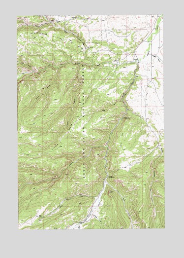
Indian Hill, MT USGS Topographic Map
Click on map above to begin viewing in our Map Viewer.

This topographic map contains these locations and features:
Feature Name Type Latitude Longitude GNIS ID View Map
13N11E25DA__01 WellWellN46.8566°W110.2624°818840View Map
13N11E25DA__02 WellWellN46.8566°W110.2624°818841View Map
13N11E25DA__03 WellWellN46.8566°W110.2624°818842View Map
13N11E26BD__01 WellWellN46.8602°W110.2941°818876View Map
13N11E26BD__02 WellWellN46.8602°W110.2941°818877View Map
13N11E35AB__01 WellWellN46.8491°W110.2888°818761View Map
13N11E36DA__01 WellWellN46.8419°W110.2624°818713View Map
13N12E19BD__01 WellWellN46.8741°W110.2519°819001View Map
13N12E19CA__01 WellWellN46.8705°W110.2519°818971View Map
13N12E30BA__01 WellWellN46.8633°W110.2519°818911View Map
American MineMineN46.8711°W110.3446°801914View Map
Arch CouleeValleyN46.8427°W110.3621°779113View Map
Bower CanyonValleyN46.8194°W110.2821°780304View Map
Burley CreekStreamN46.7605°W110.3121°780618View Map
Dry Pole CampgroundLocaleN46.7802°W110.2985°782664View Map
Dry Pole CanyonValleyN46.7769°W110.3005°782665View Map
Ettien GulchValleyN46.8463°W110.3227°783236View Map
Fred M Ellis Memorial CampgroundLocaleN46.8397°W110.2744°793996View Map
Hay CanyonValleyN46.7980°W110.2999°784640View Map
Hay Canyon CampgroundLocaleN46.7983°W110.3002°793997View Map
High SpringSpringN46.7577°W110.3584°784864View Map
High Spring CreekStreamN46.7666°W110.3069°784865View Map
Indian HillSummitN46.7961°W110.2860°785271View Map
Indian Hill CampgroundLocaleN46.8147°W110.2849°785272View Map
Judith Ranger StationLocaleN46.8480°W110.2905°785582View Map
Kelly CouleeValleyN46.8708°W110.3460°785656View Map
Korells Dude RanchLocaleN46.8575°W110.2635°793995View Map
Middle Fork Judith RiverStreamN46.8491°W110.2694°787283View Map
NW SE Section 20 MineMineN46.8705°W110.3513°803610View Map
Pagil GulchValleyN46.8525°W110.2635°788579View Map
Rocky GulchValleyN46.8250°W110.2866°789732View Map
Russell PointCapeN46.7711°W110.2977°789868View Map
Sapphire Post Office (historical)Post OfficeN46.8716°W110.3458°1750599View Map
South Fork Judith RiverStreamN46.8491°W110.2694°790990View Map
Trask GulchValleyN46.7525°W110.3246°792357View Map
Trask RanchLocaleN46.7575°W110.3116°794001View Map
Vortex MineMineN46.8708°W110.3458°803609View Map
Yogo CreekStreamN46.8458°W110.3105°793614View Map
Yogo CrossingPopulated PlaceN46.8555°W110.3166°793615View Map

Note: Coordinates in the location and feature list above are referenced to NAD83 datum.


Copyright (C) 2008-2024 Ryan Niemi / Sunset Dynamics ... All Rights Reserved