TopoQuest Logo
Do you find TopoQuest useful?
Help keep TopoQuest running and adding new maps/features by donating!
Bitcoin:  19c7KJd3qBynnjoSw5npx9KScwjBe4ifkT
Litecoin:  LXs6TkuXGGXo1vDsWCkWVdjQX94eUKd6ui
Home View Maps Find Maps Find Places Resources & Links


Woodhurst Mountain, Montana Topographic Map

USGS Map Title: Woodhurst Mountain, MT
USGS Map MRC: 46110H3
DRG (GeoTIFF) Download: o46110h3.tif


Neighboring USGS Topographic Map Quads:


  Wolf Butte, MT  
47110A4
 

  Cayuse Basin, MT  
47110A3
 

  Windham, MT  
47110A2
 

  Bandbox Mountain, MT  
46110H4
 

  Woodhurst Mountain, MT  
46110H3
 

  Red Hill, MT  
46110H2
 

  Ettien Spring, MT  
46110G4
 

  Indian Hill, MT  
46110G3
 

  Browns Canyon, MT  
46110G2


Map MRC Location:

N47°
W111°
N47°
W110°
H8 H7 H6 H5 H4 H3 H2 H1
G8 G7 G6 G5 G4 G3 G2 G1
F8 F7 F6 F5 F4 F3 F2 F1
E8 E7 E6 E5 E4 E3 E2 E1
D8 D7 D6 D5 D4 D3 D2 D1
C8 C7 C6 C5 C4 C3 C2 C1
B8 B7 B6 B5 B4 B3 B2 B1
A8 A7 A6 A5 A4 A3 A2 A1
N46°
W111°
N46°
W110°

Woodhurst Mountain, MT USGS 1:24K Topographic Map Preview:
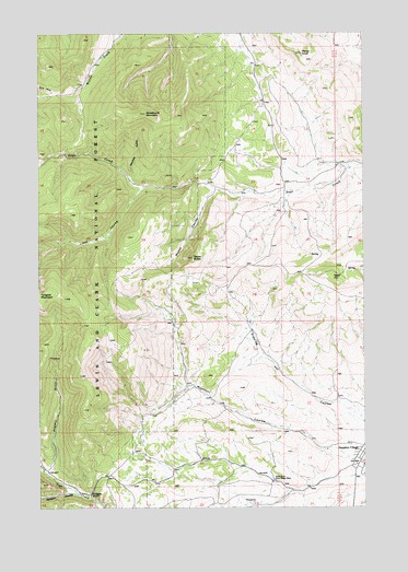
Woodhurst Mountain, MT USGS Topographic Map
Click on map above to begin viewing in our Map Viewer.

This topographic map contains these locations and features:
Feature Name Type Latitude Longitude GNIS ID View Map
13N11E02AB__01 WellWellN46.9222°W110.2888°819402View Map
13N11E11BC__01 WellWellN46.9038°W110.2994°819290View Map
13N11E11DC__01 WellWellN46.8966°W110.2888°819237View Map
13N11E13AD__01 WellWellN46.8894°W110.2624°819152View Map
13N11E14BC__01 WellWellN46.8894°W110.2994°819153View Map
13N11E14CC__01 WellWellN46.8822°W110.2994°819064View Map
13N11E14CC__02 WellWellN46.8822°W110.2994°819065View Map
13N11E14DD__01 WellWellN46.8822°W110.2835°819063View Map
13N11E15AB__01 WellWellN46.8930°W110.3099°819198View Map
13N11E15BA__01 WellWellN46.8930°W110.3152°819199View Map
13N11E16CA__01 WellWellN46.8858°W110.3360°819105View Map
13N11E16CA__02 WellWellN46.8858°W110.3360°819106View Map
14N11E04CD__01 WellWellN46.9975°W110.3366°820032View Map
14N11E12AD__01 SpringSpringN46.9902°W110.2630°819978View Map
14N11E13AA__01 SpringSpringN46.9794°W110.2630°819900View Map
14N11E13DD__01 SpringSpringN46.9686°W110.2630°819821View Map
14N11E22BC__01 SpringSpringN46.9611°W110.3210°819724View Map
14N11E23DC__01 SpringSpringN46.9539°W110.2894°819644View Map
14N11E23DC__02 SpringSpringN46.9539°W110.2894°819645View Map
14N11E23DC__03 SpringSpringN46.9539°W110.2894°819646View Map
14N11E24BC__01 SpringSpringN46.9611°W110.2788°819723View Map
14N11E24CA__01 SpringSpringN46.9575°W110.2735°819689View Map
14N11E24CA__02 SpringSpringN46.9575°W110.2735°819690View Map
14N11E25BC__01 SpringSpringN46.9466°W110.2788°819563View Map
14N11E25DA__01 SpringSpringN46.9430°W110.2630°819536View Map
14N11E25DA__02 SpringSpringN46.9430°W110.2630°819537View Map
14N11E26BD__01 SpringSpringN46.9466°W110.2947°819564View Map
14N11E26CB__01 SpringSpringN46.9430°W110.2999°819541View Map
14N11E26CC__01 SpringSpringN46.9394°W110.2999°819517View Map
14N11E26DB__01 SpringSpringN46.9430°W110.2894°819538View Map
14N11E26DB__02 SpringSpringN46.9430°W110.2894°819539View Map
14N11E26DB__03 SpringSpringN46.9430°W110.2894°819540View Map
14N11E33BC__01 SpringSpringN46.9322°W110.3419°819463View Map
14N11E34DB__01 SpringSpringN46.9286°W110.3105°819445View Map
14N11E35BD__01 SpringSpringN46.9322°W110.2946°819462View Map
14N11E36CA__01 SpringSpringN46.9286°W110.2735°819444View Map
14N12E07BC__01 SpringSpringN46.9897°W110.2605°819976View Map
14N12E19BB__01 SpringSpringN46.9641°W110.2605°819766View Map
14N12E19BC__01 WellWellN46.9605°W110.2605°819718View Map
14N12E19BC__02 SpringSpringN46.9605°W110.2605°819719View Map
14N12E30BB__01 SpringSpringN46.9497°W110.2605°819582View Map
Hay CouleeValleyN46.9591°W110.3358°784642View Map
Judith River Game Range HeadquartersLocaleN46.8822°W110.2855°785584View Map
Judith River State Wildlife Management AreaParkN46.8863°W110.3055°793970View Map
Marys KnollSummitN46.9947°W110.2744°786909View Map
Mitchell GulchValleyN46.9619°W110.3405°787515View Map
Mitchell SpringSpringN46.9683°W110.3352°798870View Map
Moose CouleeValleyN46.9586°W110.3074°787625View Map
NE NE Section 8 MineMineN46.9950°W110.3508°803652View Map
NW SE Section 6 MineMineN46.9147°W110.3719°803611View Map
Reed HillSummitN46.9358°W110.2633°789503View Map
Rickard CouleeValleyN46.8791°W110.3633°789579View Map
Saphire MineMineN46.8763°W110.3077°798871View Map
Sapphire VillagePopulated PlaceN46.8891°W110.2513°790020View Map
Sawmill GulchValleyN46.8852°W110.3727°790070View Map
SE SE Section 6 MineMineN46.9105°W110.3710°803612View Map
Tepee ButteSummitN46.9408°W110.3163°791973View Map
TollgateLocaleN46.8786°W110.3560°792242View Map
Woodhurst MountainSummitN46.9789°W110.3344°793503View Map

Note: Coordinates in the location and feature list above are referenced to NAD83 datum.


Copyright (C) 2008-2024 Ryan Niemi / Sunset Dynamics ... All Rights Reserved