TopoQuest Logo
Do you find TopoQuest useful?
Help keep TopoQuest running and adding new maps/features by donating!
Bitcoin:  19c7KJd3qBynnjoSw5npx9KScwjBe4ifkT
Litecoin:  LXs6TkuXGGXo1vDsWCkWVdjQX94eUKd6ui
Home View Maps Find Maps Find Places Resources & Links


Eureka, Utah Topographic Map

USGS Map Title: Eureka, UT
USGS Map MRC: 39112H1
DRG (GeoTIFF) Download: o39112h1.tif


Neighboring USGS Topographic Map Quads:


  Boulter Peak, UT  
40112A2
 

  Allens Ranch, UT  
40112A1
 

  Goshen Valley North, UT  
40111A8
 

  Tintic Junction, UT  
39112H2
 

  Eureka, UT  
39112H1
 

  Goshen, UT  
39111H8
 

  McIntyre, UT  
39112G2
 

  Tintic Mountain, UT  
39112G1
 

  Slate Jack Canyon, UT  
39111G8


Map MRC Location:

N40°
W113°
N40°
W112°
H8 H7 H6 H5 H4 H3 H2 H1
G8 G7 G6 G5 G4 G3 G2 G1
F8 F7 F6 F5 F4 F3 F2 F1
E8 E7 E6 E5 E4 E3 E2 E1
D8 D7 D6 D5 D4 D3 D2 D1
C8 C7 C6 C5 C4 C3 C2 C1
B8 B7 B6 B5 B4 B3 B2 B1
A8 A7 A6 A5 A4 A3 A2 A1
N39°
W113°
N39°
W112°

Eureka, UT USGS 1:24K Topographic Map Preview:
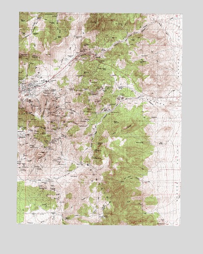
Eureka, UT USGS Topographic Map
Click on map above to begin viewing in our Map Viewer.

This topographic map contains these locations and features:
Feature Name Type Latitude Longitude GNIS ID View Map
AjaxMineN39.9272°W112.1127°1425061View Map
AlaskaMineN39.9113°W112.0930°1425064View Map
AnnandaleMineN39.9372°W112.1208°1425123View Map
Aperdue SpringSpringN39.9344°W112.0672°1425157View Map
Apex SpringSpringN39.9352°W112.0633°1437946View Map
Apex Standard Number 1MineN39.9416°W112.0549°1454387View Map
Apex Standard Number 2MineN39.9455°W112.0561°1454388View Map
Beck Number 1 ShaftMineN39.9408°W112.0977°1454393View Map
Beck Number 2 ShaftMineN39.9438°W112.0974°1454394View Map
Big CanyonValleyN39.9500°W112.0011°1437950View Map
Big Gough SpringSpringN39.9146°W112.0675°1425492View Map
Big HillSummitN39.9519°W112.0802°1425493View Map
Big Hill ShaftMineN39.9538°W112.0777°1425496View Map
Black DragonMineN39.9202°W112.1063°1425658View Map
BlackjackMineN39.9255°W112.1130°1425743View Map
Blackjack TunnelMineN39.9205°W112.1105°1425745View Map
Blue BirdMineN39.8883°W112.0930°1425783View Map
BluffMineN39.9816°W112.0402°1425841View Map
Boss TweedMineN39.9222°W112.1022°1425890View Map
Burgin Number 1MineN39.9500°W112.0461°1454411View Map
Burgin Number 2MineN39.9488°W112.0483°1454580View Map
Burriston CanyonValleyN39.9419°W112.0555°1426206View Map
Burriston PassGapN39.9505°W112.0986°1426207View Map
CarisaMineN39.9275°W112.1019°1426356View Map
Carisa TunnelMineN39.9266°W112.1019°1426357View Map
Centennial-EurekaMineN39.9430°W112.1224°1437955View Map
Central StandardMineN39.9777°W112.0627°1426512View Map
Chief Lime PlantBuildingN39.9808°W112.0830°1437957View Map
Chief Number 1MineN39.9508°W112.1174°1454409View Map
Chief Number 2MineN39.9544°W112.1055°1454410View Map
Chiulos SpringSpringN39.9989°W112.1059°1426599View Map
City of EurekaCivilN39.9588°W112.1149°2410465View Map
ClevelandMineN39.9161°W112.1208°1426711View Map
Colorado ChiefMineN39.9608°W112.1224°1426812View Map
Colorado Number 1MineN39.9363°W112.0952°1454414View Map
Colorado Number 2MineN39.9394°W112.0958°1454415View Map
Columbus TunnelMineN39.8972°W112.1088°1426817View Map
Copper LeafMineN39.9711°W112.0619°1426857View Map
Crown PointMineN39.9338°W112.0922°1427126View Map
Crown Point Number 2MineN39.9388°W112.0911°1454417View Map
Crown Point Number 3MineN39.9352°W112.0880°1454418View Map
Crystal CanyonValleyN39.8794°W112.0899°1427130View Map
DiamondPopulated PlaceN39.8816°W112.0974°1455093View Map
Diamond CemeteryCemeteryN39.8811°W112.1083°2769291View Map
Diamond DivideGapN39.8808°W112.0597°1437967View Map
Diamond PassGapN39.9222°W112.1136°1427390View Map
Diamond SpringSpringN39.8784°W112.0892°1427393View Map
DividendPopulated PlaceN39.9547°W112.0613°1427422View Map
Dragon MineMineN39.9172°W112.1049°1427471View Map
Dry CanyonValleyN39.8811°W112.0958°1427514View Map
Dry Herd CanyonValleyN39.8991°W112.0227°1427552View Map
Eagle and Bluebell ShaftMineN39.9466°W112.1169°1437972View Map
Eagle CanyonValleyN39.9488°W112.1161°1427643View Map
East Crown PointMineN39.9333°W112.0736°1427680View Map
East StandardMineN39.9747°W112.0274°1427726View Map
East Tintic CoalitionMineN39.9552°W112.0841°1427728View Map
East Tintic MountainsRangeN39.8988°W112.0605°1427729View Map
EmeraldMineN39.9319°W112.1191°1427813View Map
EurekaPopulated PlaceN39.9541°W112.1202°1437974View Map
Eureka BullionMineN39.9550°W112.0727°1427849View Map
Eureka ConsolidatedMineN39.9288°W112.1047°1427850View Map
Eureka Elementary SchoolSchoolN39.9565°W112.1133°1435516View Map
Eureka Fire DepartmentBuildingN39.9545°W112.1206°2627435View Map
Eureka HillMineN39.9477°W112.1222°1427852View Map
Eureka LillyMineN39.9525°W112.0686°1427853View Map
Eureka PeakSummitN39.9405°W112.1180°1427854View Map
Eureka Post OfficePost OfficeN39.9587°W112.1035°2767352View Map
Eureka RidgeRidgeN39.9399°W112.1197°1427855View Map
Eureka StandardMineN39.9433°W112.0602°1427856View Map
Farragut ShaftMineN39.9866°W112.1208°1427891View Map
Fitchville RidgeRidgeN39.9166°W112.0841°1435532View Map
Fremont CanyonValleyN39.9991°W112.1105°1428094View Map
Gardner CanyonValleyN39.9491°W112.1119°1428141View Map
GeminiMineN39.9533°W112.1244°1428165View Map
Godiva MountainSummitN39.9425°W112.1033°1428222View Map
Godiva ShaftMineN39.9516°W112.1030°1428223View Map
Godiva TunnelMineN39.9527°W112.1022°1428224View Map
Gold Bond SpringSpringN39.9230°W112.0648°1428227View Map
Gold ChainMineN39.9283°W112.1119°1428228View Map
Golden TreasureMineN39.8983°W112.1030°1428245View Map
GovernorMineN39.9205°W112.1027°1428292View Map
Grand CentralMineN39.9366°W112.1158°1428306View Map
Great EasternMineN39.9191°W112.1024°1428380View Map
Green SpringSpringN39.9034°W112.0801°1428402View Map
Hannibal SpringSpringN39.9625°W112.0755°1428510View Map
Herrington BasinBasinN39.9916°W112.1133°1428676View Map
Herrington SpringSpringN39.9872°W112.1152°1428677View Map
Hidden Treasure SpringSpringN39.9669°W112.0586°1428695View Map
Hillside (historical)Populated PlaceN39.9783°W112.0011°1437981View Map
HomansvillePopulated PlaceN39.9750°W112.0841°1437590View Map
Homansville CanyonValleyN39.9750°W112.0633°1437983View Map
Homansville PassGapN39.9861°W112.0827°1428786View Map
Homansville ShaftMineN39.9763°W112.0791°1428787View Map
HomestakeMineN39.8925°W112.1038°1428792View Map
Humbug TunnelsMineN39.9436°W112.1008°1428940View Map
Independence ShaftMineN39.9716°W112.0333°1428980View Map
Iron Blossom Number 1MineN39.9250°W112.0997°1454449View Map
Iron Blossom Number 3MineN39.9311°W112.0963°1454450View Map
Iron Blossom TunnelMineN39.9238°W112.1005°1429037View Map
Iron King Number 1MineN39.9416°W112.0761°1454451View Map
Iron King Number 2MineN39.9430°W112.0688°1454452View Map
Iron King TunnelMineN39.9411°W112.0663°1429042View Map
Jameson SpringSpringN39.9566°W112.0476°1429128View Map
Joe BowersMineN39.8927°W112.0933°1429182View Map
Joe DalyMineN39.9072°W112.1099°1429184View Map
Juab County Ambulance WestBuildingN39.9531°W112.1229°2665429View Map
Keg SpringSpringN39.9386°W112.0238°1429303View Map
KnightvillePopulated PlaceN39.9538°W112.1008°1437606View Map
LacledeMineN39.8869°W112.1038°1429403View Map
Laguna (historical)LocaleN39.9919°W112.0316°1437990View Map
Last ChanceMineN39.9125°W112.0988°1429485View Map
Latite RidgeRidgeN39.9297°W112.0472°1429496View Map
Lime PeakSummitN39.9808°W112.0766°1429618View Map
Lime Quarry MineMineN39.9777°W112.0783°1429620View Map
Little Gough SpringSpringN39.9188°W112.0672°1429735View Map
Little HillSummitN39.9483°W112.0705°1429738View Map
Little May MineMineN39.9008°W112.1011°1429757View Map
Lower MammothMineN39.9275°W112.1166°1429987View Map
Lucky BoyMineN39.9050°W112.1055°1430005View Map
Luzerne ShaftMineN39.9069°W112.1197°1430018View Map
Mammoth PeakSummitN39.9319°W112.1036°1430072View Map
Mammoth ShaftMineN39.9322°W112.1122°1430073View Map
Maple ShaftMineN39.9469°W112.0897°1430088View Map
Maple SpringSpringN39.9855°W112.0961°1430090View Map
Martha Washington ShaftMineN39.9127°W112.1080°1430125View Map
Mayday ShaftMineN39.9508°W112.1019°1430153View Map
Mayday TunnelMineN39.9519°W112.1022°1437936View Map
Mineral HillSummitN39.9477°W112.0661°1430363View Map
Molly GibsonMineN39.9102°W112.0949°1430409View Map
Montana ShaftMineN39.9416°W112.0636°1430427View Map
MontereyMineN39.9111°W112.1249°1430431View Map
New StateMineN39.9058°W112.0930°1430701View Map
NiebauerMineN39.8922°W112.1094°1437938View Map
North HillSummitN39.9644°W112.0766°1430816View Map
North Lily ShaftMineN39.9586°W112.0711°1430827View Map
North StandardMineN39.9930°W112.0491°1430860View Map
North StarMineN39.9208°W112.1069°1430861View Map
Northern SpyMineN39.9294°W112.0997°1430878View Map
Old Beck TunnelMineN39.9433°W112.0933°1430966View Map
Old OpexMineN39.9319°W112.1213°1430984View Map
OpexMineN39.9361°W112.1205°1431014View Map
Original Iron KingMineN39.9408°W112.0863°1431027View Map
OxenMineN39.9733°W112.0761°1431054View Map
Packard PeakSummitN39.9738°W112.1244°1438005View Map
PaxmanMineN39.9644°W112.1236°1431146View Map
PhoenixMineN39.9269°W112.1105°1431211View Map
Pine CanyonValleyN39.9447°W112.0911°1431241View Map
Pinyon Creek CanyonValleyN39.9983°W112.0011°1438009View Map
Pinyon PeakSummitN39.9941°W112.0663°1431311View Map
Pinyon QueenMineN39.9844°W112.0402°1444435View Map
PrimroseMineN39.9072°W112.1199°1431473View Map
ProvoMineN39.9533°W112.0688°1431487View Map
Rabbits FootMineN39.9086°W112.1208°1431542View Map
Rattlesnake CanyonValleyN39.9977°W112.1127°1431590View Map
RaymondMineN39.9602°W112.1247°1431603View Map
Red RoseMineN39.9238°W112.1044°1431695View Map
RepublicMineN39.8894°W112.1108°1437939View Map
RGW TunnelMineN39.9769°W112.0749°1431531View Map
Ridge and Valley MineMineN39.9583°W112.1233°1438011View Map
Rock CanyonValleyN39.8822°W112.0186°1431896View Map
Ruby CanyonValleyN39.9044°W112.0969°1432043View Map
Ruby ShaftMineN39.9066°W112.0844°1432046View Map
Saddle (historical)LocaleN39.9800°W112.0836°1438018View Map
Saint Patricks Catholic ChurchChurchN39.9558°W112.1230°1450646View Map
SalvadorMineN39.9402°W112.0997°1432153View Map
Shoebridge BonanzaMineN39.8944°W112.0972°1432414View Map
ShowersMineN39.8900°W112.0941°1432429View Map
Silver PassGapN39.9113°W112.0777°1432466View Map
Silver Pass CanyonValleyN39.9505°W112.0322°1432467View Map
Silver SparMineN39.9230°W112.1061°1432470View Map
Sioux Ajax TunnelMineN39.9299°W112.1138°1432488View Map
Sioux PassGapN39.9244°W112.1002°1432489View Map
Sioux PeakSummitN39.9355°W112.1011°1432490View Map
Sioux ShaftMineN39.9322°W112.0955°1432491View Map
Sioux TunnelMineN39.9327°W112.0972°1432492View Map
SnowflakeMineN39.9480°W112.1183°1432601View Map
South Apex HillSummitN39.9358°W112.0527°1432641View Map
South Iron BlossomMineN39.9133°W112.0927°1432727View Map
South StandardMineN39.9283°W112.0688°1432761View Map
Southern EurekaMineN39.9377°W112.1227°1432774View Map
SunbeamMineN39.9091°W112.1122°1433061View Map
Swanson SpringSpringN39.9953°W112.1120°1433108View Map
Tennessee RebelMineN39.9319°W112.1227°1433233View Map
TesoraMineN39.9005°W112.1002°1433245View Map
Tetro ShaftMineN39.9525°W112.1066°1433246View Map
Tetro TunnelMineN39.9522°W112.1074°1433247View Map
The Church of Jesus Christ of Latter Day SaintsChurchN39.9549°W112.1174°1450746View Map
The SummitSummitN39.9594°W112.1019°1433434View Map
Tintic CentralMineN39.9255°W112.0947°1433541View Map
Tintic DavisMineN39.9980°W112.0969°1433543View Map
Tintic Davis SpringSpringN39.9943°W112.0986°1433545View Map
Tintic Drain TunnelTunnelN39.8763°W112.0124°1433546View Map
Tintic High SchoolSchoolN39.9592°W112.1048°1438051View Map
Tintic PreschoolSchoolN39.9566°W112.1131°1437940View Map
Tintic Standard Number 1MineN39.9516°W112.0655°1454536View Map
Tintic Standard Number 2MineN39.9555°W112.0619°1454537View Map
Tintic Standard Number 3MineN39.9558°W112.0594°1454538View Map
TiptopMineN39.9747°W112.0708°1438033View Map
Treasure HillSummitN39.8961°W112.1052°1433661View Map
Treasure Hill ShaftMineN39.8997°W112.1033°1433662View Map
TrixieMineN39.9319°W112.0666°1433675View Map
TrixieMineN39.9313°W112.0677°1438034View Map
TurkMineN39.9197°W112.1024°1433701View Map
UndineMineN39.9077°W112.1097°1433781View Map
United TinticMineN39.9052°W112.0941°1433788View Map
Utah MineMineN39.9400°W112.0997°1455845View Map
Victoria ShaftMineN39.9444°W112.1147°1433892View Map
Water CanyonValleyN39.8811°W112.0958°1433998View Map
Water LilyMineN39.9852°W112.0552°1434011View Map
West Morning GloryMineN39.8883°W112.1152°1437941View Map
Wheeler ShaftMineN39.9097°W112.1208°1434143View Map
White StarMineN39.9752°W112.0680°1434203View Map
Willow SpringSpringN39.9238°W112.0297°1434353View Map
Wing SpringSpringN39.9230°W112.0162°1434403View Map
X Iron DukeMineN39.9122°W112.1247°1434487View Map
YankeeMineN39.9477°W112.0977°1434491View Map
Zuma ShaftMineN39.9361°W112.0780°1434531View Map

Note: Coordinates in the location and feature list above are referenced to NAD83 datum.


Copyright (C) 2008-2024 Ryan Niemi / Sunset Dynamics ... All Rights Reserved