TopoQuest Logo
Do you find TopoQuest useful?
Help keep TopoQuest running and adding new maps/features by donating!
Bitcoin:  19c7KJd3qBynnjoSw5npx9KScwjBe4ifkT
Litecoin:  LXs6TkuXGGXo1vDsWCkWVdjQX94eUKd6ui
Home View Maps Find Maps Find Places Resources & Links


Duncan Ridge, Washington Topographic Map

USGS Map Title: Duncan Ridge, WA
USGS Map MRC: 48119G7
DRG (GeoTIFF) Download: o48119g7.tif


Neighboring USGS Topographic Map Quads:


  Horseshoe Basin, WA  
48119H8
 

  Hurley Peak, WA  
48119H7
 

  Nighthawk, WA  
48119H6
 

  Corral Butte, WA  
48119G8
 

  Duncan Ridge, WA  
48119G7
 

  Loomis, WA  
48119G6
 

  Tiffany Mountain, WA  
48119F8
 

  Coxit Mountain, WA  
48119F7
 

  Blue Goat Mountain, WA  
48119F6


Map MRC Location:

N49°
W120°
N49°
W119°
H8 H7 H6 H5 H4 H3 H2 H1
G8 G7 G6 G5 G4 G3 G2 G1
F8 F7 F6 F5 F4 F3 F2 F1
E8 E7 E6 E5 E4 E3 E2 E1
D8 D7 D6 D5 D4 D3 D2 D1
C8 C7 C6 C5 C4 C3 C2 C1
B8 B7 B6 B5 B4 B3 B2 B1
A8 A7 A6 A5 A4 A3 A2 A1
N48°
W120°
N48°
W119°

Duncan Ridge, WA USGS 1:24K Topographic Map Preview:
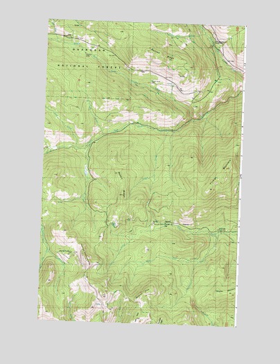
Duncan Ridge, WA USGS Topographic Map
Click on map above to begin viewing in our Map Viewer.

This topographic map contains these locations and features:
Feature Name Type Latitude Longitude GNIS ID View Map
Cecil Creek Loading CorralLocaleN48.7899°W119.7917°1528723View Map
Chickadee CreekStreamN48.7885°W119.7601°1517687View Map
Chickadee RidgeRidgeN48.7629°W119.8062°1517688View Map
Cold CreekStreamN48.8221°W119.8548°1517925View Map
Cougar CreekStreamN48.8235°W119.8445°1518158View Map
Crazy Cow CreekStreamN48.8707°W119.7751°1518300View Map
Daisy CampgroundLocaleN48.8679°W119.8606°1528957View Map
Daisy CreekStreamN48.8657°W119.8670°1518455View Map
Duncan James CabinLocaleN48.8490°W119.8081°1519005View Map
Duncan RidgeRidgeN48.8610°W119.8017°1528956View Map
Finney FlatFlatN48.7896°W119.8020°1519539View Map
Juniper PointSummitN48.8688°W119.7604°1529971View Map
Middle Fork Toats Coulee CreekStreamN48.8354°W119.7812°1523093View Map
Ninemile CreekStreamN48.8740°W119.7787°1523675View Map
North Fork Chickadee CreekStreamN48.7763°W119.7745°1523757View Map
North Fork Ninemile CampgroundLocaleN48.8668°W119.7701°1523747View Map
Parks CreekStreamN48.8274°W119.8367°1524219View Map
Rabbit CreekStreamN48.8302°W119.7962°1524786View Map
Rabbit RidgeRidgeN48.8032°W119.8245°1524790View Map
Skull and Crossbones CabinLocaleN48.7782°W119.8540°1528722View Map
Skull and Crossbones RidgeRidgeN48.7757°W119.8451°1525885View Map
South Fork TrailTrailN48.8321°W119.8317°1526276View Map
Stump SpringsSpringN48.7904°W119.8284°1526652View Map
Tillman MountainSummitN48.8152°W119.7570°1527223View Map

Note: Coordinates in the location and feature list above are referenced to NAD83 datum.


Copyright (C) 2008-2024 Ryan Niemi / Sunset Dynamics ... All Rights Reserved