TopoQuest Logo
Do you find TopoQuest useful?
Help keep TopoQuest running and adding new maps/features by donating!
Bitcoin:  19c7KJd3qBynnjoSw5npx9KScwjBe4ifkT
Litecoin:  LXs6TkuXGGXo1vDsWCkWVdjQX94eUKd6ui
Home View Maps Find Maps Find Places Resources & Links


Loomis, Washington Topographic Map

USGS Map Title: Loomis, WA
USGS Map MRC: 48119G6
DRG (GeoTIFF) Download: o48119g6.tif


Neighboring USGS Topographic Map Quads:


  Hurley Peak, WA  
48119H7
 

  Nighthawk, WA  
48119H6
 

  Bullfrog Mountain, WA  
48119H5
 

  Duncan Ridge, WA  
48119G7
 

  Loomis, WA  
48119G6
 

  Enterprise, WA  
48119G5
 

  Coxit Mountain, WA  
48119F7
 

  Blue Goat Mountain, WA  
48119F6
 

  Aeneas Lake, WA  
48119F5


Map MRC Location:

N49°
W120°
N49°
W119°
H8 H7 H6 H5 H4 H3 H2 H1
G8 G7 G6 G5 G4 G3 G2 G1
F8 F7 F6 F5 F4 F3 F2 F1
E8 E7 E6 E5 E4 E3 E2 E1
D8 D7 D6 D5 D4 D3 D2 D1
C8 C7 C6 C5 C4 C3 C2 C1
B8 B7 B6 B5 B4 B3 B2 B1
A8 A7 A6 A5 A4 A3 A2 A1
N48°
W120°
N48°
W119°

Loomis, WA USGS 1:24K Topographic Map Preview:
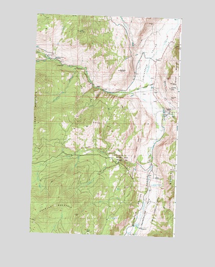
Loomis, WA USGS Topographic Map
Click on map above to begin viewing in our Map Viewer.

This topographic map contains these locations and features:
Feature Name Type Latitude Longitude GNIS ID View Map
Black Bear MineMineN48.8357°W119.6259°1516595View Map
Cecil CreekStreamN48.7985°W119.6473°1534572View Map
Chopaka CreekStreamN48.8521°W119.6451°1517742View Map
Deer CreekStreamN48.8329°W119.6887°1518604View Map
Doney BasinBasinN48.7538°W119.6976°1529029View Map
Douglas MountainSummitN48.7618°W119.7106°1531440View Map
Gold HillSummitN48.8090°W119.7109°1520093View Map
Hercules FlatFlatN48.7974°W119.6762°1529033View Map
Highland Fire CampLocaleN48.7835°W119.6437°1529032View Map
Huckleberry CreekStreamN48.8443°W119.7070°1521021View Map
Jim Black LakeLakeN48.7598°W119.6795°1521366View Map
Katasa CreekStreamN48.7977°W119.7042°1521573View Map
LoomisPopulated PlaceN48.8210°W119.6334°1522442View Map
Loomis Census Designated PlaceCensusN48.8235°W119.6398°2586736View Map
Loomis Community ChurchChurchN48.8223°W119.6373°2609631View Map
Loomis Post OfficePost OfficeN48.8217°W119.6354°2606966View Map
North Fork Toats Coulee CreekStreamN48.8479°W119.7342°1523864View Map
Okanogan County Fire District 10 Loomis Fire and AidBuildingN48.8215°W119.6350°2643527View Map
Olie CreekStreamN48.8493°W119.7317°1524025View Map
Palmer Mountain TunnelTunnelN48.8249°W119.6259°1524158View Map
Quartz MountainSummitN48.8649°W119.7070°1524747View Map
Rattlesnake DrawValleyN48.8535°W119.6570°1524890View Map
Rattlesnake MountainSummitN48.8429°W119.6734°1524895View Map
Redman CreekStreamN48.7927°W119.6717°1524960View Map
Renn LakeLakeN48.7751°W119.6742°1525000View Map
Security DrawValleyN48.8310°W119.6367°1529036View Map
Security MineMineN48.8407°W119.6362°1529037View Map
South Fork Junction CampgroundLocaleN48.8490°W119.7340°1529038View Map
South Fork Toats Coulee CreekStreamN48.8477°W119.7342°1526270View Map
Stadium LakeLakeN48.7570°W119.6589°1531547View Map
Three ForksStreamN48.7879°W119.7373°1527149View Map
Toats Coulee CreekStreamN48.8382°W119.6459°1527267View Map
Tunnel FlatFlatN48.8274°W119.6359°1529034View Map
War Eagle MineMineN48.8343°W119.6301°1529035View Map

Note: Coordinates in the location and feature list above are referenced to NAD83 datum.


Copyright (C) 2008-2024 Ryan Niemi / Sunset Dynamics ... All Rights Reserved