TopoQuest Logo
Do you find TopoQuest useful?
Help keep TopoQuest running and adding new maps/features by donating!
Bitcoin:  19c7KJd3qBynnjoSw5npx9KScwjBe4ifkT
Litecoin:  LXs6TkuXGGXo1vDsWCkWVdjQX94eUKd6ui
Home View Maps Find Maps Find Places Resources & Links


Derrick City, Pennsylvania Topographic Map

USGS Map Title: Derrick City, PA
USGS Map MRC: 41078H5
DRG (GeoTIFF) Download: o41078h5.tif


Neighboring USGS Topographic Map Quads:


  Limestone, NY  
42078A6
 

  Knapp Creek, NY  
42078A5
 

  Olean, NY  
42078A4
 

  Bradford, PA  
41078H6
 

  Derrick City, PA  
41078H5
 

  Eldred, PA  
41078H4
 

  Lewis Run, PA  
41078G6
 

  Cyclone, PA  
41078G5
 

  Smethport, PA  
41078G4


Map MRC Location:

N42°
W79°
N42°
W78°
H8 H7 H6 H5 H4 H3 H2 H1
G8 G7 G6 G5 G4 G3 G2 G1
F8 F7 F6 F5 F4 F3 F2 F1
E8 E7 E6 E5 E4 E3 E2 E1
D8 D7 D6 D5 D4 D3 D2 D1
C8 C7 C6 C5 C4 C3 C2 C1
B8 B7 B6 B5 B4 B3 B2 B1
A8 A7 A6 A5 A4 A3 A2 A1
N41°
W79°
N41°
W78°

Derrick City, PA USGS 1:24K Topographic Map Preview:
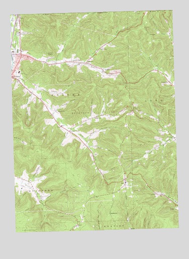
Derrick City, PA USGS Topographic Map
Click on map above to begin viewing in our Map Viewer.

This topographic map contains these locations and features:
Feature Name Type Latitude Longitude GNIS ID View Map
AikenPopulated PlaceN41.8781°W78.5778°1168093View Map
AllenPopulated PlaceN41.8828°W78.5731°1200716View Map
Baker RunStreamN41.9270°W78.5000°1168606View Map
BeechwoodPopulated PlaceN41.9737°W78.6020°1200718View Map
Bells CampPopulated PlaceN41.9801°W78.5536°1169181View Map
Bolivar RunStreamN41.9734°W78.6247°969282View Map
BordellPopulated PlaceN41.8753°W78.5367°1203127View Map
Buchanan HollowValleyN41.9544°W78.6090°1170497View Map
Chamberlain HollowValleyN41.9398°W78.5638°1171534View Map
ColevillePopulated PlaceN41.8951°W78.5159°1172203View Map
Corwins CornersPopulated PlaceN41.9323°W78.5811°1172479View Map
Dallas CityPopulated PlaceN41.9409°W78.5556°1172896View Map
Derrick CityPopulated PlaceN41.9706°W78.5714°1173172View Map
Derrick City Elementary SchoolSchoolN41.9706°W78.5725°1207258View Map
Derrick City Post OfficePost OfficeN41.9719°W78.5780°2773117View Map
Derrick City Volunteer Fire Department Station 11 Main StationBuildingN41.9721°W78.5751°2645809View Map
Driver SchoolSchoolN41.9353°W78.5870°1173484View Map
Fairview HeightsPopulated PlaceN41.9737°W78.5959°1174535View Map
Foster BrookPopulated PlaceN41.9751°W78.6172°1175035View Map
Foster Brook Census Designated PlaceCensusN41.9793°W78.6063°2634229View Map
Foster HollowValleyN41.8933°W78.6019°1175040View Map
Foster Township Municipal BuildingBuildingN41.9895°W78.6178°1214519View Map
Foster Township Police DepartmentBuildingN41.9896°W78.6178°2777134View Map
Fretz Junior High SchoolSchoolN41.9670°W78.6186°1175234View Map
FullertonPopulated PlaceN41.9865°W78.5175°1175329View Map
Garlock HollowValleyN41.9284°W78.5672°1175454View Map
GilmorePopulated PlaceN41.9709°W78.5659°1175621View Map
Harrisburg RunStreamN41.9728°W78.5889°952280View Map
Lafferty RunStreamN41.9565°W78.6059°1178758View Map
Lincoln SchoolSchoolN41.9895°W78.6178°1179399View Map
MiddletownPopulated PlaceN41.8834°W78.5511°1181073View Map
Minard Run SchoolSchoolN41.9037°W78.6120°1200717View Map
Pennbrook RunStreamN41.9720°W78.5650°1193099View Map
Pratt HollowValleyN41.9239°W78.5650°1184384View Map
Red RockPopulated PlaceN41.9659°W78.5528°1184777View Map
RewPopulated PlaceN41.9015°W78.5392°1184956View Map
Rew Census Designated PlaceCensusN41.8992°W78.5388°2631299View Map
Rew Post OfficePost OfficeN41.9017°W78.5391°2773247View Map
Rew Volunteer Fire DepartmentBuildingN41.9027°W78.5394°2645816View Map
Sawyer ChurchChurchN41.9348°W78.5875°1187042View Map
Sawyer CityPopulated PlaceN41.9442°W78.5909°1187043View Map
SummitPopulated PlaceN41.9428°W78.5317°1189037View Map
Tibbitts HollowValleyN41.9060°W78.6098°1189561View Map
Totten HollowValleyN41.9451°W78.5908°1200122View Map
Township of FosterCivilN41.9609°W78.6170°1216784View Map
TunaPopulated PlaceN41.9962°W78.6172°1189918View Map
WalkertownPopulated PlaceN41.9590°W78.5036°1190508View Map

Note: Coordinates in the location and feature list above are referenced to NAD83 datum.


Copyright (C) 2008-2024 Ryan Niemi / Sunset Dynamics ... All Rights Reserved