TopoQuest Logo
Do you find TopoQuest useful?
Help keep TopoQuest running and adding new maps/features by donating!
Bitcoin:  19c7KJd3qBynnjoSw5npx9KScwjBe4ifkT
Litecoin:  LXs6TkuXGGXo1vDsWCkWVdjQX94eUKd6ui
Home View Maps Find Maps Find Places Resources & Links


Bradford, Pennsylvania Topographic Map

USGS Map Title: Bradford, PA
USGS Map MRC: 41078H6
DRG (GeoTIFF) Download: o41078h6.tif


Neighboring USGS Topographic Map Quads:


  Red House, NY  
42078A7
 

  Limestone, NY  
42078A6
 

  Knapp Creek, NY  
42078A5
 

  Stickney, PA  
41078H7
 

  Bradford, PA  
41078H6
 

  Derrick City, PA  
41078H5
 

  Westline, PA  
41078G7
 

  Lewis Run, PA  
41078G6
 

  Cyclone, PA  
41078G5


Map MRC Location:

N42°
W79°
N42°
W78°
H8 H7 H6 H5 H4 H3 H2 H1
G8 G7 G6 G5 G4 G3 G2 G1
F8 F7 F6 F5 F4 F3 F2 F1
E8 E7 E6 E5 E4 E3 E2 E1
D8 D7 D6 D5 D4 D3 D2 D1
C8 C7 C6 C5 C4 C3 C2 C1
B8 B7 B6 B5 B4 B3 B2 B1
A8 A7 A6 A5 A4 A3 A2 A1
N41°
W79°
N41°
W78°

Bradford, PA USGS 1:24K Topographic Map Preview:
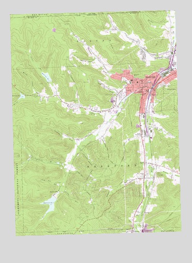
Bradford, PA USGS Topographic Map
Click on map above to begin viewing in our Map Viewer.

This topographic map contains these locations and features:
Feature Name Type Latitude Longitude GNIS ID View Map
Beacon Hill Lookout TowerTowerN41.9751°W78.7056°1212821View Map
Bennett BrookStreamN41.9545°W78.6575°1209416View Map
Bennett Brook SchoolSchoolN41.9767°W78.6856°1210278View Map
Blacksnake MountainSummitN41.9873°W78.7150°1210489View Map
Bolivar Run SchoolSchoolN41.9809°W78.6525°1210279View Map
BradfordPopulated PlaceN41.9559°W78.6439°1213612View Map
Bradford Area Senior High SchoolSchoolN41.9598°W78.6545°1210394View Map
Bradford City Fire Department CentralBuildingN41.9556°W78.6480°2644707View Map
Bradford City Fire Department East BradfordBuildingN41.9643°W78.6270°2645811View Map
Bradford City Number Five DamDamN41.8967°W78.7214°1210262View Map
Bradford City Number Three DamDamN41.9534°W78.7398°1210264View Map
Bradford City Number Two DamDamN41.9617°W78.7231°1210266View Map
Bradford Fire and AmbulanceBuildingN41.9567°W78.6472°2644759View Map
Bradford Oil FieldOilfieldN41.9170°W78.6845°1209442View Map
Bradford Police DepartmentBuildingN41.9567°W78.6472°2777227View Map
Bradford Post OfficePost OfficeN41.9578°W78.6457°2773083View Map
Bradford Regional Medical CenterHospitalN41.9611°W78.6596°2718009View Map
Bradford Township Police DepartmentBuildingN41.9309°W78.6523°2776915View Map
Bradford Township Volunteer Fire DepartmentBuildingN41.9655°W78.6709°2645813View Map
Brown ValleyValleyN41.9552°W78.7318°1209448View Map
Central Christian High SchoolSchoolN41.9495°W78.6723°1209486View Map
Childrens Center for Treatment and EducationSchoolN41.9073°W78.6507°1210392View Map
City of BradfordCivilN41.9603°W78.6414°1215429View Map
Control Tower BuildingBuildingN41.9458°W78.6733°2115039View Map
Criminal Forensic Lab BuildingBuildingN41.9442°W78.6761°2115040View Map
Crooker HollowValleyN41.9224°W78.6982°1209537View Map
Crooker SchoolSchoolN41.9201°W78.7025°1210276View Map
Custer CityPopulated PlaceN41.9059°W78.6517°1209541View Map
Custer City Post OfficePost OfficeN41.9059°W78.6516°2772659View Map
DegoliaPopulated PlaceN41.9148°W78.6511°1209555View Map
Derrick City Volunteer Fire Department Station 11ABuildingN41.9881°W78.6662°2645810View Map
East Bradford StationLocaleN41.9726°W78.6272°1212825View Map
East Branch Tunungwant CreekStreamN41.9578°W78.6414°1209584View Map
Emery Towers SchoolSchoolN41.9559°W78.6517°1210069View Map
Emily Dickinson HouseBuildingN41.9439°W78.6717°2115041View Map
Ernest Hemingway HouseBuildingN41.9436°W78.6719°2115042View Map
F Scott Fitzgerald HouseBuildingN41.9425°W78.6747°2115043View Map
Fifth Ward School (historical)SchoolN41.9528°W78.6436°1214515View Map
Foster BrookStreamN41.9837°W78.6253°1209610View Map
Foster RunStreamN41.8767°W78.6589°1212822View Map
Frame-Westerberg CommonsBuildingN41.9433°W78.6739°2115045View Map
Fuller BrookStreamN41.9142°W78.7109°1209621View Map
Gates HollowValleyN41.9539°W78.6698°1209625View Map
George G Blaisdell Elementary SchoolSchoolN41.9740°W78.6439°1214518View Map
Gertrude Stein HouseBuildingN41.9428°W78.6722°2115046View Map
Gilbert RunStreamN41.9540°W78.7164°1209628View Map
Hangar BuildingBuildingN41.9464°W78.6722°2115047View Map
Hanley LibraryBuildingN41.9444°W78.6731°2115048View Map
Hazelton MillsPopulated PlaceN41.8987°W78.7189°1209663View Map
Hedgehog HollowValleyN41.9735°W78.6873°1209665View Map
Herman Melville HouseBuildingN41.9433°W78.6717°2115049View Map
Hobson Place SchoolSchoolN41.9545°W78.6598°1209673View Map
HowardPopulated PlaceN41.8865°W78.6520°1209682View Map
Howard Junction StationLocaleN41.8873°W78.6522°1212823View Map
James Baldwin HouseBuildingN41.9422°W78.6758°2115050View Map
Kendall CreekStreamN41.9684°W78.6253°1209723View Map
Kendall Residence HallsLocaleN41.9428°W78.6756°2115051View Map
Kessel Athletic ComplexLocaleN41.9533°W78.6647°2115052View Map
Kissem RunStreamN41.9006°W78.7153°1209736View Map
Langmade BrookStreamN41.9251°W78.6995°1209746View Map
Latchaw CreekStreamN41.9928°W78.6250°955066View Map
Marilla BrookStreamN41.9415°W78.6736°1209795View Map
Marilla Brook SchoolSchoolN41.9473°W78.7053°1210277View Map
McKean Residence HallsLocaleN41.9431°W78.6719°2115053View Map
Meadow BrookStreamN41.9459°W78.6998°1212820View Map
Miller Airport (historical)AirportN41.8853°W78.7392°1210254View Map
Minard RunStreamN41.9109°W78.6459°1209826View Map
Niles HollowValleyN41.9292°W78.6834°1209855View Map
Number Four ReservoirReservoirN41.9630°W78.6568°1209926View Map
Number One ReservoirReservoirN41.9543°W78.7299°1209923View Map
Nusbaum Chemical PlantBuildingN41.9109°W78.7073°1210275View Map
Oak Hill CemeteryCemeteryN41.9599°W78.6356°1209867View Map
Pecora FieldAirportN41.9047°W78.6277°2442997View Map
Reed-Colt HouseBuildingN41.9428°W78.6747°2115055View Map
Reservoir Number FiveReservoirN41.8928°W78.7230°1210261View Map
Reservoir Number ThreeReservoirN41.9536°W78.7424°1210263View Map
Reservoir Number TwoReservoirN41.9641°W78.7232°1210265View Map
Rutherford RunStreamN41.9353°W78.6497°1209945View Map
Saint Bernard Elementary SchoolSchoolN41.9551°W78.6464°1214517View Map
Saint Bernards CemeteryCemeteryN41.9519°W78.6726°1209948View Map
School Street Junior High SchoolSchoolN41.9601°W78.6539°1210395View Map
Second Ward SchoolSchoolN41.9534°W78.6497°1209964View Map
Sheppard RunStreamN41.9090°W78.6464°1209974View Map
Songbird SchoolSchoolN41.9042°W78.6914°1210274View Map
South BradfordPopulated PlaceN41.9292°W78.6528°1209997View Map
South Penn RunStreamN41.9034°W78.7139°1210001View Map
Student Laundry BuildingBuildingN41.9431°W78.6725°2115146View Map
Swarts HallBuildingN41.9436°W78.6728°2115147View Map
T S Ellot HouseBuildingN41.9428°W78.6717°2115148View Map
Third Ward SchoolSchoolN41.9601°W78.6511°1210034View Map
Tome HollowValleyN41.9109°W78.7065°1210049View Map
Township of BradfordCivilN41.9183°W78.6916°1216780View Map
Two Mile RunStreamN41.8806°W78.7345°1210379View Map
University of Pittsburgh - Bradford CampusSchoolN41.9434°W78.6731°1210391View Map
Walt Whitman HouseBuildingN41.9431°W78.6756°2115149View Map
Watrous RunStreamN41.8801°W78.6584°1210089View Map
WESB-AM (Bradford)TowerN41.9365°W78.6453°1210248View Map
West BradfordPopulated PlaceN41.9637°W78.6681°1212824View Map
West Branch Elementary SchoolSchoolN41.9434°W78.6831°1210393View Map
West Branch Tunungwant CreekStreamN41.9581°W78.6414°1210227View Map
Willa Cather HouseBuildingN41.9419°W78.6747°2115151View Map
William Faulkner HouseBuildingN41.9431°W78.6756°2115152View Map
Willow Dale CemeteryCemeteryN41.9475°W78.7017°1210123View Map
Zora Neale Hurston HouseBuildingN41.9442°W78.6714°2115153View Map

Note: Coordinates in the location and feature list above are referenced to NAD83 datum.


Copyright (C) 2008-2024 Ryan Niemi / Sunset Dynamics ... All Rights Reserved