TopoQuest Logo
Do you find TopoQuest useful?
Help keep TopoQuest running and adding new maps/features by donating!
Bitcoin:  19c7KJd3qBynnjoSw5npx9KScwjBe4ifkT
Litecoin:  LXs6TkuXGGXo1vDsWCkWVdjQX94eUKd6ui
Home View Maps Find Maps Find Places Resources & Links


Candia, New Hampshire Topographic Map

USGS Map Title: Candia, NH
USGS Map MRC: 43071A3
DRG (GeoTIFF) Download: o43071a3.tif


Neighboring USGS Topographic Map Quads:


  Suncook, NH  
43071B4
 

  Gossville, NH  
43071B3
 

  Northwood, NH  
43071B2
 

  Manchester North, NH  
43071A4
 

  Candia, NH  
43071A3
 

  Mount Pawtuckaway, NH  
43071A2
 

  Manchester South, NH  
42071H4
 

  Derry, NH  
42071H3
 

  Sandown, NH  
42071H2


Map MRC Location:

N44°
W72°
N44°
W71°
H8 H7 H6 H5 H4 H3 H2 H1
G8 G7 G6 G5 G4 G3 G2 G1
F8 F7 F6 F5 F4 F3 F2 F1
E8 E7 E6 E5 E4 E3 E2 E1
D8 D7 D6 D5 D4 D3 D2 D1
C8 C7 C6 C5 C4 C3 C2 C1
B8 B7 B6 B5 B4 B3 B2 B1
A8 A7 A6 A5 A4 A3 A2 A1
N43°
W72°
N43°
W71°

Candia, NH USGS 1:24K Topographic Map Preview:
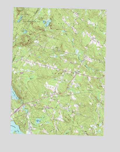
Candia, NH USGS Topographic Map
Click on map above to begin viewing in our Map Viewer.

This topographic map contains these locations and features:
Feature Name Type Latitude Longitude GNIS ID View Map
Abe Emerson MarshSwampN43.0438°W71.2895°1914133View Map
AuburnPopulated PlaceN43.0045°W71.3484°865283View Map
Auburn CemeteryCemeteryN43.0073°W71.3453°1914147View Map
Auburn Fire Department Station 2BuildingN43.0071°W71.3435°2605201View Map
Auburn Police DeptBuildingN43.0070°W71.3432°2752839View Map
Auburn Post OfficePost OfficeN43.0062°W71.3454°1914148View Map
Auburn Railroad StationLocaleN43.0204°W71.3501°1914149View Map
Battery PointCapeN43.0020°W71.3692°865417View Map
Bear Brook State ParkParkN43.1079°W71.3528°865439View Map
Bear HillSummitN43.1226°W71.3645°865441View Map
Bear Hill PondLakeN43.1132°W71.3662°865445View Map
Bear Hill Pond CampLocaleN43.1129°W71.3623°865446View Map
Beaver PondLakeN43.1106°W71.3281°865491View Map
Broken Boulder Smith Pond TrailTrailN43.1165°W71.3481°865806View Map
Campground TrailTrailN43.1201°W71.3195°865968View Map
CandiaPopulated PlaceN43.0779°W71.2767°865976View Map
Candia Congregational ChurchChurchN43.0634°W71.3031°1914167View Map
Candia Fire Rescue DepartmentBuildingN43.0623°W71.2876°2605137View Map
Candia Four CornersPopulated PlaceN43.0615°W71.2884°865977View Map
Candia Hill School (historical)SchoolN43.0626°W71.3031°1914168View Map
Candia Police DeptBuildingN43.0616°W71.2910°2752813View Map
Candia Post OfficePost OfficeN43.0599°W71.2809°1914169View Map
Candia StationLocaleN43.0518°W71.2931°1914170View Map
Charmingfare LinksLocaleN43.0654°W71.3037°1914180View Map
Charmingfare Ski Touring CenterLocaleN43.0459°W71.3206°1914665View Map
Childrens CampLocaleN43.1142°W71.3378°866155View Map
Clark PondReservoirN43.0241°W71.3550°1775165View Map
Clark Pond BrookStreamN43.0126°W71.3484°866188View Map
Clark Pond East DamDamN43.0201°W71.3512°1775162View Map
Clark Pond West DamDamN43.0201°W71.3528°1775164View Map
Cleary AirportAirportN43.0010°W71.3361°2770548View Map
East Candia Railroad StationLocaleN43.0429°W71.2517°1914215View Map
First Baptist ChurchChurchN43.0737°W71.2645°1914256View Map
Griffin Free Public LibraryBuildingN43.0051°W71.3484°1914284View Map
Hall MountainSummitN43.0926°W71.3545°867324View Map
Hall Mountain MarshReservoirN43.1014°W71.3584°867325View Map
Hall Mountain Marsh DamDamN43.1034°W71.3578°1775673View Map
Henry W Moore SchoolSchoolN43.0629°W71.2888°868539View Map
Holbrook CemeteryCemeteryN43.0590°W71.2920°867546View Map
Hook BrookStreamN43.0148°W71.3359°867584View Map
Hooks CrossingPopulated PlaceN43.0251°W71.3303°871188View Map
Interchange 2CrossingN43.0231°W71.3667°1914327View Map
Interchange 3CrossingN43.0393°W71.3195°1914328View Map
Jesse Remington High SchoolSchoolN43.0640°W71.3063°2499407View Map
Kinnicum PondLakeN43.0547°W71.3516°867896View Map
Leavitts HillPopulated PlaceN43.1198°W71.2903°867975View Map
Little Massabesic BrookStreamN43.0123°W71.3481°868069View Map
Little Massabesic LakeLakeN43.0131°W71.3378°868070View Map
Maple Falls BrookStreamN43.0279°W71.3578°868250View Map
Moore ParkParkN43.0609°W71.2906°868536View Map
Mount PisgahSummitN43.0148°W71.2976°869232View Map
Mount Pisgah BrookStreamN43.0237°W71.2965°868600View Map
Murray Mill BrookStreamN43.0268°W71.3259°868668View Map
North ChesterPopulated PlaceN43.0040°W71.2753°868777View Map
Norton PondLakeN43.0109°W71.2543°868836View Map
Patten HillSummitN43.0318°W71.2662°869023View Map
Preston BrookStreamN43.0148°W71.3331°869359View Map
Saint Peter Parish ChurchChurchN43.0037°W71.3512°1914505View Map
Smyth Public LibraryBuildingN43.0631°W71.3023°1914542View Map
South DeerfieldPopulated PlaceN43.0959°W71.2678°870032View Map
Spruce LakesLakeN43.0030°W71.2982°870111View Map
Spruce PondLakeN43.1118°W71.3333°870113View Map
Sucker BrookStreamN43.0004°W71.3470°870250View Map
Tot Spot Learning CenterSchoolN43.0381°W71.3187°2499412View Map
Tower HillSummitN43.0415°W71.3617°870469View Map
Tower Hill PondReservoirN43.0398°W71.3726°870470View Map
Tower Hill Pond DamDamN43.0350°W71.3647°1775146View Map
Town of CandiaCivilN43.0595°W71.3095°873558View Map
Village Childrens CenterSchoolN43.0065°W71.3482°2499474View Map
Walnut HillSummitN43.0859°W71.3128°870659View Map

Note: Coordinates in the location and feature list above are referenced to NAD83 datum.


Copyright (C) 2008-2024 Ryan Niemi / Sunset Dynamics ... All Rights Reserved