TopoQuest Logo
Do you find TopoQuest useful?
Help keep TopoQuest running and adding new maps/features by donating!
Bitcoin:  19c7KJd3qBynnjoSw5npx9KScwjBe4ifkT
Litecoin:  LXs6TkuXGGXo1vDsWCkWVdjQX94eUKd6ui
Home View Maps Find Maps Find Places Resources & Links


Suncook, New Hampshire Topographic Map

USGS Map Title: Suncook, NH
USGS Map MRC: 43071B4
DRG (GeoTIFF) Download: o43071b4.tif


Neighboring USGS Topographic Map Quads:


  Penacook, NH  
43071C5
 

  Loudon, NH  
43071C4
 

  Pittsfield, NH  
43071C3
 

  Concord, NH  
43071B5
 

  Suncook, NH  
43071B4
 

  Gossville, NH  
43071B3
 

  Goffstown, NH  
43071A5
 

  Manchester North, NH  
43071A4
 

  Candia, NH  
43071A3


Map MRC Location:

N44°
W72°
N44°
W71°
H8 H7 H6 H5 H4 H3 H2 H1
G8 G7 G6 G5 G4 G3 G2 G1
F8 F7 F6 F5 F4 F3 F2 F1
E8 E7 E6 E5 E4 E3 E2 E1
D8 D7 D6 D5 D4 D3 D2 D1
C8 C7 C6 C5 C4 C3 C2 C1
B8 B7 B6 B5 B4 B3 B2 B1
A8 A7 A6 A5 A4 A3 A2 A1
N43°
W72°
N43°
W71°

Suncook, NH USGS 1:24K Topographic Map Preview:
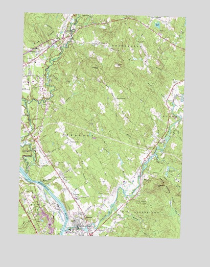
Suncook, NH USGS Topographic Map
Click on map above to begin viewing in our Map Viewer.

This topographic map contains these locations and features:
Feature Name Type Latitude Longitude GNIS ID View Map
Allenstown Elementary SchoolPopulated PlaceN43.1579°W71.4056°865220View Map
Allenstown Fire DepartmentBuildingN43.1273°W71.4554°2605111View Map
Ames BrookStreamN43.1712°W71.3990°865232View Map
Armand R Dupont SchoolSchoolN43.1272°W71.4537°1916938View Map
Bear BrookStreamN43.1717°W71.3945°865437View Map
Bear Brook Park PondReservoirN43.1651°W71.3862°1775550View Map
Bear Brook State Park DamDamN43.1651°W71.3862°1775549View Map
Boat Meadow BrookStreamN43.1365°W71.4301°865686View Map
Bow Bog BrookStreamN43.1515°W71.4798°865725View Map
Bow Police DepartmentBuildingN43.1449°W71.4984°2752949View Map
Brigham HeliportAirportN43.1959°W71.4767°873433View Map
Broken GroundSummitN43.2356°W71.4837°865807View Map
Buck Street East DamDamN43.1601°W71.4062°1775547View Map
Buck Street West DamDamN43.1601°W71.4078°1775545View Map
Burnham BrookStreamN43.2048°W71.3809°865868View Map
Capital Christian SchoolSchoolN43.2284°W71.4756°2499533View Map
Careplus Ambulance Services Station 4 - BowBuildingN43.1420°W71.4810°2658912View Map
Catamount BrookStreamN43.1537°W71.3751°866039View Map
Catamount HillSummitN43.1534°W71.3931°866040View Map
Catamount PondLakeN43.1634°W71.3843°866042View Map
Cemetery BrookStreamN43.2315°W71.4678°866069View Map
ChichesterPopulated PlaceN43.2492°W71.3998°866151View Map
Chichester Congregational ChurchChurchN43.2470°W71.4023°1916991View Map
Chichester Fire and RescueBuildingN43.2463°W71.4017°2605133View Map
Chichester Police DeptBuildingN43.2462°W71.4017°2752843View Map
Chichester United Methodist ChurchChurchN43.2495°W71.3995°1916993View Map
China DamDamN43.1301°W71.4562°1774794View Map
Congregational CenterBuildingN43.1654°W71.4703°866304View Map
Deer BrookStreamN43.1892°W71.3809°866525View Map
Early Enrichment CenterSchoolN43.2108°W71.4971°2499383View Map
Epsom Valley CampgroundLocaleN43.2362°W71.3820°1917052View Map
Evergreen CemeteryCemeteryN43.1370°W71.4381°1917054View Map
Family Tree Child Care CenterSchoolN43.1510°W71.4613°2499397View Map
First Choice for Children Child Care CenterSchoolN43.1488°W71.4602°2499394View Map
First ChurchChurchN43.1606°W71.3801°1917061View Map
Fowler BrookStreamN43.1767°W71.3928°866949View Map
Franklin Pierce University at ConcordSchoolN43.2130°W71.4951°1917075View Map
Frenchs BrookStreamN43.2134°W71.4787°866983View Map
Garvin HillSummitN43.2217°W71.4270°867032View Map
Green Valley School Montessori Learning CenterSchoolN43.1585°W71.4681°1917185View Map
Hartford BrookStreamN43.1398°W71.4298°867394View Map
Hillside Baptist ChurchChurchN43.1742°W71.4840°1917117View Map
Hook CemeteryCemeteryN43.2453°W71.4355°867585View Map
Horse CornerPopulated PlaceN43.2337°W71.4417°867609View Map
Horse Corner CemeteryCemeteryN43.2347°W71.4426°1917134View Map
Institute for Learning Child Care CenterSchoolN43.1505°W71.4608°2499416View Map
Knowlton CemeteryCemeteryN43.2355°W71.4099°867908View Map
Little Bear BrookStreamN43.1651°W71.3842°868039View Map
Marden BrookStreamN43.2031°W71.3823°868262View Map
Marsh PondLakeN43.2451°W71.3963°868272View Map
Meetinghouse BrookStreamN43.1551°W71.4826°868355View Map
New Hampshire Fire Academy Emergency Response TeamBuildingN43.2085°W71.4779°2605199View Map
New Hampshire Office of Vocation and TravelBuildingN43.2148°W71.4970°1917202View Map
North PembrokePopulated PlaceN43.2029°W71.4281°868805View Map
Old Reservoir DamDamN43.1251°W71.3962°1775103View Map
Onemile TrailTrailN43.1565°W71.3823°868913View Map
PembrokePopulated PlaceN43.1467°W71.4576°869053View Map
Pembroke AcademySchoolN43.1459°W71.4556°869054View Map
Pembroke DamDamN43.1301°W71.4528°1775427View Map
Pembroke Fire DepartmentBuildingN43.1436°W71.4538°2605145View Map
Pembroke HillSummitN43.1779°W71.4620°869055View Map
Pembroke Hill SchoolSchoolN43.1576°W71.4642°869056View Map
Pembroke Place School (historical)SchoolN43.1592°W71.4115°1917246View Map
Pembroke Police DepartmentBuildingN43.1438°W71.4541°2752977View Map
Pembroke Post OfficePost OfficeN43.1304°W71.4508°2760151View Map
Pembroke Street CemeteryCemeteryN43.1556°W71.4667°1917248View Map
Pembroke Town HallBuildingN43.1498°W71.4601°1917249View Map
Pembroke Town LibraryBuildingN43.1445°W71.4553°1917250View Map
Pembroke Town OfficesBuildingN43.1484°W71.4601°1917251View Map
Pembroke Village SchoolSchoolN43.1339°W71.4562°869057View Map
Pettingill BrookStreamN43.1512°W71.4184°869104View Map
Pine Haven Boys CenterSchoolN43.1349°W71.4188°2499535View Map
Plausawa HillSummitN43.2192°W71.4409°869249View Map
Plausawa Valley Country ClubLocaleN43.1637°W71.4837°873266View Map
PSNH HeliportAirportN43.1451°W71.4748°873374View Map
River Road School (historical)SchoolN43.1381°W71.4751°1917270View Map
Saint Jean Baptiste CemeteryCemeteryN43.1254°W71.4330°869697View Map
Saint Michaels ChurchChurchN43.1337°W71.4495°869720View Map
Saw Mill Dam BreechedDamN43.1317°W71.4462°1775431View Map
Saw Mill PondReservoirN43.1317°W71.4462°1775432View Map
Soucook RiverStreamN43.1590°W71.4937°870010View Map
Spectacle PondsLakeN43.1320°W71.4740°870084View Map
Spectacle Ponds (historical)LakeN43.1334°W71.4745°1917321View Map
Stanley CemeteryCemeteryN43.2325°W71.4443°870137View Map
Steeplegate Mall Shopping CenterLocaleN43.2281°W71.4826°1917326View Map
Strong Foundations Charter SchoolSchoolN43.1952°W71.4839°2499513View Map
SuncookPopulated PlaceN43.1306°W71.4531°870274View Map
Suncook Census Designated PlaceCensusN43.1382°W71.4530°2378092View Map
Suncook RiverStreamN43.1276°W71.4642°870275View Map
Suncook River Reservoir (historical)ReservoirN43.1596°W71.4063°1775546View Map
Sunrise Baptist ChurchChurchN43.1287°W71.4401°1917330View Map
Taylor State ForestForestN43.2415°W71.4651°870344View Map
The Tender Years Childcare and Learning CenterSchoolN43.1251°W71.4413°2499446View Map
Three Rivers SchoolSchoolN43.1455°W71.4509°1917339View Map
Town of AllenstownCivilN43.1378°W71.3825°873528View Map
Town of PembrokeCivilN43.1802°W71.4500°873696View Map
Tri - Town Volunteer Emergency Ambulance ServiceBuildingN43.1435°W71.4537°2658917View Map
Tri State AmbulanceBuildingN43.1491°W71.4881°2658877View Map
Waste HeliportAirportN43.2051°W71.4837°873385View Map
Webster DamDamN43.1284°W71.4512°1775429View Map
Webster ParkParkN43.1790°W71.3926°1917368View Map

Note: Coordinates in the location and feature list above are referenced to NAD83 datum.


Copyright (C) 2008-2024 Ryan Niemi / Sunset Dynamics ... All Rights Reserved