TopoQuest Logo
Do you find TopoQuest useful?
Help keep TopoQuest running and adding new maps/features by donating!
Bitcoin:  19c7KJd3qBynnjoSw5npx9KScwjBe4ifkT
Litecoin:  LXs6TkuXGGXo1vDsWCkWVdjQX94eUKd6ui
Home View Maps Find Maps Find Places Resources & Links


Camden East, New York Topographic Map

USGS Map Title: Camden East, NY
USGS Map MRC: 43075C6
DRG (GeoTIFF) Download: o43075c6.tif


Neighboring USGS Topographic Map Quads:


  Westdale, NY  
43075D7
 

  Florence, NY  
43075D6
 

  Point Rock, NY  
43075D5
 

  Camden West, NY  
43075C7
 

  Camden East, NY  
43075C6
 

  Lee Center, NY  
43075C5
 

  Jewell, NY  
43075B7
 

  Sylvan Beach, NY  
43075B6
 

  Verona, NY  
43075B5


Map MRC Location:

N44°
W76°
N44°
W75°
H8 H7 H6 H5 H4 H3 H2 H1
G8 G7 G6 G5 G4 G3 G2 G1
F8 F7 F6 F5 F4 F3 F2 F1
E8 E7 E6 E5 E4 E3 E2 E1
D8 D7 D6 D5 D4 D3 D2 D1
C8 C7 C6 C5 C4 C3 C2 C1
B8 B7 B6 B5 B4 B3 B2 B1
A8 A7 A6 A5 A4 A3 A2 A1
N43°
W76°
N43°
W75°

Camden East, NY USGS 1:24K Topographic Map Preview:
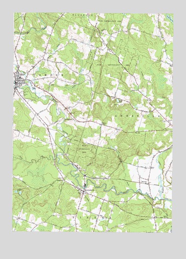
Camden East, NY USGS Topographic Map
Click on map above to begin viewing in our Map Viewer.

This topographic map contains these locations and features:
Feature Name Type Latitude Longitude GNIS ID View Map
Adirondack Manor Assisted Living CenterBuildingN43.3389°W75.7493°2614566View Map
Annsville Area SchoolSchoolN43.3125°W75.6256°2437711View Map
Blennes CornerPopulated PlaceN43.3115°W75.6810°972242View Map
BlossvalePopulated PlaceN43.2798°W75.6435°944297View Map
CamdenPopulated PlaceN43.3345°W75.7480°945512View Map
Camden Central School (historical)SchoolN43.3378°W75.7450°2391690View Map
Camden Elementary SchoolSchoolN43.3494°W75.7486°2437724View Map
Camden Fire DepartmentBuildingN43.3362°W75.7460°2391668View Map
Camden Middle SchoolSchoolN43.3381°W75.7450°2437725View Map
Camden Post OfficePost OfficeN43.3362°W75.7485°2617839View Map
Camden Public LibraryBuildingN43.3369°W75.7469°2391689View Map
Camden Town HallBuildingN43.3361°W75.7467°2391669View Map
Camden Village HallBuildingN43.3361°W75.7464°2391667View Map
Camden Village Wastewater Treatment PlantLocaleN43.3521°W75.7215°2617706View Map
Camden Wesleyan ChurchChurchN43.3358°W75.7454°2615678View Map
Cobb BrookStreamN43.3290°W75.7296°946957View Map
Cold BrookStreamN43.2748°W75.6568°947027View Map
Corkin HillSummitN43.3626°W75.6855°947449View Map
DibbletownPopulated PlaceN43.2803°W75.7102°948430View Map
East Branch Fish CreekStreamN43.2692°W75.6330°949002View Map
Emmons BrookStreamN43.3320°W75.7338°949641View Map
Faulkner PondsLakeN43.2721°W75.7436°949930View Map
Forest Lawn CemeteryCemeteryN43.3244°W75.7376°950415View Map
Forest Park CemeteryCemeteryN43.3287°W75.7432°950420View Map
Free Methodist ChurchChurchN43.3358°W75.7461°2390081View Map
Glenridge Mobile Home ParkPopulated PlaceN43.3178°W75.6258°2485838View Map
Little RiverStreamN43.2937°W75.7155°955657View Map
Living Hope Assembly of God ChurchChurchN43.3290°W75.7236°2616659View Map
Mack PondLakeN43.3250°W75.6682°956235View Map
Mad RiverStreamN43.3328°W75.7369°956244View Map
McConnellsvillePopulated PlaceN43.2731°W75.6941°956746View Map
McConnellsville CemeteryCemeteryN43.2778°W75.7056°2703446View Map
McConnellsville Community ChurchChurchN43.2736°W75.6963°2616706View Map
McConnellsville Fire DepartmentBuildingN43.2725°W75.6939°2718241View Map
McConnellsville Golf ClubLocaleN43.2737°W75.6889°2615436View Map
Old State Road Protestant CemeteryCemeteryN43.3134°W75.6298°959305View Map
PinePopulated PlaceN43.2587°W75.6388°960411View Map
Pine HillPopulated PlaceN43.3076°W75.6521°972946View Map
Pond HillSummitN43.3237°W75.6702°960893View Map
Queen Village Bible ChurchChurchN43.3480°W75.7272°2616814View Map
Saint John's Roman Catholic ChurchChurchN43.3364°W75.7461°2391109View Map
Saint Johns CemeteryCemeteryN43.3276°W75.7424°963619View Map
Saint Patrick CemeteryCemeteryN43.3128°W75.6268°964045View Map
School Number 1 (historical)SchoolN43.2723°W75.6946°974920View Map
School Number 1 (historical)SchoolN43.3103°W75.6814°2106126View Map
School Number 10 (historical)SchoolN43.2584°W75.6285°974959View Map
School Number 11 (historical)SchoolN43.3392°W75.6567°2106130View Map
School Number 12 (historical)SchoolN43.3225°W75.7108°2106131View Map
School Number 13 (historical)SchoolN43.3514°W75.6858°2106132View Map
School Number 14 (historical)SchoolN43.2806°W75.7097°2106133View Map
School Number 14 (historical)SchoolN43.3631°W75.6822°2106134View Map
School Number 2 (historical)SchoolN43.2867°W75.6424°975210View Map
School Number 5 (historical)SchoolN43.3108°W75.7228°2106127View Map
School Number 7 (historical)SchoolN43.3478°W75.7272°2106128View Map
School Number 9 (historical)SchoolN43.2781°W75.6261°2106129View Map
Trinity Episcopal ChurchChurchN43.3358°W75.7492°2391671View Map
United ChurchChurchN43.3361°W75.7478°2391670View Map
United Methodist Church of CamdenChurchN43.3396°W75.7491°2389024View Map
Village of CamdenCivilN43.3365°W75.7477°2391573View Map
West Branch Fish CreekStreamN43.2695°W75.6330°969120View Map
West Branch Fish Creek BridgeBridgeN43.2744°W75.6504°2615003View Map
Wickwire BrookStreamN43.3731°W75.7321°971217View Map

Note: Coordinates in the location and feature list above are referenced to NAD83 datum.


Copyright (C) 2008-2024 Ryan Niemi / Sunset Dynamics ... All Rights Reserved