TopoQuest Logo
Do you find TopoQuest useful?
Help keep TopoQuest running and adding new maps/features by donating!
Bitcoin:  19c7KJd3qBynnjoSw5npx9KScwjBe4ifkT
Litecoin:  LXs6TkuXGGXo1vDsWCkWVdjQX94eUKd6ui
Home View Maps Find Maps Find Places Resources & Links


Calhoun Creek, South Carolina Topographic Map

USGS Map Title: Calhoun Creek, SC
USGS Map MRC: 34082A4
DRG (GeoTIFF) Download: o34082a4.tif


Neighboring USGS Topographic Map Quads:


  Latimer, SC  
34082B5
 

  Abbeville West, SC  
34082B4
 

  Abbeville East, SC  
34082B3
 

  Calhoun Falls, SC  
34082A5
 

  Calhoun Creek, SC  
34082A4
 

  Verdery, SC  
34082A3
 

  Chennault, GA  
33082H5
 

  Willington, SC  
33082H4
 

  McCormick, SC  
33082H3


Map MRC Location:

N35°
W83°
N35°
W82°
H8 H7 H6 H5 H4 H3 H2 H1
G8 G7 G6 G5 G4 G3 G2 G1
F8 F7 F6 F5 F4 F3 F2 F1
E8 E7 E6 E5 E4 E3 E2 E1
D8 D7 D6 D5 D4 D3 D2 D1
C8 C7 C6 C5 C4 C3 C2 C1
B8 B7 B6 B5 B4 B3 B2 B1
A8 A7 A6 A5 A4 A3 A2 A1
N34°
W83°
N34°
W82°

Calhoun Creek, SC USGS 1:24K Topographic Map Preview:
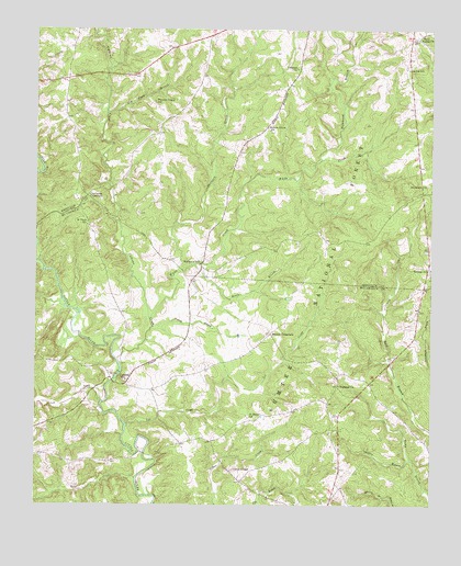
Calhoun Creek, SC USGS Topographic Map
Click on map above to begin viewing in our Map Viewer.

This topographic map contains these locations and features:
Feature Name Type Latitude Longitude GNIS ID View Map
Abbeville County Fire Department BethiahBuildingN34.0601°W82.3752°2737339View Map
Belcher CrossroadsPopulated PlaceN34.0454°W82.4251°1245039View Map
Bell CreekStreamN34.0071°W82.4676°1229395View Map
Bethea School (historical)SchoolN34.0826°W82.3773°1229016View Map
BethelPopulated PlaceN34.1173°W82.3823°1229017View Map
Bethel Methodist ChurchChurchN34.1223°W82.3793°1229018View Map
Bethel SchoolSchoolN34.1146°W82.3823°1229405View Map
BethiahPopulated PlaceN34.0640°W82.3754°1229019View Map
Bethiah CemeteryCemeteryN34.0618°W82.3757°1229020View Map
Bethiah Presbyterian ChurchChurchN34.0621°W82.3751°1229021View Map
Bold Branch School (historical)SchoolN34.0226°W82.3826°1252040View Map
Bowie BranchStreamN34.0632°W82.4496°1229449View Map
Calhoun CemeteryCemeteryN34.0642°W82.4447°1229031View Map
Calhoun CreekStreamN34.0385°W82.4737°1247088View Map
Calhoun MillPopulated PlaceN34.0329°W82.4710°1247091View Map
Candys ChapelChurchN34.0096°W82.4374°1229512View Map
Charleston CrossroadsPopulated PlaceN34.0812°W82.4837°1231157View Map
Hammond BranchStreamN34.0907°W82.4101°1229768View Map
Hartzog BranchStreamN34.0468°W82.4624°1229780View Map
Hillbern CreekStreamN34.0635°W82.4529°1245989View Map
Hopewell Baptist ChurchChurchN34.0315°W82.4040°1246041View Map
Hopewell CemeteryCemeteryN34.0393°W82.4185°1229815View Map
Horton BranchStreamN34.0001°W82.3865°1229827View Map
Jim Knox BranchStreamN34.1032°W82.4774°1229859View Map
Lebanon CemeteryCemeteryN34.1148°W82.4179°1229099View Map
Lebanon Presbyterian ChurchChurchN34.1148°W82.4173°1246319View Map
Lee CreekStreamN34.0210°W82.4710°1246322View Map
Lott CreekStreamN34.0271°W82.4787°1229957View Map
Mars BridgeBridgeN34.0135°W82.4654°1252049View Map
Morrah BranchStreamN34.0023°W82.3893°1230039View Map
Mountain ChurchChurchN34.0843°W82.3757°1249738View Map
Mulberry ChurchChurchN34.0635°W82.4479°1229112View Map
Mulberry SchoolSchoolN34.0635°W82.4476°1230080View Map
Mulberry School (historical)SchoolN34.0712°W82.4810°1229311View Map
Oak Grove Church (historical)ChurchN34.0065°W82.4349°1252055View Map
Pleasant Grove SchoolSchoolN34.1062°W82.4624°1230180View Map
Rock Buffalo ChurchChurchN34.1223°W82.3793°1230240View Map
Saint Marys ChurchChurchN34.0237°W82.4329°1229273View Map
Saint Marys SchoolSchoolN34.0232°W82.4321°1230276View Map
Saint Paul ChurchChurchN34.0743°W82.4837°1229274View Map
Saint Pauls SchoolSchoolN34.0746°W82.4835°1230278View Map
Sawney CreekStreamN34.0521°W82.4904°1230308View Map
Sumter National ForestForestN34.0070°W82.3826°1230531View Map
Tanyard BranchStreamN34.0121°W82.3810°1230397View Map
Walnut Grove ChurchChurchN34.0998°W82.4271°1229157View Map
Walnut Grove SchoolSchoolN34.0996°W82.4268°1230456View Map
White CreekStreamN34.0493°W82.4635°1251408View Map

Note: Coordinates in the location and feature list above are referenced to NAD83 datum.


Copyright (C) 2008-2024 Ryan Niemi / Sunset Dynamics ... All Rights Reserved