TopoQuest Logo
Do you find TopoQuest useful?
Help keep TopoQuest running and adding new maps/features by donating!
Bitcoin:  19c7KJd3qBynnjoSw5npx9KScwjBe4ifkT
Litecoin:  LXs6TkuXGGXo1vDsWCkWVdjQX94eUKd6ui
Home View Maps Find Maps Find Places Resources & Links


Abilene, Virginia Topographic Map

USGS Map Title: Abilene, VA
USGS Map MRC: 37078B5
DRG (GeoTIFF) Download: o37078b5.tif


Neighboring USGS Topographic Map Quads:


  Pamplin, VA  
37078C6
 

  Prospect, VA  
37078C5
 

  Farmville, VA  
37078C4
 

  Madisonville, VA  
37078B6
 

  Abilene, VA  
37078B5
 

  Hampden Sydney, VA  
37078B4
 

  Charlotte Court House, VA  
37078A6
 

  Eureka, VA  
37078A5
 

  Keysville, VA  
37078A4


Map MRC Location:

N38°
W79°
N38°
W78°
H8 H7 H6 H5 H4 H3 H2 H1
G8 G7 G6 G5 G4 G3 G2 G1
F8 F7 F6 F5 F4 F3 F2 F1
E8 E7 E6 E5 E4 E3 E2 E1
D8 D7 D6 D5 D4 D3 D2 D1
C8 C7 C6 C5 C4 C3 C2 C1
B8 B7 B6 B5 B4 B3 B2 B1
A8 A7 A6 A5 A4 A3 A2 A1
N37°
W79°
N37°
W78°

Abilene, VA USGS 1:24K Topographic Map Preview:
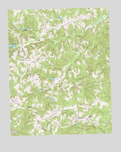
Abilene, VA USGS Topographic Map
Click on map above to begin viewing in our Map Viewer.

This topographic map contains these locations and features:
Feature Name Type Latitude Longitude GNIS ID View Map
AbilenePopulated PlaceN37.1415°W78.5442°1492445View Map
Abilene AirportAirportN37.1675°W78.5167°2770626View Map
Bell CreekStreamN37.2440°W78.5633°1463024View Map
Bell LakeReservoirN37.1691°W78.5853°1463025View Map
Bethlehem ChurchChurchN37.1446°W78.5928°1463230View Map
Bethpeor CemeteryCemeteryN37.2365°W78.5767°1492245View Map
Bethpeor ChurchChurchN37.2363°W78.5767°1463251View Map
Beulah ChurchChurchN37.1413°W78.5278°1463265View Map
Browns BranchStreamN37.1721°W78.5717°1463918View Map
Buffalo CemeteryCemeteryN37.2401°W78.6006°1492250View Map
Buffalo ChurchChurchN37.2410°W78.6003°1464032View Map
Buffalo Creek Number Eight DamDamN37.1718°W78.5414°1490664View Map
Buffalo Creek Number Five DamDamN37.1802°W78.5664°1490661View Map
Buffalo Creek Number Four DamDamN37.2151°W78.6164°1490657View Map
Buffalo Creek Number Nine DamDamN37.1735°W78.5331°1490665View Map
Buffalo Creek Number Seven DamDamN37.1635°W78.5747°1490663View Map
Buffalo Creek Number Six DamDamN37.1701°W78.5831°1490662View Map
Buffalo Creek Number Three DamDamN37.2335°W78.5997°1490656View Map
Buffalo Creek Number Two DamDamN37.2402°W78.5581°1490660View Map
Buffalo LakeReservoirN37.1805°W78.5719°1464043View Map
Carey CreekStreamN37.1952°W78.5461°1464438View Map
Caulk BranchStreamN37.2107°W78.6197°1464573View Map
County Line Cross RoadsPopulated PlaceN37.1410°W78.5286°1477228View Map
Darlington HeightsPopulated PlaceN37.2001°W78.6042°1477247View Map
Darlington Heights School (historical)SchoolN37.2015°W78.6042°1492257View Map
Darlington Heights Volunteer Fire DepartmentBuildingN37.1986°W78.5951°2086058View Map
District 501CivilN37.2367°W78.5660°1927277View Map
Douglas CemeteryCemeteryN37.1771°W78.5122°1492258View Map
Douglas ChurchChurchN37.1765°W78.5125°1465910View Map
Five ForksPopulated PlaceN37.2382°W78.5769°1477330View Map
Five Forks School (historical)SchoolN37.2432°W78.5889°1492278View Map
Flintoy CreekStreamN37.1271°W78.6208°1466722View Map
Lake GayleReservoirN37.1602°W78.5742°1467025View Map
Little Creek LakeReservoirN37.2310°W78.6052°1469523View Map
Morris BranchStreamN37.1782°W78.5658°1470752View Map
Mount Nebo ChurchChurchN37.1360°W78.5208°1470950View Map
Mud CreekStreamN37.2207°W78.5758°1471211View Map
New Hope Baptist ChurchChurchN37.1654°W78.5147°1471437View Map
Saint Ann CemeteryCemeteryN37.2329°W78.5675°1473702View Map
Spring Creek ChurchChurchN37.1929°W78.6244°1474993View Map
Spring Creek LakeReservoirN37.2143°W78.6234°1474995View Map
Stockton LakeReservoirN37.2410°W78.5606°1475169View Map
Tredway (historical)Populated PlaceN37.2349°W78.5217°1492347View Map
Triumph ChurchChurchN37.1974°W78.5936°1475888View Map
Willow Grove ChurchChurchN37.2215°W78.5919°1476795View Map

Note: Coordinates in the location and feature list above are referenced to NAD83 datum.


Copyright (C) 2008-2024 Ryan Niemi / Sunset Dynamics ... All Rights Reserved