TopoQuest Logo
Do you find TopoQuest useful?
Help keep TopoQuest running and adding new maps/features by donating!
Bitcoin:  19c7KJd3qBynnjoSw5npx9KScwjBe4ifkT
Litecoin:  LXs6TkuXGGXo1vDsWCkWVdjQX94eUKd6ui
Home View Maps Find Maps Find Places Resources & Links


Cabot, Vermont Topographic Map

USGS Map Title: Cabot, VT
USGS Map MRC: 44072D3
DRG (GeoTIFF) Download: o44072d3.tif


Neighboring USGS Topographic Map Quads:


  Wolcott, VT  
44072E4
 

  Caspian Lake, VT  
44072E3
 

  Stannard, VT  
44072E2
 

  Woodbury, VT  
44072D4
 

  Cabot, VT  
44072D3


  Plainfield, VT  
44072C4
 

  Marshfield, VT  
44072C3


Map MRC Location:

N45°
W73°
N45°
W72°
H8 H7 H6 H5 H4 H3 H2 H1
G8 G7 G6 G5 G4 G3 G2 G1
F8 F7 F6 F5 F4 F3 F2 F1
E8 E7 E6 E5 E4 E3 E2 E1
D8 D7 D6 D5 D4 D3 D2 D1
C8 C7 C6 C5 C4 C3 C2 C1
B8 B7 B6 B5 B4 B3 B2 B1
A8 A7 A6 A5 A4 A3 A2 A1
N44°
W73°
N44°
W72°

Cabot, VT USGS 1:24K Topographic Map Preview:
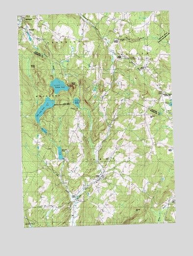
Cabot, VT USGS Topographic Map
Click on map above to begin viewing in our Map Viewer.

This topographic map contains these locations and features:
Feature Name Type Latitude Longitude GNIS ID View Map
Burbank HillSummitN44.4373°W72.2707°1456653View Map
CabotPopulated PlaceN44.4014°W72.3123°1456711View Map
Cabot Census Designated PlaceCensusN44.4049°W72.3115°2729388View Map
Cabot Emergency AmbulanceBuildingN44.4013°W72.3134°2578085View Map
Cabot Plains CemeteryCemeteryN44.4226°W72.2666°1458996View Map
Cabot Plains CemeteryCemeteryN44.4225°W72.2748°1919007View Map
Cabot Post OfficePost OfficeN44.4029°W72.3110°1919008View Map
Cabot SchoolSchoolN44.4035°W72.3095°1919010View Map
Cabot Village CemeteryCemeteryN44.4015°W72.3213°1919011View Map
Cabot Volunteer Fire DepartmentBuildingN44.4013°W72.3135°2121374View Map
Catamount AirfieldAirportN44.3926°W72.3506°2442745View Map
Center CemeteryCemeteryN44.4028°W72.2985°1456815View Map
Coits PondLakeN44.4478°W72.3281°1456955View Map
Danville HillSummitN44.3837°W72.2854°1457106View Map
Dunstable FarmLocaleN44.4075°W72.3317°2680831View Map
Durant CemeteryCemeteryN44.3833°W72.3337°1457220View Map
East CabotPopulated PlaceN44.3898°W72.2512°1460411View Map
East Cabot CemeteryCemeteryN44.3885°W72.2504°1919038View Map
East Long PondReservoirN44.4447°W72.3552°1457296View Map
East Long Pond DamDamN44.4453°W72.3565°1766621View Map
Fairview - Saint Roberts CemeteryCemeteryN44.4981°W72.3551°1919505View Map
Folsom CemeteryCemeteryN44.4737°W72.2518°1919511View Map
Houston Hill CemeteryCemeteryN44.4671°W72.3148°1919550View Map
Houston Hill SchoolSchoolN44.4687°W72.3134°1457911View Map
Idle Hours CampgroundLocaleN44.4873°W72.3662°1919551View Map
Jug BrookStreamN44.3917°W72.3312°1458048View Map
Lightning Bolt FieldAirportN44.4017°W72.2634°2442717View Map
Lower CabotPopulated PlaceN44.3903°W72.3326°1458298View Map
MackvillePopulated PlaceN44.4901°W72.3682°1458328View Map
Mackville DamDamN44.4901°W72.3696°1766718View Map
Mackville PondReservoirN44.4911°W72.3685°1766719View Map
Martell SwampSwampN44.4703°W72.3690°1458369View Map
Morrill BrookStreamN44.4828°W72.3015°1458540View Map
Mud PondLakeN44.4318°W72.3557°1458615View Map
Nichols BrookStreamN44.4948°W72.3734°1458685View Map
Nichols LedgeBenchN44.4570°W72.3318°1458686View Map
Nichols PondReservoirN44.4579°W72.3425°1458688View Map
Nichols Pond DamDamN44.4317°W72.3559°1766619View Map
Perkins Meadow BrookStreamN44.4828°W72.3018°1458409View Map
Smith CornerPopulated PlaceN44.4667°W72.2712°1460453View Map
South WaldenPopulated PlaceN44.4745°W72.2898°1460457View Map
South Walden CemeteryCemeteryN44.4880°W72.2918°1919715View Map
South Woodbury CemeteryCemeteryN44.4231°W72.3594°1459625View Map
Steam Mill Brook Wildlife Management AreaParkN44.4848°W72.2551°1919721View Map
Stevens Hill CemeteryCemeteryN44.4704°W72.2637°1919724View Map
Taylor BridgePopulated PlaceN44.4842°W72.2926°1459826View Map
Town of CabotCivilN44.4013°W72.2963°1462061View Map
United Church of CabotChurchN44.4037°W72.3098°1919230View Map
Village of Cabot (historical)CivilN44.4049°W72.3115°2378301View Map
Walden Fire DepartmentBuildingN44.4522°W72.2570°2121405View Map
Walden HeightsPopulated PlaceN44.4523°W72.2570°1460041View Map
Walden Heights CemeteryCemeteryN44.4492°W72.2574°1919744View Map
Walden StationLocaleN44.4498°W72.2587°1460042View Map
West Hill CemeteryCemeteryN44.4075°W72.3353°1919273View Map
West Hill PondReservoirN44.4177°W72.3430°1460153View Map
West Hill Pond DamDamN44.4176°W72.3437°1766445View Map
Westhill CemeteryCemeteryN44.4075°W72.3359°1460183View Map

Note: Coordinates in the location and feature list above are referenced to NAD83 datum.


Copyright (C) 2008-2024 Ryan Niemi / Sunset Dynamics ... All Rights Reserved