TopoQuest Logo
Do you find TopoQuest useful?
Help keep TopoQuest running and adding new maps/features by donating!
Bitcoin:  19c7KJd3qBynnjoSw5npx9KScwjBe4ifkT
Litecoin:  LXs6TkuXGGXo1vDsWCkWVdjQX94eUKd6ui
Home View Maps Find Maps Find Places Resources & Links


Buckhorn, Virginia Topographic Map

USGS Map Title: Buckhorn, VA
USGS Map MRC: 36076F6
DRG (GeoTIFF) Download: o36076f6.tif


Neighboring USGS Topographic Map Quads:


  Zuni, VA  
36076G7
 

  Windsor, VA  
36076G6
 

  Chuckatuck, VA  
36076G5
 

  Holland, VA  
36076F7
 

  Buckhorn, VA  
36076F6
 

  Suffolk, VA  
36076F5
 

  Gates, NC  
36076E7
 

  Whaleyville, VA  
36076E6


Map MRC Location:

N37°
W77°
N37°
W76°
H8 H7 H6 H5 H4 H3 H2 H1
G8 G7 G6 G5 G4 G3 G2 G1
F8 F7 F6 F5 F4 F3 F2 F1
E8 E7 E6 E5 E4 E3 E2 E1
D8 D7 D6 D5 D4 D3 D2 D1
C8 C7 C6 C5 C4 C3 C2 C1
B8 B7 B6 B5 B4 B3 B2 B1
A8 A7 A6 A5 A4 A3 A2 A1
N36°
W77°
N36°
W76°

Buckhorn, VA USGS 1:24K Topographic Map Preview:
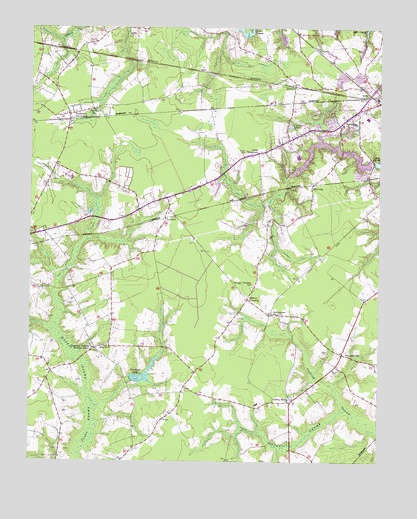
Buckhorn, VA USGS Topographic Map
Click on map above to begin viewing in our Map Viewer.

This topographic map contains these locations and features:
Feature Name Type Latitude Longitude GNIS ID View Map
Bakers CrossingPopulated PlaceN36.6721°W76.6711°1478136View Map
Barrett AcresPopulated PlaceN36.7201°W76.6405°1707306View Map
Barrett CemeteryCemeteryN36.6518°W76.6383°1478151View Map
Bethlehem ChurchChurchN36.7224°W76.6377°1478201View Map
Bethlehem CourtPopulated PlaceN36.7213°W76.6344°1707314View Map
Bethlehem School (historical)SchoolN36.7210°W76.6391°1707315View Map
Bethlehem TerracePopulated PlaceN36.7257°W76.6425°1707316View Map
Box ElderPopulated PlaceN36.6577°W76.7261°1707317View Map
Boxelder School (historical)SchoolN36.6565°W76.7277°1707318View Map
BuckhornLocaleN36.7249°W76.7361°1478284View Map
City of SuffolkCivilN36.7018°W76.6340°1498560View Map
Copeland Pond (historical)ReservoirN36.6882°W76.7158°1707332View Map
Council SwampStreamN36.6399°W76.6366°1478427View Map
Daughtrey PocosonSwampN36.7000°W76.7267°1707334View Map
El Bethel Worship CenterChurchN36.6973°W76.7132°2520280View Map
Forest Glen Middle SchoolSchoolN36.7129°W76.6538°1707349View Map
Forest Glen TerracePopulated PlaceN36.7160°W76.6594°1707350View Map
Galatian United Christian ChurchChurchN36.6758°W76.6688°2520319View Map
Gethsemane ChurchChurchN36.6677°W76.6605°1478647View Map
Grasso Salvage AirportAirportN36.6699°W76.7286°1501656View Map
HillsdalePopulated PlaceN36.7263°W76.6330°1707355View Map
KenyonPopulated PlaceN36.7335°W76.6550°1478885View Map
KilbyPopulated PlaceN36.7321°W76.6291°1493165View Map
Kilby Shores Elementary SchoolSchoolN36.7244°W76.6292°1707370View Map
Lake Kilby Boat RampLocaleN36.7121°W76.6277°2518541View Map
Lake Speight ColonyPopulated PlaceN36.7079°W76.6316°1707379View Map
Lakeland High SchoolSchoolN36.7211°W76.6606°2465310View Map
LakewoodPopulated PlaceN36.7199°W76.6444°1707383View Map
LeesvillePopulated PlaceN36.6465°W76.6941°1707385View Map
Liberty Spring ChurchChurchN36.6432°W76.6552°1478949View Map
Little TabernacleChurchN36.7143°W76.6677°1478978View Map
LummisPopulated PlaceN36.6952°W76.7011°1479003View Map
Luter PondReservoirN36.7218°W76.6563°1479004View Map
LutersvillePopulated PlaceN36.7182°W76.6641°1707391View Map
ManningPopulated PlaceN36.7052°W76.6483°1479035View Map
Maple HillPopulated PlaceN36.7113°W76.6588°1707394View Map
Noah Howell School (historical)SchoolN36.6502°W76.7427°1707403View Map
Norfleet DamDamN36.6485°W76.7136°1501695View Map
Norfleet PondSwampN36.6488°W76.7071°1502082View Map
NurneysvillePopulated PlaceN36.6560°W76.6375°1479231View Map
Oak RidgePopulated PlaceN36.7232°W76.6422°1707405View Map
Oak Ridge EastPopulated PlaceN36.7276°W76.6372°1707406View Map
Oak Ridge EstatesPopulated PlaceN36.7251°W76.6483°1707407View Map
Paul D Camp Community College - Hobbs Suffolk CampusSchoolN36.7253°W76.6552°1707519View Map
PinairePopulated PlaceN36.7218°W76.6472°1707417View Map
Pine Grove ChurchChurchN36.7265°W76.7275°1479325View Map
Rabey CemeteryCemeteryN36.6568°W76.6422°1479395View Map
Rawles CemeteryCemeteryN36.6901°W76.6638°1479405View Map
Savage Crossing SchoolSchoolN36.6760°W76.6691°1479553View Map
Somerton Friends Meeting HouseChurchN36.6565°W76.7272°1479647View Map
Speights RunStreamN36.7132°W76.6497°1480053View Map
Speights Run DamDamN36.7118°W76.6280°1501691View Map
Speights Run ReservoirReservoirN36.7123°W76.6325°1501692View Map
Suffolk Animal Control BureauBuildingN36.7163°W76.6556°2332021View Map
WestgatePopulated PlaceN36.7279°W76.6402°1707450View Map
Zion ChurchChurchN36.6582°W76.7219°1479594View Map

Note: Coordinates in the location and feature list above are referenced to NAD83 datum.


Copyright (C) 2008-2024 Ryan Niemi / Sunset Dynamics ... All Rights Reserved