TopoQuest Logo
Do you find TopoQuest useful?
Help keep TopoQuest running and adding new maps/features by donating!
Bitcoin:  19c7KJd3qBynnjoSw5npx9KScwjBe4ifkT
Litecoin:  LXs6TkuXGGXo1vDsWCkWVdjQX94eUKd6ui
Home View Maps Find Maps Find Places Resources & Links


Alicia, Arkansas Topographic Map

USGS Map Title: Alicia, AR
USGS Map MRC: 35091H1
DRG (GeoTIFF) Download: o35091h1.tif


Neighboring USGS Topographic Map Quads:


  Eaton, AR  
36091A2
 

  Black Rock, AR  
36091A1
 

  Walnut Ridge, AR  
36090A8
 

  Strangers Home, AR  
35091H2
 

  Alicia, AR  
35091H1
 

  Podo Creek, AR  
35090H8
 

  Swifton West, AR  
35091G2
 

  Swifton East, AR  
35091G1
 

  Cash, AR  
35090G8


Map MRC Location:

N36°
W92°
N36°
W91°
H8 H7 H6 H5 H4 H3 H2 H1
G8 G7 G6 G5 G4 G3 G2 G1
F8 F7 F6 F5 F4 F3 F2 F1
E8 E7 E6 E5 E4 E3 E2 E1
D8 D7 D6 D5 D4 D3 D2 D1
C8 C7 C6 C5 C4 C3 C2 C1
B8 B7 B6 B5 B4 B3 B2 B1
A8 A7 A6 A5 A4 A3 A2 A1
N35°
W92°
N35°
W91°

Alicia, AR USGS 1:24K Topographic Map Preview:
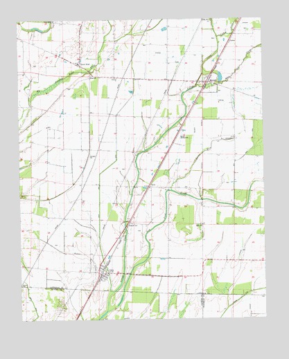
Alicia, AR USGS Topographic Map
Click on map above to begin viewing in our Map Viewer.

This topographic map contains these locations and features:
Feature Name Type Latitude Longitude GNIS ID View Map
AliciaPopulated PlaceN35.8931°W91.0829°45823View Map
Alicia Volunteer Fire DepartmentBuildingN35.8934°W91.0836°2116063View Map
Bear Creek DitchCanalN35.9465°W91.0057°46219View Map
Bennett Landing Strip (historical)AirportN35.9509°W91.0426°64904View Map
Black Spice DitchCanalN35.9415°W91.0760°46679View Map
Broom (historical)Populated PlaceN35.9201°W91.1215°61594View Map
CalvinPopulated PlaceN35.9301°W91.0587°56949View Map
Clark CemeteryCemeteryN35.9140°W91.0326°47801View Map
Clover BendPopulated PlaceN35.9809°W91.0932°61593View Map
Clover Bend CemeteryCemeteryN35.9995°W91.1054°47862View Map
Clover Bend High SchoolSchoolN35.9820°W91.0943°66357View Map
Clover Bend Historic DistrictParkN35.9809°W91.0932°66358View Map
Clover Bend School (historical)SchoolN35.9959°W91.1162°61592View Map
Clover Bend Volunteer Fire DepartmentBuildingN35.9815°W91.0938°2116286View Map
Covington CemeteryCemeteryN35.9440°W91.0890°48112View Map
Haynes CemeteryCemeteryN35.8890°W91.1243°49962View Map
Holloway School (historical)SchoolN35.9215°W91.0251°61599View Map
HopewellPopulated PlaceN35.9784°W91.0890°50300View Map
Hopewell ChurchChurchN35.9756°W91.0748°77218View Map
Hopewell School (historical)SchoolN35.9756°W91.0885°61595View Map
Lick Pond SloughStreamN35.8787°W91.0810°45752View Map
LindseyPopulated PlaceN35.9909°W91.0165°58069View Map
Lindsey School (historical)SchoolN35.9973°W91.0129°61597View Map
Marrow Bone SloughStreamN35.9287°W91.0476°51684View Map
Miller CemeteryCemeteryN35.9995°W91.0268°52059View Map
Miller Church (historical)ChurchN35.9998°W91.0262°61596View Map
MinturnPopulated PlaceN35.9745°W91.0276°58194View Map
Minturn Post OfficePost OfficeN35.9736°W91.0302°2781932View Map
Town of AliciaCivilN35.8944°W91.0832°2405134View Map
Town of MinturnCivilN35.9758°W91.0276°2406171View Map
Township of AshlandCivilN35.9658°W91.0208°66783View Map
Township of LawrenceCivilN35.9905°W91.1128°66795View Map
Township of MarionCivilN35.9190°W91.0961°66796View Map
Turkey CreekStreamN35.9923°W91.0232°55719View Map
White Oak SloughStreamN35.9717°W91.0348°56300View Map
Williams School (historical)SchoolN35.9423°W91.0432°61598View Map

Note: Coordinates in the location and feature list above are referenced to NAD83 datum.


Copyright (C) 2008-2024 Ryan Niemi / Sunset Dynamics ... All Rights Reserved