TopoQuest Logo
Do you find TopoQuest useful?
Help keep TopoQuest running and adding new maps/features by donating!
Bitcoin:  19c7KJd3qBynnjoSw5npx9KScwjBe4ifkT
Litecoin:  LXs6TkuXGGXo1vDsWCkWVdjQX94eUKd6ui
Home View Maps Find Maps Find Places Resources & Links


Brewersville, Alabama Topographic Map

USGS Map Title: Brewersville, AL
USGS Map MRC: 32088E1
DRG (GeoTIFF) Download: o32088e1.tif


Neighboring USGS Topographic Map Quads:


  Epes West, AL  
32088F2
 

  Epes East, AL  
32088F1
 

  Forkland, AL  
32087F8
 

  Livingston, AL  
32088E2
 

  Brewersville, AL  
32088E1
 

  McDowell, AL  
32087E8
 

  Bellamy, AL  
32088D2
 

  Coatopa, AL  
32088D1
 

  Jefferson, AL  
32087D8


Map MRC Location:

N33°
W89°
N33°
W88°
H8 H7 H6 H5 H4 H3 H2 H1
G8 G7 G6 G5 G4 G3 G2 G1
F8 F7 F6 F5 F4 F3 F2 F1
E8 E7 E6 E5 E4 E3 E2 E1
D8 D7 D6 D5 D4 D3 D2 D1
C8 C7 C6 C5 C4 C3 C2 C1
B8 B7 B6 B5 B4 B3 B2 B1
A8 A7 A6 A5 A4 A3 A2 A1
N32°
W89°
N32°
W88°

Brewersville, AL USGS 1:24K Topographic Map Preview:
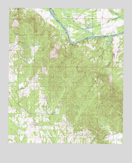
Brewersville, AL USGS Topographic Map
Click on map above to begin viewing in our Map Viewer.

This topographic map contains these locations and features:
Feature Name Type Latitude Longitude GNIS ID View Map
Arrington CemeteryCemeteryN32.5112°W88.0089°113235View Map
Benny BranchStreamN32.5168°W88.0200°113929View Map
Bethel Hill School (historical)SchoolN32.5571°W88.1009°134084View Map
Bluff Port BarBarN32.5940°W88.0572°132471View Map
Bluff Port Ferry (historical)CrossingN32.5982°W88.0606°134094View Map
Bluff Port Landing (historical)LocaleN32.6029°W88.0614°132470View Map
Bluff Port Post OfficePost OfficeN32.6029°W88.0597°169241View Map
BluffportPopulated PlaceN32.5940°W88.1156°114623View Map
BluffportLocaleN32.6029°W88.0597°166004View Map
BrewersvillePopulated PlaceN32.5165°W88.0920°114872View Map
Brewersville CemeteryCemeteryN32.5176°W88.0956°114873View Map
Brewersville ChurchChurchN32.5174°W88.0911°158426View Map
Brown CemeteryCemeteryN32.6179°W88.0597°114985View Map
Buzzard Roost BluffCliffN32.5924°W88.0570°134102View Map
Caney SloughGutN32.6021°W88.0653°134104View Map
Christian Valley Baptist ChurchChurchN32.5187°W88.0950°157915View Map
Christian Valley Baptist ChurchChurchN32.5337°W88.0834°157916View Map
Cobb CreekStreamN32.5999°W88.0339°116325View Map
Cobbs BranchStreamN32.6246°W88.0397°132507View Map
Cold Springs BarBarN32.6121°W88.0714°134116View Map
Dallas BranchStreamN32.6151°W88.0059°117021View Map
Dug HillPopulated PlaceN32.5049°W88.0297°1805634View Map
Dug Hill CemeteryCemeteryN32.5051°W88.0306°1805635View Map
Dug Hill Primitive Baptist ChurchChurchN32.5051°W88.0303°157939View Map
Dug Hill School (historical)SchoolN32.5051°W88.0295°134127View Map
Epes TowerTowerN32.6240°W88.1167°134131View Map
HawkinsLocaleN32.6154°W88.1192°134153View Map
Hawkins ChapelChurchN32.6182°W88.1175°119870View Map
High RunStreamN32.5993°W88.0145°120068View Map
Horns BranchStreamN32.5176°W88.1050°134162View Map
Katherine Allison DamDamN32.5468°W88.1167°130682View Map
Katherine Allison LakeReservoirN32.5468°W88.1167°130683View Map
Kenyon ChurchChurchN32.5301°W88.0214°134172View Map
Maye CemeteryCemeteryN32.6244°W88.1179°152252View Map
Moore TownPopulated PlaceN32.5510°W88.1070°123021View Map
Mount Nebo Primitive Baptist ChurchChurchN32.5921°W88.1109°158021View Map
Mount Prospect ChurchChurchN32.6001°W88.1172°123376View Map
Neal CemeteryCemeteryN32.6118°W88.0647°158410View Map
Nebo CemeteryCemeteryN32.5832°W88.0583°123662View Map
Nebo ChurchChurchN32.5837°W88.0578°134210View Map
New Port (historical)LocaleN32.6154°W88.0806°134216View Map
New Prospect (historical)LocaleN32.6012°W88.1181°134217View Map
New Prospect Baptist ChurchChurchN32.6021°W88.1186°158129View Map
Old BluffportPopulated PlaceN32.5924°W88.0570°156830View Map
Phares CemeteryCemeteryN32.5957°W88.0125°124668View Map
Saint Matthew Baptist ChurchChurchN32.6226°W88.0325°158072View Map
Saint Matthew CemeteryCemeteryN32.6224°W88.0342°158656View Map
Sand BranchStreamN32.5301°W88.0286°126299View Map
Soctum Fire Tower (historical)TowerN32.5524°W88.1236°134259View Map
Southern Sportsman LodgeBuildingN32.5415°W88.0861°134261View Map
Taylor BranchStreamN32.6240°W88.0153°127720View Map
Walker CemeteryCemeteryN32.5951°W88.0133°128507View Map
Walton BranchStreamN32.5301°W88.0289°128567View Map
WoodfordPopulated PlaceN32.5040°W88.0064°157278View Map
Zion HillPopulated PlaceN32.5274°W88.0736°157815View Map
Zion Hill Methodist ChurchChurchN32.5276°W88.0753°158108View Map
Zion School (historical)SchoolN32.5274°W88.0739°158136View Map

Note: Coordinates in the location and feature list above are referenced to NAD83 datum.


Copyright (C) 2008-2024 Ryan Niemi / Sunset Dynamics ... All Rights Reserved