TopoQuest Logo
Do you find TopoQuest useful?
Help keep TopoQuest running and adding new maps/features by donating!
Bitcoin:  19c7KJd3qBynnjoSw5npx9KScwjBe4ifkT
Litecoin:  LXs6TkuXGGXo1vDsWCkWVdjQX94eUKd6ui
Home View Maps Find Maps Find Places Resources & Links


Brazil East, Indiana Topographic Map

USGS Map Title: Brazil East, IN
USGS Map MRC: 39087E1
DRG (GeoTIFF) Download: o39087e1.tif


Neighboring USGS Topographic Map Quads:


  Catlin, IN  
39087F2
 

  Mansfield, IN  
39087F1
 

  Clinton Falls, IN  
39086F8
 

  Brazil West, IN  
39087E2
 

  Brazil East, IN  
39087E1
 

  Reelsville, IN  
39086E8
 

  Staunton, IN  
39087D2
 

  Center Point, IN  
39087D1
 

  Poland, IN  
39086D8


Map MRC Location:

N40°
W88°
N40°
W87°
H8 H7 H6 H5 H4 H3 H2 H1
G8 G7 G6 G5 G4 G3 G2 G1
F8 F7 F6 F5 F4 F3 F2 F1
E8 E7 E6 E5 E4 E3 E2 E1
D8 D7 D6 D5 D4 D3 D2 D1
C8 C7 C6 C5 C4 C3 C2 C1
B8 B7 B6 B5 B4 B3 B2 B1
A8 A7 A6 A5 A4 A3 A2 A1
N39°
W88°
N39°
W87°

Brazil East, IN USGS 1:24K Topographic Map Preview:
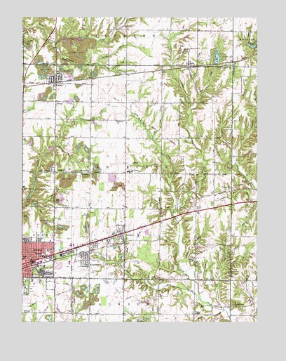
Brazil East, IN USGS Topographic Map
Click on map above to begin viewing in our Map Viewer.

This topographic map contains these locations and features:
Feature Name Type Latitude Longitude GNIS ID View Map
Alma CreekStreamN39.5870°W87.1092°430109View Map
Alma LakePopulated PlaceN39.6084°W87.0195°447125View Map
Alma LakeLakeN39.6087°W87.0213°430110View Map
BenwoodPopulated PlaceN39.5612°W87.1142°430833View Map
Benwood RunStreamN39.5495°W87.1245°430834View Map
Bethel ChurchChurchN39.5187°W87.1208°430928View Map
Bethel RunStreamN39.5202°W87.1195°2559206View Map
Billy CreekStreamN39.5084°W87.0297°431089View Map
Bowles LakeReservoirN39.5731°W87.1204°448754View Map
Bowles Lake DamDamN39.5728°W87.1197°448753View Map
Brazil Fire DepartmentBuildingN39.5234°W87.1246°2701370View Map
Brazil High SchoolSchoolN39.5264°W87.1245°446525View Map
Bullet BranchStreamN39.5220°W87.0189°431802View Map
CalcuttaPopulated PlaceN39.6042°W87.0695°452223View Map
Calcutta CemeteryCemeteryN39.6021°W87.0704°431948View Map
Calcutta RunStreamN39.6031°W87.1078°431949View Map
CarbonPopulated PlaceN39.5978°W87.1186°432123View Map
CardoniaPopulated PlaceN39.5617°W87.1189°432127View Map
Cardonia RunStreamN39.5723°W87.1186°432128View Map
City of BrazilCivilN39.5232°W87.1243°2393404View Map
Clay County Search and RescueBuildingN39.5241°W87.1218°2719273View Map
Croys Creek ChurchChurchN39.5067°W87.0128°433222View Map
Dam BrookStreamN39.5495°W87.1245°433300View Map
DonaldsonvillePopulated PlaceN39.5292°W87.0989°449071View Map
East BrookStreamN39.5267°W87.0725°433872View Map
East Side Elementary SchoolSchoolN39.5270°W87.1211°433933View Map
Ebenezer ChurchChurchN39.5825°W87.1072°433979View Map
Ebenezer CreekStreamN39.6145°W87.1195°452440View Map
Girton CemeteryCemeteryN39.5630°W87.0141°435093View Map
Girton RunStreamN39.5645°W87.1228°435095View Map
Green HollowValleyN39.5705°W87.0128°435404View Map
Gun CreekStreamN39.5050°W87.0175°435557View Map
Harm RunStreamN39.5214°W87.1172°435741View Map
HarmonyPopulated PlaceN39.5367°W87.1058°435746View Map
Harmony CemeteryCemeteryN39.5310°W87.0763°441836View Map
Harmony DrainStreamN39.5237°W87.0733°435752View Map
Jack BrookStreamN39.6070°W87.1058°436872View Map
Kid RunStreamN39.5131°W87.0542°437285View Map
KnightsvillePopulated PlaceN39.5259°W87.1125°437396View Map
LenaPopulated PlaceN39.6050°W87.1072°437775View Map
Lena DrainStreamN39.5870°W87.0353°437776View Map
MechanicsburgPopulated PlaceN39.6009°W87.0875°452222View Map
Mount Lebanon ChurchChurchN39.5614°W87.1122°439594View Map
National RunStreamN39.5450°W87.1220°439948View Map
Owens CemeteryCemeteryN39.5542°W87.1182°440798View Map
Pell BrookStreamN39.5809°W87.1170°440980View Map
Pell CemeteryCemeteryN39.5247°W87.0642°440981View Map
Pell CemeteryCemeteryN39.5834°W87.0876°440982View Map
Poff BrookStreamN39.5753°W87.1050°441383View Map
Poff CemeteryCemeteryN39.5744°W87.1110°441384View Map
PontiacPopulated PlaceN39.5903°W87.1186°441432View Map
Poplar CemeteryCemeteryN39.5038°W87.0981°441441View Map
Reinoehl FieldAirportN39.6087°W87.0147°2676932View Map
Risslers LakeReservoirN39.5083°W87.0589°448751View Map
Risslers Lake DamDamN39.5084°W87.0583°448752View Map
Roberts BrookStreamN39.5198°W87.0375°442150View Map
Roberts CemeteryCemeteryN39.5253°W87.0352°442152View Map
Saint Vincent Clay HospitalHospitalN39.5288°W87.1119°2660475View Map
School BrookStreamN39.5448°W87.1228°443092View Map
Scrouge BranchStreamN39.6067°W87.1108°443176View Map
Thomas LakeLakeN39.6134°W87.1117°444693View Map
Town of CarbonCivilN39.5991°W87.1079°2396627View Map
Town of HarmonyCivilN39.5335°W87.0734°2396986View Map
Town of KnightsvilleCivilN39.5254°W87.0891°2396695View Map
Township of BrazilCivilN39.5347°W87.1222°453135View Map
Township of Van BurenCivilN39.5642°W87.0645°453943View Map
Van Buren CreekStreamN39.5564°W87.1117°445204View Map
Van Buren Elementary SchoolSchoolN39.5617°W87.1050°445206View Map
Van Buren High SchoolSchoolN39.5617°W87.0672°446523View Map
Van Buren Volunteer Fire DepartmentBuildingN39.5334°W87.0791°2626062View Map
Wesley ChapelChurchN39.5034°W87.0333°445699View Map
Wesley Chapel CemeteryCemeteryN39.5071°W87.0311°445701View Map
Wesley DrainStreamN39.5050°W87.0178°445707View Map

Note: Coordinates in the location and feature list above are referenced to NAD83 datum.


Copyright (C) 2008-2024 Ryan Niemi / Sunset Dynamics ... All Rights Reserved