TopoQuest Logo
Do you find TopoQuest useful?
Help keep TopoQuest running and adding new maps/features by donating!
Bitcoin:  19c7KJd3qBynnjoSw5npx9KScwjBe4ifkT
Litecoin:  LXs6TkuXGGXo1vDsWCkWVdjQX94eUKd6ui
Home View Maps Find Maps Find Places Resources & Links


Alexander, Illinois Topographic Map

USGS Map Title: Alexander, IL
USGS Map MRC: 39090F1
DRG (GeoTIFF) Download: o39090f1.tif


Neighboring USGS Topographic Map Quads:


  Literberry, IL  
39090G2
 

  Prentice, IL  
39090G1
 

  Pleasant Plains, IL  
39089G8
 

  Jacksonville, IL  
39090F2
 

  Alexander, IL  
39090F1
 

  New Berlin, IL  
39089F8
 

  Nortonville, IL  
39090E2
 

  Franklin, IL  
39090E1
 

  Waverly, IL  
39089E8


Map MRC Location:

N40°
W91°
N40°
W90°
H8 H7 H6 H5 H4 H3 H2 H1
G8 G7 G6 G5 G4 G3 G2 G1
F8 F7 F6 F5 F4 F3 F2 F1
E8 E7 E6 E5 E4 E3 E2 E1
D8 D7 D6 D5 D4 D3 D2 D1
C8 C7 C6 C5 C4 C3 C2 C1
B8 B7 B6 B5 B4 B3 B2 B1
A8 A7 A6 A5 A4 A3 A2 A1
N39°
W91°
N39°
W90°

Alexander, IL USGS 1:24K Topographic Map Preview:
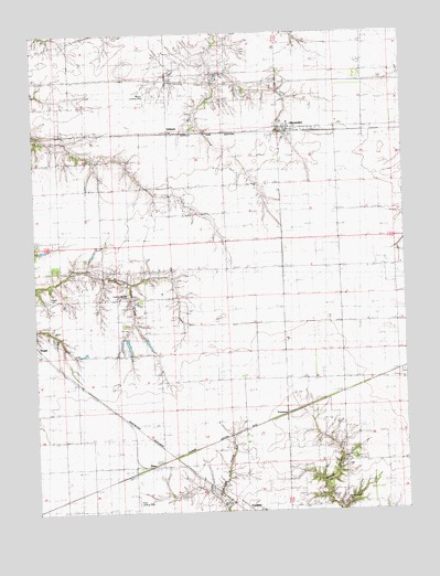
Alexander, IL USGS Topographic Map
Click on map above to begin viewing in our Map Viewer.

This topographic map contains these locations and features:
Feature Name Type Latitude Longitude GNIS ID View Map
AlexanderPopulated PlaceN39.7245°W90.0382°403398View Map
Alexander Election PrecinctCivilN39.7397°W90.0425°1928427View Map
Alexander Elementary SchoolSchoolN39.7264°W90.0387°1822092View Map
Alexander Fire DepartmentBuildingN39.7245°W90.0396°2640205View Map
Alexander Post OfficePost OfficeN39.7246°W90.0396°1822093View Map
College Grove School (historical)SchoolN39.6256°W90.1059°406369View Map
East Liberty School (historical)SchoolN39.6417°W90.0226°407668View Map
East Walnut Grove School (historical)SchoolN39.6809°W90.0218°407708View Map
Interchange 76CrossingN39.7370°W90.0421°1822111View Map
Little Hope School (historical)SchoolN39.6734°W90.0498°412354View Map
Negus Landing Strip (historical)AirportN39.7323°W90.0871°1748126View Map
OrleansPopulated PlaceN39.7237°W90.0796°423048View Map
Pisgah CemeteryCemeteryN39.6813°W90.1203°1748131View Map
Pisgah Church (historical)ChurchN39.7162°W90.1040°415741View Map
ReesPopulated PlaceN39.6356°W90.0926°416499View Map
Rees Landing Strip (historical)AirportN39.6264°W90.0912°1748133View Map
Rees School (historical)SchoolN39.6306°W90.0687°416501View Map
Sacred Heart CemeteryCemeteryN39.6278°W90.0217°1748139View Map
Sulphur Spring School (historical)SchoolN39.6806°W90.0932°419336View Map
Sulphur Springs CemeteryCemeteryN39.6808°W90.0935°1748149View Map
Union CemeteryCemeteryN39.6699°W90.1169°1748152View Map
West Liberty School (historical)SchoolN39.7114°W90.0934°420871View Map
Woodlawn Station (historical)LocaleN39.6589°W90.1115°1822133View Map
YeomansPopulated PlaceN39.6506°W90.0409°423343View Map

Note: Coordinates in the location and feature list above are referenced to NAD83 datum.


Copyright (C) 2008-2024 Ryan Niemi / Sunset Dynamics ... All Rights Reserved