TopoQuest Logo
Do you find TopoQuest useful?
Help keep TopoQuest running and adding new maps/features by donating!
Bitcoin:  19c7KJd3qBynnjoSw5npx9KScwjBe4ifkT
Litecoin:  LXs6TkuXGGXo1vDsWCkWVdjQX94eUKd6ui
Home View Maps Find Maps Find Places Resources & Links


Franklin, Illinois Topographic Map

USGS Map Title: Franklin, IL
USGS Map MRC: 39090E1
DRG (GeoTIFF) Download: o39090e1.tif


Neighboring USGS Topographic Map Quads:


  Jacksonville, IL  
39090F2
 

  Alexander, IL  
39090F1
 

  New Berlin, IL  
39089F8
 

  Nortonville, IL  
39090E2
 

  Franklin, IL  
39090E1
 

  Waverly, IL  
39089E8
 

  Athensville, IL  
39090D2
 

  Scottville, IL  
39090D1
 

  Palmyra, IL  
39089D8


Map MRC Location:

N40°
W91°
N40°
W90°
H8 H7 H6 H5 H4 H3 H2 H1
G8 G7 G6 G5 G4 G3 G2 G1
F8 F7 F6 F5 F4 F3 F2 F1
E8 E7 E6 E5 E4 E3 E2 E1
D8 D7 D6 D5 D4 D3 D2 D1
C8 C7 C6 C5 C4 C3 C2 C1
B8 B7 B6 B5 B4 B3 B2 B1
A8 A7 A6 A5 A4 A3 A2 A1
N39°
W91°
N39°
W90°

Franklin, IL USGS 1:24K Topographic Map Preview:
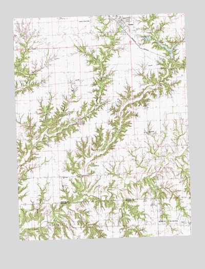
Franklin, IL USGS Topographic Map
Click on map above to begin viewing in our Map Viewer.

This topographic map contains these locations and features:
Feature Name Type Latitude Longitude GNIS ID View Map
Baitter BranchStreamN39.5106°W90.1107°403815View Map
Berean ChurchChurchN39.5075°W90.0054°1821324View Map
Berean School (historical)SchoolN39.5087°W90.0057°404207View Map
Bucks BranchStreamN39.5595°W90.1048°405141View Map
Bull CemeteryCemeteryN39.5385°W90.0888°405175View Map
CentervillePopulated PlaceN39.5584°W90.0293°1748087View Map
College Corner School (historical)SchoolN39.6153°W90.0073°406365View Map
Criswell George CemeteryCemeteryN39.5878°W90.0839°1748090View Map
Criswell School (historical)SchoolN39.5856°W90.0823°406793View Map
Durbin ChurchChurchN39.6148°W90.1246°1748094View Map
Fanning Ollie CemeteryCemeteryN39.5548°W90.0809°2025187View Map
FranklinPopulated PlaceN39.6203°W90.0440°408656View Map
Franklin CemeteryCemeteryN39.6167°W90.0460°1822104View Map
Franklin East Grade SchoolSchoolN39.6228°W90.0446°1822105View Map
Franklin Election PrecinctCivilN39.6143°W90.0617°1928498View Map
Franklin Fire Protection DistrictBuildingN39.6217°W90.0461°2640226View Map
Franklin High SchoolSchoolN39.6239°W90.0471°1822106View Map
Franklin Junior High SchoolSchoolN39.6237°W90.0468°1822107View Map
Franklin Post OfficePost OfficeN39.6227°W90.0458°2788498View Map
Franklin Waverly Outing Club LakeReservoirN39.6112°W90.0281°1691855View Map
Franklin Waverly Outing Club Lake DamDamN39.6117°W90.0251°1691854View Map
Harmony School (historical)SchoolN39.5653°W90.0168°409812View Map
Hartland School (historical)SchoolN39.5420°W90.0918°409883View Map
Harts Prairie CemeteryCemeteryN39.5295°W90.0929°1748100View Map
Harts Prairie ChurchChurchN39.5345°W90.0929°409882View Map
Hurricane Neck School (historical)SchoolN39.5867°W90.0554°410722View Map
Jones CemeteryCemeteryN39.5684°W90.0379°1748114View Map
New Hope CemeteryCemeteryN39.5592°W90.0293°1822126View Map
New Hope ChurchChurchN39.5575°W90.0296°414429View Map
Panther CreekStreamN39.5187°W90.0893°415354View Map
Panther Creek ChurchChurchN39.5067°W90.0571°415360View Map
Panther Creek School (historical)SchoolN39.5109°W90.0826°415361View Map
Providence CemeteryCemeteryN39.6014°W90.0965°1748132View Map
Providence Church (historical)ChurchN39.6012°W90.0965°416255View Map
Providence School (historical)SchoolN39.5898°W90.1015°416261View Map
Ranson Strip (historical)AirportN39.6228°W90.0715°427293View Map
Reed CemeteryCemeteryN39.5895°W90.1034°1822129View Map
Robert CemeteryCemeteryN39.5834°W90.0818°1748135View Map
Seymore BranchStreamN39.5612°W90.1051°418243View Map
Seymour Bird CemeteryCemeteryN39.5822°W90.0687°1748144View Map
Sims Old CemeteryCemeteryN39.5045°W90.0140°1764700View Map
Turner CreekStreamN39.5275°W90.0518°419952View Map
Vanwinkle BranchStreamN39.5978°W90.0618°420236View Map
Village of FranklinCivilN39.6213°W90.0478°2398916View Map
Waverly City LakeReservoirN39.6050°W90.0131°1691859View Map
Waverly City Lake DamDamN39.6000°W90.0101°1691858View Map
Waverly LakeReservoirN39.6050°W90.0131°1748155View Map
West Point School (historical)SchoolN39.5420°W90.0487°420893View Map
West Union School (historical)SchoolN39.5364°W90.0012°420937View Map
Whippoorwill School (historical)SchoolN39.5217°W90.0329°421007View Map
Woods CreekStreamN39.5242°W90.0790°421478View Map

Note: Coordinates in the location and feature list above are referenced to NAD83 datum.


Copyright (C) 2008-2024 Ryan Niemi / Sunset Dynamics ... All Rights Reserved