TopoQuest Logo
Do you find TopoQuest useful?
Help keep TopoQuest running and adding new maps/features by donating!
Bitcoin:  19c7KJd3qBynnjoSw5npx9KScwjBe4ifkT
Litecoin:  LXs6TkuXGGXo1vDsWCkWVdjQX94eUKd6ui
Home View Maps Find Maps Find Places Resources & Links


Bourneville, Ohio Topographic Map

USGS Map Title: Bourneville, OH
USGS Map MRC: 39083C2
DRG (GeoTIFF) Download: o39083c2.tif


Neighboring USGS Topographic Map Quads:


  Good Hope, OH  
39083D3
 

  Frankfort, OH  
39083D2
 

  Andersonville, OH  
39083D1
 

  South Salem, OH  
39083C3
 

  Bourneville, OH  
39083C2
 

  Chillicothe West, OH  
39083C1
 

  Bainbridge, OH  
39083B3
 

  Morgantown, OH  
39083B2
 

  Summithill, OH  
39083B1


Map MRC Location:

N40°
W84°
N40°
W83°
H8 H7 H6 H5 H4 H3 H2 H1
G8 G7 G6 G5 G4 G3 G2 G1
F8 F7 F6 F5 F4 F3 F2 F1
E8 E7 E6 E5 E4 E3 E2 E1
D8 D7 D6 D5 D4 D3 D2 D1
C8 C7 C6 C5 C4 C3 C2 C1
B8 B7 B6 B5 B4 B3 B2 B1
A8 A7 A6 A5 A4 A3 A2 A1
N39°
W84°
N39°
W83°

Bourneville, OH USGS 1:24K Topographic Map Preview:
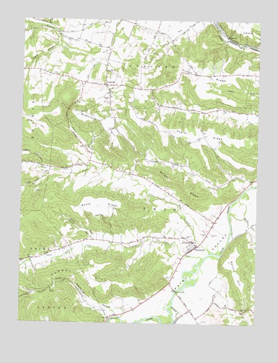
Bourneville, OH USGS Topographic Map
Click on map above to begin viewing in our Map Viewer.

This topographic map contains these locations and features:
Feature Name Type Latitude Longitude GNIS ID View Map
Asher HillSummitN39.3323°W83.2485°1037515View Map
Barger RidgeRidgeN39.3084°W83.1691°1037632View Map
Baum Hill CemeteryCemeteryN39.2553°W83.1319°1037690View Map
Baum School (historical)SchoolN39.2556°W83.1330°1050075View Map
Beath RidgeRidgeN39.2984°W83.2091°1037737View Map
Black RunStreamN39.3017°W83.1344°1038083View Map
BournevillePopulated PlaceN39.2820°W83.1566°1064471View Map
Bourneville Census Designated PlaceCensusN39.2829°W83.1596°2628867View Map
Bourneville Methodist CemeteryCemeteryN39.2853°W83.1619°1963455View Map
Bourneville Post OfficePost OfficeN39.2820°W83.1569°2042805View Map
California HollowValleyN39.2551°W83.1941°1038619View Map
Concord ChurchChurchN39.3534°W83.2046°1060992View Map
Concord Presbyterian CemeteryCemeteryN39.3540°W83.2049°1963461View Map
Concord School (historical)SchoolN39.3534°W83.1407°1050076View Map
Eagle HollowValleyN39.3640°W83.2313°1039923View Map
Farrell HillRidgeN39.2695°W83.2282°1040393View Map
Hester School (historical)SchoolN39.3151°W83.2477°1050073View Map
Hopewell Culture National Historical ParkParkN39.2794°W83.1352°1888931View Map
Latta RunStreamN39.3609°W83.2119°1067204View Map
LattavillePopulated PlaceN39.3481°W83.2063°1064973View Map
Lower Twin CreekStreamN39.2790°W83.1502°1042811View Map
McDonald HillRidgeN39.3331°W83.2085°1043164View Map
MusselmanPopulated PlaceN39.3681°W83.1424°1065088View Map
Musselman Post OfficePost OfficeN39.3681°W83.1430°2043396View Map
Pierce School (historical)SchoolN39.3659°W83.1816°1050074View Map
Plug RunStreamN39.3073°W83.1274°1057932View Map
Plyley RidgeRidgeN39.3523°W83.1519°1044653View Map
Poplar RidgeRidgeN39.3273°W83.1555°1044695View Map
Porter HollowValleyN39.3156°W83.2074°1044710View Map
Proud RunStreamN39.2817°W83.2116°1044782View Map
Reeves RunStreamN39.2776°W83.1446°1067206View Map
Roundtop School (historical)SchoolN39.2842°W83.2091°1050072View Map
Sheron CemeteryCemeteryN39.3431°W83.2049°1046203View Map
Speakman CemeteryCemeteryN39.2870°W83.1516°1963471View Map
Spruce HillRidgeN39.2737°W83.1363°1046603View Map
Sulphur LickStreamN39.2501°W83.1685°1066998View Map
Sulphur LickStreamN39.2573°W83.1691°1046850View Map
Township of TwinCivilN39.2848°W83.1568°1086905View Map
Twin Elementary SchoolSchoolN39.2840°W83.1591°1050003View Map
Twin Township CemeteryCemeteryN39.2873°W83.1494°1963473View Map
Twin Township Volunteer Fire and Life SquadBuildingN39.2808°W83.1588°2549637View Map
Upland OrchardLocaleN39.2590°W83.1299°1963475View Map
Upper Twin CreekStreamN39.2773°W83.1524°1047377View Map
WVXC-FM (Chillicothe)TowerN39.3459°W83.1874°1083788View Map

Note: Coordinates in the location and feature list above are referenced to NAD83 datum.


Copyright (C) 2008-2024 Ryan Niemi / Sunset Dynamics ... All Rights Reserved