TopoQuest Logo
Do you find TopoQuest useful?
Help keep TopoQuest running and adding new maps/features by donating!
Bitcoin:  19c7KJd3qBynnjoSw5npx9KScwjBe4ifkT
Litecoin:  LXs6TkuXGGXo1vDsWCkWVdjQX94eUKd6ui
Home View Maps Find Maps Find Places Resources & Links


Woody, California Topographic Map

USGS Map Title: Woody, CA
USGS Map MRC: 35118F7
DRG (GeoTIFF) Download: o35118f7.tif


Neighboring USGS Topographic Map Quads:


  Quincy School, CA  
35118G8
 

  White River, CA  
35118G7
 

  Posey, CA  
35118G6
 

  Sand Canyon, CA  
35118F8
 

  Woody, CA  
35118F7
 

  Glennville, CA  
35118F6
 

  Knob Hill, CA  
35118E8
 

  Pine Mountain, CA  
35118E7
 

  Democrat Hot Springs, CA  
35118E6


Map MRC Location:

N36°
W119°
N36°
W118°
H8 H7 H6 H5 H4 H3 H2 H1
G8 G7 G6 G5 G4 G3 G2 G1
F8 F7 F6 F5 F4 F3 F2 F1
E8 E7 E6 E5 E4 E3 E2 E1
D8 D7 D6 D5 D4 D3 D2 D1
C8 C7 C6 C5 C4 C3 C2 C1
B8 B7 B6 B5 B4 B3 B2 B1
A8 A7 A6 A5 A4 A3 A2 A1
N35°
W119°
N35°
W118°

Woody, CA USGS 1:24K Topographic Map Preview:
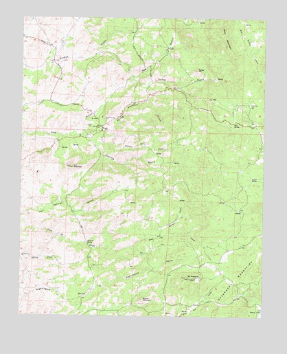
Woody, CA USGS Topographic Map
Click on map above to begin viewing in our Map Viewer.

This topographic map contains these locations and features:
Feature Name Type Latitude Longitude GNIS ID View Map
Blake Elementary SchoolSchoolN35.7036°W118.8371°239467View Map
Blue Mountain CemeteryCemeteryN35.7067°W118.8323°239502View Map
Butler SpringSpringN35.6827°W118.7542°239903View Map
Dead Ox SpringSpringN35.6560°W118.8413°241316View Map
Doney GulchValleyN35.7238°W118.8220°241560View Map
Doney HillSummitN35.7280°W118.7854°241561View Map
Fine SpringSpringN35.7052°W118.7665°242252View Map
Howling GulchValleyN35.7033°W118.8462°243704View Map
Iron MountainSummitN35.6869°W118.8493°243888View Map
Jordon RanchLocaleN35.6950°W118.7520°276212View Map
KDNO-FM (Delano)TowerN35.7127°W118.7904°1662847View Map
Kern County Fire Department Station 35 WoodyBuildingN35.7052°W118.8325°2665351View Map
Mount PheasantSummitN35.6405°W118.7859°247425View Map
Rabbit GulchValleyN35.6591°W118.8051°254182View Map
Round MountainSummitN35.6319°W118.8120°248420View Map
Spring Mountain GulchValleyN35.7022°W118.8401°254291View Map
Wildcat CreekStreamN35.6977°W118.8381°255869View Map
WoodyPopulated PlaceN35.7041°W118.8343°253006View Map
Woody FlatsFlatN35.7427°W118.7566°1655286View Map
Woody Post OfficePost OfficeN35.7047°W118.8337°2769558View Map
Woody RanchLocaleN35.7375°W118.8006°251804View Map
Woody School (historical)SchoolN35.7425°W118.8195°1670240View Map

Note: Coordinates in the location and feature list above are referenced to NAD83 datum.


Copyright (C) 2008-2024 Ryan Niemi / Sunset Dynamics ... All Rights Reserved