TopoQuest Logo
Do you find TopoQuest useful?
Help keep TopoQuest running and adding new maps/features by donating!
Bitcoin:  19c7KJd3qBynnjoSw5npx9KScwjBe4ifkT
Litecoin:  LXs6TkuXGGXo1vDsWCkWVdjQX94eUKd6ui
Home View Maps Find Maps Find Places Resources & Links


Woodfords, California Topographic Map

USGS Map Title: Woodfords, CA
USGS Map MRC: 38119G7
DRG (GeoTIFF) Download: o38119g7.tif


Neighboring USGS Topographic Map Quads:


  South Lake Tahoe, CA  
38119H8
 

  Minden, NV  
38119H7
 

  Gardnerville, NV  
38119H6
 

  Freel Peak, CA  
38119G8
 

  Woodfords, CA  
38119G7
 

  Carters Station, NV  
38119G6
 

  Carson Pass, CA  
38119F8
 

  Markleeville, CA  
38119F7
 

  Heenan Lake, CA  
38119F6


Map MRC Location:

N39°
W120°
N39°
W119°
H8 H7 H6 H5 H4 H3 H2 H1
G8 G7 G6 G5 G4 G3 G2 G1
F8 F7 F6 F5 F4 F3 F2 F1
E8 E7 E6 E5 E4 E3 E2 E1
D8 D7 D6 D5 D4 D3 D2 D1
C8 C7 C6 C5 C4 C3 C2 C1
B8 B7 B6 B5 B4 B3 B2 B1
A8 A7 A6 A5 A4 A3 A2 A1
N38°
W120°
N38°
W119°

Woodfords, CA USGS 1:24K Topographic Map Preview:
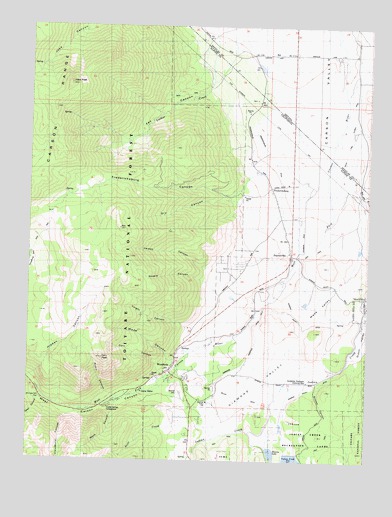
Woodfords, CA USGS Topographic Map
Click on map above to begin viewing in our Map Viewer.

This topographic map contains these locations and features:
Feature Name Type Latitude Longitude GNIS ID View Map
Acorn CanyonValleyN38.7682°W119.8416°217960View Map
Alpine County Secondary Community Day SchoolSchoolN38.8105°W119.7797°2111058View Map
Alpine County Secondary Community Day SchoolSchoolN38.7666°W119.8092°2111059View Map
Alpine VillagePopulated PlaceN38.7730°W119.8180°1877182View Map
Alpine Village Census Designated PlaceCensusN38.7855°W119.8009°2407729View Map
Burns Gravel PitMineN38.8256°W119.7967°2675081View Map
Cary CanyonValleyN38.7738°W119.8249°220655View Map
Cary PeakSummitN38.7794°W119.8482°220656View Map
Cloudburst CanyonValleyN38.7646°W119.8560°233691View Map
Crystal Springs CampgroundLocaleN38.7652°W119.8460°221888View Map
Deep CanyonValleyN38.7680°W119.8696°233769View Map
Diamond ValleyValleyN38.7839°W119.7758°222355View Map
Diamond Valley DitchCanalN38.7721°W119.7682°222356View Map
Diamond Valley Elementary SchoolSchoolN38.7665°W119.8094°222357View Map
Dry CanyonValleyN38.8205°W119.7841°222603View Map
Falke and Tillman DitchCanalN38.8446°W119.7577°233866View Map
Fay CanyonValleyN38.8716°W119.8016°223418View Map
Fay CanyonValleyN38.8577°W119.8105°274780View Map
FredericksburgPopulated PlaceN38.8288°W119.7868°1658575View Map
Fredericksburg CanyonValleyN38.8357°W119.7746°223853View Map
Fredericksburg DitchCanalN38.8527°W119.7871°859764View Map
Heise Boulder QuarryMineN38.7733°W119.7989°2677927View Map
Indian Creek 1062 DamDamN38.7518°W119.7757°1664215View Map
Jobs PeakSummitN38.8580°W119.8616°226251View Map
Larson CanyonValleyN38.8105°W119.7830°226886View Map
Luther CreekStreamN38.8716°W119.8016°227850View Map
Merk CanyonValleyN38.7677°W119.8424°228522View Map
Mesa VistaPopulated PlaceN38.8071°W119.7960°1877181View Map
Mesa Vista Census Designated PlaceCensusN38.8103°W119.8033°2408820View Map
Millich DitchCanalN38.7668°W119.8093°228758View Map
Olds (historical)LocaleN38.8657°W119.7993°856546View Map
PaynesvillePopulated PlaceN38.8091°W119.7793°1659355View Map
Scossa CanyonValleyN38.7727°W119.7696°232713View Map
Scott CreekStreamN38.7574°W119.8077°232724View Map
Shingle Mill FlatLocaleN38.7677°W119.8713°233015View Map
Snowshoe Thompson Ditch Number TwoCanalN38.7860°W119.7916°253905View Map
Snowshoe Thompson Historical MonParkN38.7730°W119.7727°234786View Map
Stevens LakeReservoirN38.7524°W119.7857°235456View Map
Stuard CanyonValleyN38.7941°W119.7896°235610View Map
Thoringtons (historical)LocaleN38.8563°W119.7905°848009View Map
Valley View (historical)Populated PlaceN38.8641°W119.8021°857338View Map
Voight CanyonValleyN38.7827°W119.8116°237121View Map
Wade CanyonValleyN38.7738°W119.8246°237144View Map
Wade ValleyValleyN38.8025°W119.7594°237145View Map
Washoe CemeteryCemeteryN38.7696°W119.8193°237317View Map
West Carson CanyonValleyN38.7752°W119.8230°237447View Map
WoodfordsPopulated PlaceN38.7777°W119.8218°1660199View Map
Woodfords CommunityCivilN38.8005°W119.7942°1985241View Map
Woodfords High SchoolSchoolN38.7662°W119.8082°2111057View Map
Woodsford Volunteer Fire DepartmentBuildingN38.7697°W119.8164°2624613View Map

Note: Coordinates in the location and feature list above are referenced to NAD83 datum.


Copyright (C) 2008-2024 Ryan Niemi / Sunset Dynamics ... All Rights Reserved