TopoQuest Logo
Do you find TopoQuest useful?
Help keep TopoQuest running and adding new maps/features by donating!
Bitcoin:  19c7KJd3qBynnjoSw5npx9KScwjBe4ifkT
Litecoin:  LXs6TkuXGGXo1vDsWCkWVdjQX94eUKd6ui
Home View Maps Find Maps Find Places Resources & Links


Minden, Nevada Topographic Map

USGS Map Title: Minden, NV
USGS Map MRC: 38119H7
DRG (GeoTIFF) Download: o38119h7.tif


Neighboring USGS Topographic Map Quads:


  Glenbrook, NV  
39119A8
 

  Genoa, NV  
39119A7
 

  McTarnahan Hill, NV  
39119A6
 

  South Lake Tahoe, CA  
38119H8
 

  Minden, NV  
38119H7
 

  Gardnerville, NV  
38119H6
 

  Freel Peak, CA  
38119G8
 

  Woodfords, CA  
38119G7
 

  Carters Station, NV  
38119G6


Map MRC Location:

N39°
W120°
N39°
W119°
H8 H7 H6 H5 H4 H3 H2 H1
G8 G7 G6 G5 G4 G3 G2 G1
F8 F7 F6 F5 F4 F3 F2 F1
E8 E7 E6 E5 E4 E3 E2 E1
D8 D7 D6 D5 D4 D3 D2 D1
C8 C7 C6 C5 C4 C3 C2 C1
B8 B7 B6 B5 B4 B3 B2 B1
A8 A7 A6 A5 A4 A3 A2 A1
N38°
W120°
N38°
W119°

Minden, NV USGS 1:24K Topographic Map Preview:
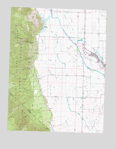
Minden, NV USGS Topographic Map
Click on map above to begin viewing in our Map Viewer.

This topographic map contains these locations and features:
Feature Name Type Latitude Longitude GNIS ID View Map
Alpine RanchLocaleN38.8794°W119.7796°847757View Map
Barber CreekStreamN38.8982°W119.8321°858810View Map
Big DitchCanalN38.9157°W119.8166°858887View Map
Brockliss SloughStreamN38.9874°W119.8302°859018View Map
Captain George CemeteryCemeteryN38.9541°W119.8404°859151View Map
Carson Tahoe Minden Medical CenterHospitalN38.9626°W119.7783°2642872View Map
Carson Valley Medical Center - Merry Medical Center and Urgent CareHospitalN38.9577°W119.7720°2642875View Map
Carson Valley Middle SchoolSchoolN38.9444°W119.7508°855286View Map
CentervillePopulated PlaceN38.9105°W119.7793°859193View Map
Childs Station (historical)LocaleN38.9413°W119.8430°857337View Map
China Spring Youth Camp Special SchoolSchoolN38.9441°W119.7518°858518View Map
Cordes RanchLocaleN38.8999°W119.7816°847773View Map
Corsers (historical)LocaleN38.9591°W119.8393°856537View Map
Corsser CreekStreamN38.9502°W119.8452°859359View Map
Cottonwood SloughStreamN38.9555°W119.7843°859388View Map
Daggett CreekStreamN38.9655°W119.8391°859443View Map
Dangberg Home RanchLocaleN38.9485°W119.7893°847778View Map
Dangberg RanchLocaleN38.9655°W119.7907°847777View Map
Douglas County Fish HatcheryLocaleN38.9277°W119.8366°847764View Map
Douglas County High School (historical)SchoolN38.9446°W119.7516°859548View Map
Douglas County Sheriff's OfficeBuildingN38.9558°W119.7652°2740027View Map
Douglas High SchoolSchoolN38.9585°W119.7810°855568View Map
East Fork Carson RiverStreamN38.9907°W119.8246°259721View Map
East Fork Fire and Paramedic Districts Station 1BuildingN38.9541°W119.7641°2581388View Map
East Fork Fire and Paramedic Districts Station 14BuildingN38.9564°W119.7781°2581384View Map
East Fork Fire and Paramedic Districts Station 8 Sheridan Volunteer Fire DepartmentBuildingN38.9103°W119.8291°2581382View Map
Frey RanchLocaleN38.9346°W119.7521°847775View Map
Gardnerville CemeteryCemeteryN38.9463°W119.7602°859799View Map
Genoa Comstock MinesMineN38.9869°W119.8349°855563View Map
Genoa Post OfficePost OfficeN38.9999°W119.8449°864587View Map
Genoa-Jacks Valley DivisionCivilN38.9988°W119.8116°1937441View Map
Haines CanyonValleyN38.9649°W119.8402°859923View Map
Heise Company DitchCanalN38.9213°W119.7735°859965View Map
Henningson SloughStreamN38.9335°W119.7888°859969View Map
Hollidays StationLocaleN38.9716°W119.8155°856781View Map
Home SloughStreamN38.9888°W119.8263°860015View Map
Jobs CanyonValleyN38.8991°W119.8232°266864View Map
Johnson SloughStreamN38.9452°W119.8327°860225View Map
KGVM-FM (Gardnerville-Minden)TowerN38.9596°W119.8443°865159View Map
Kimmerling RanchLocaleN38.8819°W119.7732°847756View Map
Martin SloughStreamN38.9705°W119.7991°860487View Map
Middle DitchCanalN38.9891°W119.7982°860560View Map
Middle River DitchCanalN38.9569°W119.7927°860573View Map
MillersLocaleN38.9482°W119.7643°858597View Map
MindenPopulated PlaceN38.9541°W119.7657°860600View Map
Minden Census Designated PlaceCensusN38.9609°W119.7688°2408835View Map
Minden Elementary SchoolSchoolN38.9630°W119.7562°2076253View Map
Minden Montessori Childrens WorldSchoolN38.9552°W119.7731°2089666View Map
Minden Post OfficePost OfficeN38.9561°W119.7694°864750View Map
Minden Rest Area (historical)LocaleN38.9599°W119.7791°864239View Map
Monument CreekStreamN38.9224°W119.8371°860633View Map
Mott CanyonValleyN38.9307°W119.8410°860655View Map
MottsvillePopulated PlaceN38.9285°W119.8377°860656View Map
Mottsville CemeteryCemeteryN38.9318°W119.8393°860657View Map
Park and Bull SloughCanalN38.9149°W119.8221°860882View Map
Pine BasinBasinN38.9780°W119.8621°860949View Map
Rocky SloughStreamN38.9205°W119.7927°861165View Map
Saint Louis Straight DitchCanalN38.9419°W119.7893°861236View Map
Schwake RanchLocaleN38.8949°W119.7880°847774View Map
Selby Ranch (historical)LocaleN38.9994°W119.8202°848469View Map
Settlemeyer RanchLocaleN38.9960°W119.8163°847812View Map
SheridanPopulated PlaceN38.8980°W119.8227°861355View Map
Sheridan CreekStreamN38.9005°W119.8257°267237View Map
Sheridan Post Office (historical)Post OfficeN38.8982°W119.8224°864572View Map
Sierra Crest AcademySchoolN38.9544°W119.7737°2091135View Map
Sierra Lutheran High SchoolSchoolN38.9553°W119.7645°2089668View Map
Simon Extension MineMineN38.9902°W119.8371°855562View Map
South Fork Daggett CreekStreamN38.9649°W119.8582°861471View Map
Stodieck RanchLocaleN38.9366°W119.7674°847776View Map
Stutler CanyonValleyN38.9155°W119.8341°267826View Map
Stutler CanyonValleyN38.9152°W119.8352°861613View Map
Taylor CanyonValleyN38.9388°W119.8455°861672View Map
Van Sickle Station (historical)LocaleN38.9724°W119.8380°847995View Map
Walleys Hot SpringsSpringN38.9810°W119.8344°856782View Map
Walleys Hot SpringsPopulated PlaceN38.9810°W119.8343°861877View Map
Waterloo (historical)LocaleN38.9291°W119.7799°847766View Map
Waterloo Post Office (historical)Post OfficeN38.9291°W119.7799°864573View Map
West Fork Carson RiverStreamN38.9908°W119.8234°237467View Map

Note: Coordinates in the location and feature list above are referenced to NAD83 datum.


Copyright (C) 2008-2024 Ryan Niemi / Sunset Dynamics ... All Rights Reserved