TopoQuest Logo
Do you find TopoQuest useful?
Help keep TopoQuest running and adding new maps/features by donating!
Bitcoin:  19c7KJd3qBynnjoSw5npx9KScwjBe4ifkT
Litecoin:  LXs6TkuXGGXo1vDsWCkWVdjQX94eUKd6ui
Home View Maps Find Maps Find Places Resources & Links


Winston, Oregon Topographic Map

USGS Map Title: Winston, OR
USGS Map MRC: 43123A4
DRG (GeoTIFF) Download: o43123a4.tif


Neighboring USGS Topographic Map Quads:


  Reston, OR  
43123B5
 

  Roseburg West, OR  
43123B4
 

  Roseburg East, OR  
43123B3
 

  Tenmile, OR  
43123A5
 

  Winston, OR  
43123A4
 

  Myrtle Creek, OR  
43123A3
 

  Live Oak Mountain, OR  
42123H5
 

  Nickel Mountain, OR  
42123H4
 

  Canyonville, OR  
42123H3


Map MRC Location:

N44°
W124°
N44°
W123°
H8 H7 H6 H5 H4 H3 H2 H1
G8 G7 G6 G5 G4 G3 G2 G1
F8 F7 F6 F5 F4 F3 F2 F1
E8 E7 E6 E5 E4 E3 E2 E1
D8 D7 D6 D5 D4 D3 D2 D1
C8 C7 C6 C5 C4 C3 C2 C1
B8 B7 B6 B5 B4 B3 B2 B1
A8 A7 A6 A5 A4 A3 A2 A1
N43°
W124°
N43°
W123°

Winston, OR USGS 1:24K Topographic Map Preview:
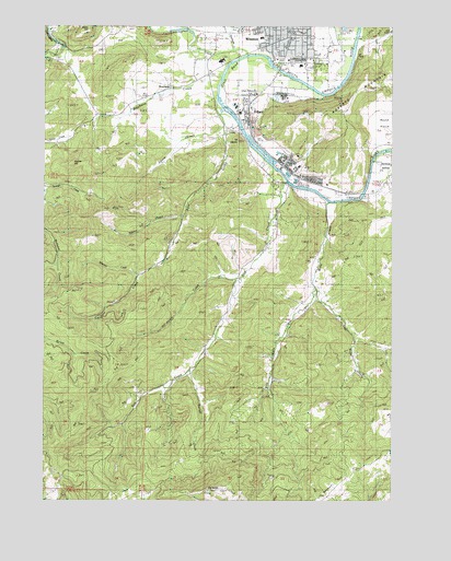
Winston, OR USGS Topographic Map
Click on map above to begin viewing in our Map Viewer.

This topographic map contains these locations and features:
Feature Name Type Latitude Longitude GNIS ID View Map
Adams CreekStreamN43.0746°W123.4509°1116766View Map
Alberson CreekStreamN43.0596°W123.4873°1132967View Map
Alsea Log PondReservoirN43.0846°W123.4012°1132968View Map
Barrett CreekStreamN43.0346°W123.4484°1117264View Map
Big BaldySummitN43.0030°W123.4376°1117580View Map
BrockwayPopulated PlaceN43.1090°W123.4554°1136094View Map
Brockway CreekStreamN43.1126°W123.4365°1118094View Map
Brockway Elementary SchoolSchoolN43.1248°W123.4430°2417810View Map
Brockway Post Office (historical)Post OfficeN43.1090°W123.4554°1164964View Map
City of WinstonCivilN43.1201°W123.4241°2412287View Map
Civil BendBendN43.1109°W123.4845°1132971View Map
Civil Bend (historical)Populated PlaceN43.1068°W123.4248°1132970View Map
Civil Bend CemeteryCemeteryN43.1174°W123.4180°1118957View Map
Civil Bend Post Office (historical)Post OfficeN43.1068°W123.4248°1165051View Map
Community Center Winston Branch LibraryBuildingN43.1150°W123.4076°2661333View Map
Cox CemeteryCemeteryN43.1168°W123.4372°1135320View Map
DillardPopulated PlaceN43.1029°W123.4279°1136220View Map
Dillard Census Designated PlaceCensusN43.1082°W123.4262°2611728View Map
Dillard Log PondReservoirN43.0923°W123.4231°1132969View Map
Dillard Post OfficePost OfficeN43.1001°W123.4285°1165160View Map
Douglas High SchoolSchoolN43.1160°W123.4374°1120046View Map
East Willis CreekStreamN43.0562°W123.4028°1120359View Map
Hoover HillSummitN43.0888°W123.4906°1136391View Map
Kent CreekStreamN43.1043°W123.4384°1122694View Map
Kent Station (historical)MilitaryN43.1014°W123.4389°1851712View Map
KGRV-AMTowerN43.1140°W123.4326°1158768View Map
KGRV-AMTowerN43.0576°W123.3978°1158769View Map
Lookingglass CreekStreamN43.1179°W123.4279°1123456View Map
Martha Rice BridgeBridgeN43.0837°W123.4123°1123803View Map
McGovern Elementary SchoolSchoolN43.1219°W123.4231°2417821View Map
Mount ObetteSummitN43.0947°W123.4314°1135319View Map
Ornoname 11 DamDamN43.0898°W123.4178°1163797View Map
Pacific Plywood Corporation Log PondReservoirN43.1065°W123.4178°1133632View Map
Pacific Plywood DamDamN43.1065°W123.4178°1133633View Map
Porter CreekStreamN43.0587°W123.4298°1125571View Map
Rainbow HollowValleyN43.0854°W123.3837°1125782View Map
Rice CreekStreamN43.0840°W123.4137°1125972View Map
Roseburg Forest Products Biomass ProductionLocaleN43.1072°W123.4163°2697279View Map
Squaw CreekStreamN43.0984°W123.4367°1135318View Map
West Willis CreekStreamN43.0562°W123.4026°1128907View Map
Willis CreekStreamN43.0790°W123.3978°1129125View Map
Willis Creek CemeteryCemeteryN43.0630°W123.4049°1129128View Map
WinstonPopulated PlaceN43.1223°W123.4126°1129240View Map
Winston - Dillard Water District Water Treatment PlantLocaleN43.1158°W123.4190°2660803View Map
Winston City HallBuildingN43.1216°W123.4160°2661595View Map
Winston Dillard County ParkParkN43.1159°W123.4048°1129241View Map
Winston Dillard Rural Fire Protection DistrictBuildingN43.1197°W123.4133°2576812View Map
Winston Middle SchoolSchoolN43.1144°W123.4090°2417822View Map
Winston Municipal CourtBuildingN43.1217°W123.4160°2661163View Map
Winston Police DepartmentBuildingN43.1217°W123.4160°2737808View Map
Winston Post OfficePost OfficeN43.1192°W123.4145°1166204View Map
Winston Public WorksBuildingN43.1145°W123.4120°2661480View Map

Note: Coordinates in the location and feature list above are referenced to NAD83 datum.


Copyright (C) 2008-2024 Ryan Niemi / Sunset Dynamics ... All Rights Reserved