TopoQuest Logo
Do you find TopoQuest useful?
Help keep TopoQuest running and adding new maps/features by donating!
Bitcoin:  19c7KJd3qBynnjoSw5npx9KScwjBe4ifkT
Litecoin:  LXs6TkuXGGXo1vDsWCkWVdjQX94eUKd6ui
Home View Maps Find Maps Find Places Resources & Links


Myrtle Creek, Oregon Topographic Map

USGS Map Title: Myrtle Creek, OR
USGS Map MRC: 43123A3
DRG (GeoTIFF) Download: o43123a3.tif


Neighboring USGS Topographic Map Quads:


  Roseburg West, OR  
43123B4
 

  Roseburg East, OR  
43123B3
 

  Dixonville, OR  
43123B2
 

  Winston, OR  
43123A4
 

  Myrtle Creek, OR  
43123A3
 

  Dodson Butte, OR  
43123A2
 

  Nickel Mountain, OR  
42123H4
 

  Canyonville, OR  
42123H3
 

  Days Creek, OR  
42123H2


Map MRC Location:

N44°
W124°
N44°
W123°
H8 H7 H6 H5 H4 H3 H2 H1
G8 G7 G6 G5 G4 G3 G2 G1
F8 F7 F6 F5 F4 F3 F2 F1
E8 E7 E6 E5 E4 E3 E2 E1
D8 D7 D6 D5 D4 D3 D2 D1
C8 C7 C6 C5 C4 C3 C2 C1
B8 B7 B6 B5 B4 B3 B2 B1
A8 A7 A6 A5 A4 A3 A2 A1
N43°
W124°
N43°
W123°

Myrtle Creek, OR USGS 1:24K Topographic Map Preview:
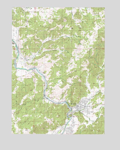
Myrtle Creek, OR USGS Topographic Map
Click on map above to begin viewing in our Map Viewer.

This topographic map contains these locations and features:
Feature Name Type Latitude Longitude GNIS ID View Map
Bilger CreekStreamN43.0429°W123.2573°1117694View Map
Boomer Hill SchoolLocaleN43.0229°W123.3712°1117936View Map
Burnett CemeteryCemeteryN43.0693°W123.3603°1157428View Map
Cedar HollowValleyN43.0198°W123.2548°1118753View Map
Church of the NazareneChurchN43.0297°W123.2847°2508122View Map
City of Myrtle CreekCivilN43.0226°W123.2811°2411204View Map
Clark BranchStreamN43.0765°W123.3670°1118963View Map
Clarks Branch Water Treatment FacilityLocaleN43.0697°W123.3465°2660764View Map
Coffenberry Middle SchoolSchoolN43.0294°W123.2816°2417813View Map
DoleLocaleN43.0590°W123.3340°1136225View Map
Douglas County Fire District 2 Station 8BuildingN43.0231°W123.2810°2576538View Map
Engles and Worth Log PondReservoirN43.0360°W123.2706°1157429View Map
Gobblers KnobSummitN43.1050°W123.2936°1132960View Map
Harrison Young BrookStreamN43.0401°W123.2623°1132958View Map
Mary Moore Bridge (historical)BridgeN43.0848°W123.3687°1123819View Map
Millsite ParkParkN43.0240°W123.2920°1638200View Map
Myrtle CreekPopulated PlaceN43.0201°W123.2931°1124576View Map
Myrtle CreekStreamN43.0229°W123.2959°1955643View Map
Myrtle Creek Branch LibraryBuildingN43.0276°W123.2877°2661379View Map
Myrtle Creek City HallBuildingN43.0267°W123.2885°2661639View Map
Myrtle Creek Elementary SchoolSchoolN43.0281°W123.2798°1124578View Map
Myrtle Creek Fire DepartmentBuildingN43.0230°W123.2810°2576896View Map
Myrtle Creek IOOF CemeteryCemeteryN43.0332°W123.2831°1157431View Map
Myrtle Creek Municipal CourtBuildingN43.0267°W123.2885°2661337View Map
Myrtle Creek Pioneer CemeteryCemeteryN43.0184°W123.2962°1157430View Map
Myrtle Creek Police DepartmentBuildingN43.0267°W123.2886°2737760View Map
Myrtle Creek Post OfficePost OfficeN43.0253°W123.2873°1165683View Map
Myrtle Creek Public WorksBuildingN43.0267°W123.2885°2661543View Map
Myrtle Creek Sewage Treatment PlantLocaleN43.0214°W123.2961°2660739View Map
Myrtle Creek Springbrook Water Treatment PlantLocaleN43.0486°W123.2754°2660763View Map
Neal Lane BridgeBridgeN43.0170°W123.2745°1955637View Map
North Myrtle CreekStreamN43.0232°W123.2848°1147043View Map
Richardson CreekStreamN43.0793°W123.3403°1125981View Map
Roberts MountainSummitN43.1116°W123.3059°1126111View Map
Rock CreekStreamN43.0623°W123.2540°1132959View Map
Round PrairiePopulated PlaceN43.0882°W123.3695°1136712View Map
Round PrairieFlatN43.0982°W123.3745°1126332View Map
Round Prairie Post Office (historical)Post OfficeN43.0882°W123.3695°1165886View Map
Ruckles (historical)LocaleN43.0623°W123.3392°1166707View Map
Ruckles Post Office (historical)Post OfficeN43.0623°W123.3392°1165895View Map
Seventh Day Adventist ChurchChurchN43.0294°W123.2817°2508123View Map
Sheep HillSummitN43.0037°W123.3588°1158477View Map
South County Christian SchoolSchoolN43.0297°W123.2850°2417828View Map
South Douglas RodeoLocaleN43.0312°W123.2727°2661195View Map
South Myrtle CreekStreamN43.0232°W123.2848°1150059View Map
South Umpqua Safety Rest AreaLocaleN43.0623°W123.3456°1162532View Map
Van Dine CreekStreamN43.0379°W123.3312°1128504View Map
WeaverPopulated PlaceN43.0076°W123.3106°1136884View Map
Weigle LandingLocaleN43.0665°W123.3708°2668457View Map

Note: Coordinates in the location and feature list above are referenced to NAD83 datum.


Copyright (C) 2008-2024 Ryan Niemi / Sunset Dynamics ... All Rights Reserved