TopoQuest Logo
Do you find TopoQuest useful?
Help keep TopoQuest running and adding new maps/features by donating!
Bitcoin:  19c7KJd3qBynnjoSw5npx9KScwjBe4ifkT
Litecoin:  LXs6TkuXGGXo1vDsWCkWVdjQX94eUKd6ui
Home View Maps Find Maps Find Places Resources & Links


Wind Mountain, New Mexico Topographic Map

USGS Map Title: Wind Mountain, NM
USGS Map MRC: 32108F4
DRG (GeoTIFF) Download: o32108f4.tif


Neighboring USGS Topographic Map Quads:


  Mangas Springs, NM  
32108G5
 

  Circle Mesa, NM  
32108G4
 

  Silver City, NM  
32108G3
 

  Bullard Peak, NM  
32108F5
 

  Wind Mountain, NM  
32108F4
 

  Tyrone, NM  
32108F3
 

  Eagle Eye Peak, NM  
32108E5
 

  Burro Peak, NM  
32108E4
 

  White Signal, NM  
32108E3


Map MRC Location:

N33°
W109°
N33°
W108°
H8 H7 H6 H5 H4 H3 H2 H1
G8 G7 G6 G5 G4 G3 G2 G1
F8 F7 F6 F5 F4 F3 F2 F1
E8 E7 E6 E5 E4 E3 E2 E1
D8 D7 D6 D5 D4 D3 D2 D1
C8 C7 C6 C5 C4 C3 C2 C1
B8 B7 B6 B5 B4 B3 B2 B1
A8 A7 A6 A5 A4 A3 A2 A1
N32°
W109°
N32°
W108°

Wind Mountain, NM USGS 1:24K Topographic Map Preview:
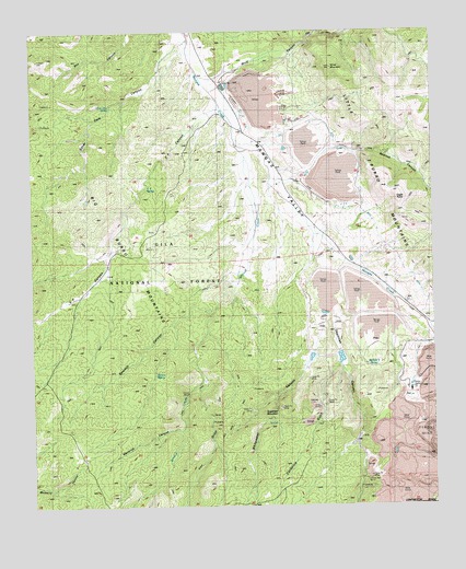
Wind Mountain, NM USGS Topographic Map
Click on map above to begin viewing in our Map Viewer.

This topographic map contains these locations and features:
Feature Name Type Latitude Longitude GNIS ID View Map
10039 Water WellWellN32.6670°W108.3825°919212View Map
Ace High Fluorspar DepositMineN32.7084°W108.3973°914861View Map
Beaseley PropertyMineN32.6626°W108.4367°914921View Map
Beaumout MineMineN32.6584°W108.4428°914922View Map
Bolton MineMineN32.6526°W108.4439°914926View Map
Burro Chief Mine (historical)MineN32.6495°W108.3792°904238View Map
C F CanyonValleyN32.7298°W108.4417°900206View Map
C F RanchLocaleN32.6920°W108.4767°904267View Map
C F SpringSpringN32.7091°W108.4651°904268View Map
California GulchValleyN32.6629°W108.4053°904303View Map
California Gulch ProspectMineN32.6570°W108.4103°914870View Map
Camp Creek TankReservoirN32.6411°W108.4447°936687View Map
Copper Mountain (historical)SummitN32.6456°W108.3806°905329View Map
Deadman CanyonValleyN32.6762°W108.4062°905643View Map
Eagle PointSummitN32.7056°W108.3864°900210View Map
Evening Star ClaimMineN32.7131°W108.4639°914956View Map
Fleming RanchLocaleN32.7448°W108.4534°906306View Map
Gardner ProspectMineN32.6251°W108.4728°914875View Map
Granite WindmillLocaleN32.7101°W108.4470°936686View Map
Grant CountyCivilN32.7390°W108.3825°915980View Map
Iron GulchValleyN32.6587°W108.4475°907253View Map
Kaufman RanchLocaleN32.6804°W108.3842°907507View Map
Liberty Bell MineMineN32.6320°W108.3989°907947View Map
Maverick CanyonValleyN32.6451°W108.4550°908468View Map
McCain SpringSpringN32.6622°W108.3934°908489View Map
Missouri Girl MineMineN32.7320°W108.4956°914846View Map
National Copper Company MineMineN32.6570°W108.4237°914855View Map
Negro CanyonValleyN32.6723°W108.3750°892539View Map
Nellie Bly MineMineN32.6529°W108.3970°914858View Map
Ohio MineMineN32.6520°W108.4128°909256View Map
Old Ranger Station WindmillLocaleN32.6284°W108.4162°936682View Map
Osmer Gold MineMineN32.6456°W108.4862°914866View Map
Phelps Dodge Tailing Dam Number ThreeDamN32.7301°W108.4173°924214View Map
Phelps Dodge Tailing Dam Number TwoDamN32.7134°W108.3973°924213View Map
Phelps Dodge Tailings Dam Number OneDamN32.6817°W108.3973°924215View Map
Phelps-Dodge Open Pit Copper MineMineN32.6401°W108.3784°936539View Map
Redrock CanyonValleyN32.7167°W108.3995°910098View Map
Redrock TankReservoirN32.7309°W108.4501°936685View Map
Ridout RanchLocaleN32.6712°W108.4098°910171View Map
Saint Louis Mine (historical)MineN32.6326°W108.3892°910532View Map
Sampson Mine (historical)MineN32.6340°W108.3842°910588View Map
Sandmill WindmillLocaleN32.6612°W108.4831°936683View Map
Sawmill CanyonValleyN32.6765°W108.4462°910830View Map
Section 22 DepositMineN32.7301°W108.4373°914891View Map
Shrine MineMineN32.6548°W108.4523°911027View Map
Silver Dale CanyonValleyN32.7470°W108.4542°911068View Map
Silver Dale CorralLocaleN32.7145°W108.4826°936691View Map
Silver Dale SpringSpringN32.7304°W108.4758°911069View Map
Silver Dale TankReservoirN32.7061°W108.4830°936692View Map
Silver Dale WindmillLocaleN32.7340°W108.4673°936684View Map
Silver King MineMineN32.7298°W108.4984°914894View Map
Siphon SpringSpringN32.6598°W108.4626°900225View Map
Southern Star DepositsMineN32.6620°W108.4075°914899View Map
Sugarloaf MountainSummitN32.6495°W108.4289°911460View Map
The PinesWellN32.6679°W108.4667°929234View Map
Thompson RanchLocaleN32.6734°W108.3795°911667View Map
Turquoise MineMineN32.6556°W108.3934°911918View Map
Turquoise TankReservoirN32.7472°W108.4931°936690View Map
Whitewater CanyonValleyN32.6770°W108.4089°912349View Map
Whitewater TankReservoirN32.6590°W108.4334°936681View Map
Willow CreekStreamN32.7184°W108.4353°912401View Map
Wind CanyonValleyN32.7376°W108.4426°912447View Map
Wind MountainSummitN32.7404°W108.4067°912448View Map
Woodward RanchLocaleN32.6892°W108.4000°912498View Map

Note: Coordinates in the location and feature list above are referenced to NAD83 datum.


Copyright (C) 2008-2024 Ryan Niemi / Sunset Dynamics ... All Rights Reserved