TopoQuest Logo
Do you find TopoQuest useful?
Help keep TopoQuest running and adding new maps/features by donating!
Bitcoin:  19c7KJd3qBynnjoSw5npx9KScwjBe4ifkT
Litecoin:  LXs6TkuXGGXo1vDsWCkWVdjQX94eUKd6ui
Home View Maps Find Maps Find Places Resources & Links


Williams Peak, Montana Topographic Map

USGS Map Title: Williams Peak, MT
USGS Map MRC: 46114H6
DRG (GeoTIFF) Download: o46114h6.tif


Neighboring USGS Topographic Map Quads:


  Lozeau, MT  
47114A7
 

  Tarkio, MT  
47114A6
 

  Stark South, MT  
47114A5
 

  Saint Patrick Peak, MT  
46114H7
 

  Williams Peak, MT  
46114H6
 

  Deer Peak, MT  
46114H5
 

  Schley Mountain, MT  
46114G7
 

  White Mountain, MT  
46114G6
 

  Lupine Creek, MT  
46114G5


Map MRC Location:

N47°
W115°
N47°
W114°
H8 H7 H6 H5 H4 H3 H2 H1
G8 G7 G6 G5 G4 G3 G2 G1
F8 F7 F6 F5 F4 F3 F2 F1
E8 E7 E6 E5 E4 E3 E2 E1
D8 D7 D6 D5 D4 D3 D2 D1
C8 C7 C6 C5 C4 C3 C2 C1
B8 B7 B6 B5 B4 B3 B2 B1
A8 A7 A6 A5 A4 A3 A2 A1
N46°
W115°
N46°
W114°

Williams Peak, MT USGS 1:24K Topographic Map Preview:
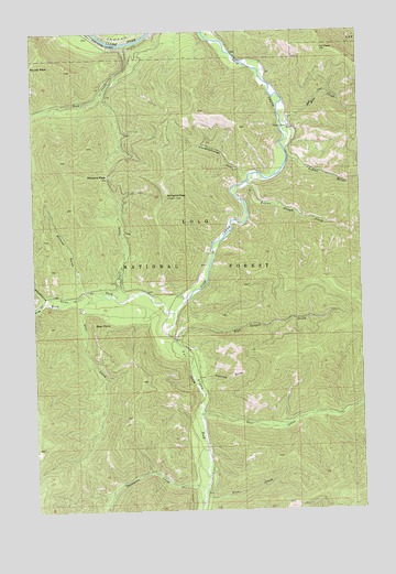
Williams Peak, MT USGS Topographic Map
Click on map above to begin viewing in our Map Viewer.

This topographic map contains these locations and features:
Feature Name Type Latitude Longitude GNIS ID View Map
Alberton DivisionCivilN46.9167°W114.6698°1940559View Map
Bear CreekStreamN46.9313°W114.7212°779484View Map
Bear PointSummitN46.9241°W114.7271°779560View Map
Beaver Slough CreekStreamN46.9605°W114.6682°779634View Map
Big Pine CampgroundLocaleN46.9896°W114.6621°1781746View Map
Big Pine Fishing Access SiteLocaleN46.9894°W114.6623°1744368View Map
Big Pine Recreation SiteLocaleN46.9927°W114.6632°794565View Map
Camillia GulchValleyN46.9088°W114.6857°780833View Map
Chicken CreekStreamN46.9844°W114.7235°794567View Map
Cyr FlatsFlatN46.9124°W114.6901°782025View Map
Cyr PeakSummitN46.9949°W114.6390°782027View Map
Deer CreekStreamN46.9016°W114.6871°782241View Map
Disappointment CreekStreamN46.8994°W114.6357°794600View Map
Fish Creek MineMineN46.9313°W114.7385°804707View Map
Forks Fishing Access SiteLocaleN46.9258°W114.7037°1744378View Map
Forks Recreation SiteLocaleN46.9266°W114.7035°794568View Map
Hay CreekStreamN46.9763°W114.6548°784648View Map
Helean CampLocaleN46.9758°W114.6523°784714View Map
Largest Pine in Montana Point of InterestLocaleN46.9905°W114.6707°794566View Map
Lion CreekStreamN46.8810°W114.6860°786186View Map
Reservoir CreekStreamN46.9321°W114.7318°1781767View Map
Rock CreekStreamN46.9969°W114.7135°789676View Map
Ruben GulchValleyN46.9669°W114.6521°789826View Map
Slaughterhouse GulchValleyN46.9627°W114.6685°790643View Map
South Fork Fish CreekStreamN46.9269°W114.6960°790962View Map
Thompson CreekStreamN46.8816°W114.6857°792086View Map
Trail CreekStreamN46.9308°W114.7148°792305View Map
Wall Canyon CreekStreamN46.9199°W114.6965°792767View Map
Whitehorse GulchValleyN46.9302°W114.7368°793228View Map
Williams PassGapN46.9624°W114.7218°793329View Map
Williams PeakSummitN46.9571°W114.6987°793330View Map
Williams Peak LookoutLocaleN46.9569°W114.6996°801935View Map
Winkler GulchValleyN46.9321°W114.7312°793418View Map

Note: Coordinates in the location and feature list above are referenced to NAD83 datum.


Copyright (C) 2008-2024 Ryan Niemi / Sunset Dynamics ... All Rights Reserved