TopoQuest Logo
Do you find TopoQuest useful?
Help keep TopoQuest running and adding new maps/features by donating!
Bitcoin:  19c7KJd3qBynnjoSw5npx9KScwjBe4ifkT
Litecoin:  LXs6TkuXGGXo1vDsWCkWVdjQX94eUKd6ui
Home View Maps Find Maps Find Places Resources & Links


Stark South, Montana Topographic Map

USGS Map Title: Stark South, MT
USGS Map MRC: 47114A5
DRG (GeoTIFF) Download: o47114a5.tif


Neighboring USGS Topographic Map Quads:


  Horsehead Peak, MT  
47114B6
 

  Stark North, MT  
47114B5
 

  McCormick Peak, MT  
47114B4
 

  Tarkio, MT  
47114A6
 

  Stark South, MT  
47114A5
 

  Alberton, MT  
47114A4
 

  Williams Peak, MT  
46114H6
 

  Deer Peak, MT  
46114H5
 

  Petty Mountain, MT  
46114H4


Map MRC Location:

N48°
W115°
N48°
W114°
H8 H7 H6 H5 H4 H3 H2 H1
G8 G7 G6 G5 G4 G3 G2 G1
F8 F7 F6 F5 F4 F3 F2 F1
E8 E7 E6 E5 E4 E3 E2 E1
D8 D7 D6 D5 D4 D3 D2 D1
C8 C7 C6 C5 C4 C3 C2 C1
B8 B7 B6 B5 B4 B3 B2 B1
A8 A7 A6 A5 A4 A3 A2 A1
N47°
W115°
N47°
W114°

Stark South, MT USGS 1:24K Topographic Map Preview:
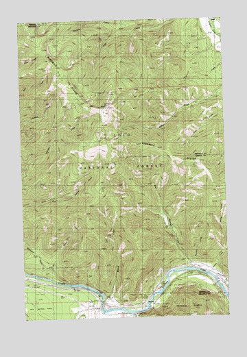
Stark South, MT USGS Topographic Map
Click on map above to begin viewing in our Map Viewer.

This topographic map contains these locations and features:
Feature Name Type Latitude Longitude GNIS ID View Map
16N23W27BBCC01 WellWellN47.1219°W114.5048°820877View Map
Adams CreekStreamN47.0302°W114.5010°778868View Map
Bestwick CreekStreamN47.0163°W114.5093°779735View Map
Clark Fork River BridgeBridgeN47.0138°W114.5073°1781750View Map
CyrPopulated PlaceN47.0102°W114.5848°782024View Map
CyrLocaleN47.0102°W114.5848°1781671View Map
Cyr BridgeBridgeN47.0063°W114.5785°1781748View Map
Cyr Bridge Fishing Access SiteLocaleN47.0052°W114.5782°1744365View Map
Cyr Post Office (historical)Post OfficeN47.0102°W114.5848°1781667View Map
Cyr School (historical)SchoolN47.0102°W114.5848°1781670View Map
Dry GulchValleyN47.0169°W114.6090°782622View Map
Freezeout GulchValleyN47.0183°W114.6148°783724View Map
Interchange 70CrossingN47.0055°W114.5773°1781718View Map
Moose CreekStreamN47.0080°W114.5771°787628View Map
Moose Creek (historical)LocaleN47.0094°W114.5760°1781623View Map
Mountain CreekStreamN47.0208°W114.5229°787751View Map
Natural Pier Fishing Access SiteLocaleN47.0149°W114.5065°1744362View Map
Negro GulchValleyN47.0230°W114.5240°788002View Map
Ninemile DivideRidgeN47.1013°W114.6026°788013View Map
PlateauLocaleN47.0055°W114.5471°788986View Map
Saint Johns Fishing Access SiteLocaleN47.0130°W114.5415°1744363View Map
Stark MountainSummitN47.0888°W114.5723°791452View Map
Stark Mountain LookoutLocaleN47.0888°W114.5723°794359View Map
Stark Mountain VistaLocaleN47.0874°W114.5721°794360View Map
West Mountain CreekStreamN47.0202°W114.5287°806995View Map

Note: Coordinates in the location and feature list above are referenced to NAD83 datum.


Copyright (C) 2008-2024 Ryan Niemi / Sunset Dynamics ... All Rights Reserved