TopoQuest Logo
Do you find TopoQuest useful?
Help keep TopoQuest running and adding new maps/features by donating!
Bitcoin:  19c7KJd3qBynnjoSw5npx9KScwjBe4ifkT
Litecoin:  LXs6TkuXGGXo1vDsWCkWVdjQX94eUKd6ui
Home View Maps Find Maps Find Places Resources & Links


Wildomar, California Topographic Map

USGS Map Title: Wildomar, CA
USGS Map MRC: 33117E3
DRG (GeoTIFF) Download: o33117e3.tif


Neighboring USGS Topographic Map Quads:


  Alberhill, CA  
33117F4
 

  Lake Elsinore, CA  
33117F3
 

  Romoland, CA  
33117F2
 

  Sitton Peak, CA  
33117E4
 

  Wildomar, CA  
33117E3
 

  Murrieta, CA  
33117E2
 

  Margarita Peak, CA  
33117D4
 

  Fallbrook, CA  
33117D3
 

  Temecula, CA  
33117D2


Map MRC Location:

N34°
W118°
N34°
W117°
H8 H7 H6 H5 H4 H3 H2 H1
G8 G7 G6 G5 G4 G3 G2 G1
F8 F7 F6 F5 F4 F3 F2 F1
E8 E7 E6 E5 E4 E3 E2 E1
D8 D7 D6 D5 D4 D3 D2 D1
C8 C7 C6 C5 C4 C3 C2 C1
B8 B7 B6 B5 B4 B3 B2 B1
A8 A7 A6 A5 A4 A3 A2 A1
N33°
W118°
N33°
W117°

Wildomar, CA USGS 1:24K Topographic Map Preview:
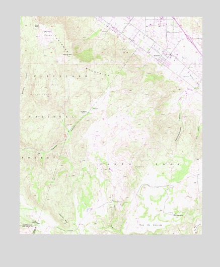
Wildomar, CA USGS Topographic Map
Click on map above to begin viewing in our Map Viewer.

This topographic map contains these locations and features:
Feature Name Type Latitude Longitude GNIS ID View Map
Adobe Loop TrailTrailN33.5122°W117.2675°1849569View Map
American Medical Response WildomarBuildingN33.5901°W117.2524°2665570View Map
Anne Sullivan Nursery and KindergartenSchoolN33.6020°W117.2694°2455888View Map
Bear Creek Golf and Country ClubLocaleN33.5820°W117.2617°1849574View Map
City of WildomarCivilN33.6173°W117.2582°2497148View Map
Cornerstone Christian SchoolSchoolN33.6183°W117.2638°2455931View Map
Donald Graham Elementary SchoolSchoolN33.5970°W117.2573°1849577View Map
Eisinore PeakSummitN33.6022°W117.3442°241868View Map
Elsinore High SchoolSchoolN33.6241°W117.2788°1849579View Map
Elsinore Valley DivisionCivilN33.6128°W117.3594°1935092View Map
Faith Baptist AcademySchoolN33.6199°W117.2864°2455958View Map
Faith Baptist ChurchChurchN33.6200°W117.2878°1849580View Map
Interchange 69CrossingN33.6123°W117.2601°2455473View Map
La CrestaPopulated PlaceN33.5625°W117.3156°1849583View Map
La Cresta HighlandsPopulated PlaceN33.5228°W117.3462°1849584View Map
Los Alamos RanchLocaleN33.5700°W117.3303°245133View Map
Los Alamos Truck TrailTrailN33.5531°W117.3495°245134View Map
Meadows LakeReservoirN33.5147°W117.3292°1849587View Map
Mesa de ColoradoSummitN33.5045°W117.2961°245797View Map
Mesa de la PuntaSummitN33.5017°W117.2559°245792View Map
Mission Valley Medical CenterHospitalN33.6206°W117.2867°1849589View Map
Morrell PotreroFlatN33.6150°W117.3575°246220View Map
Morrell RanchLocaleN33.6192°W117.3634°246221View Map
Ortega High SchoolSchoolN33.5959°W117.2761°1849598View Map
Rancho Santa Rosa Historic AreaParkN33.5117°W117.2703°1849609View Map
Riverside County Bear Creek Forest Service StationLocaleN33.5747°W117.2586°277086View Map
Riverside County Fire Department Station 61 WildomarBuildingN33.6042°W117.2784°2664983View Map
Riverside County Fire Department Station 74 Rancho CapistranoBuildingN33.6099°W117.3566°2665019View Map
Riverside County Fire Department Station 75 - Bear CreekBuildingN33.5652°W117.2642°2664964View Map
Santa RosaCivilN33.5242°W117.2761°249105View Map
Santa Rosa RanchLocaleN33.5117°W117.2698°249117View Map
Santa Rosa Ranch TrailTrailN33.5100°W117.2700°1849610View Map
Santa Rosa SouthPopulated PlaceN33.5131°W117.3273°1849611View Map
Santa Rosa WestPopulated PlaceN33.5450°W117.3086°1849612View Map
Slaughterhouse CanyonValleyN33.5784°W117.2678°249565View Map
Squaw MountainSummitN33.5086°W117.3461°249838View Map
Sylvan MeadowsPopulated PlaceN33.5303°W117.2820°1849616View Map
Tenaja Guard StationLocaleN33.5145°W117.3639°277081View Map
Tenaja Guard StationLocaleN33.5064°W117.3642°250335View Map
Tenaja Valley AirportAirportN33.5134°W117.3300°2650986View Map
WildomarPopulated PlaceN33.5989°W117.2800°1661691View Map
Wildomar CampgroundLocaleN33.5811°W117.3415°2548733View Map
Wildomar CemeteryCemeteryN33.6061°W117.2755°1849628View Map
Wildomar Census Designated Place (historical)CensusN33.6104°W117.2526°2409593View Map
Wildomar Elementary SchoolSchoolN33.6030°W117.2723°1849629View Map
Wildomar Post OfficePost OfficeN33.6056°W117.2749°1849630View Map
Wildomar TrailheadLocaleN33.5883°W117.3417°2548734View Map
Wildomar Truck TrailTrailN33.5992°W117.3134°251562View Map
Wolfranch HeliportAirportN33.5028°W117.3059°1654047View Map

Note: Coordinates in the location and feature list above are referenced to NAD83 datum.


Copyright (C) 2008-2024 Ryan Niemi / Sunset Dynamics ... All Rights Reserved