TopoQuest Logo
Do you find TopoQuest useful?
Help keep TopoQuest running and adding new maps/features by donating!
Bitcoin:  19c7KJd3qBynnjoSw5npx9KScwjBe4ifkT
Litecoin:  LXs6TkuXGGXo1vDsWCkWVdjQX94eUKd6ui
Home View Maps Find Maps Find Places Resources & Links


Fallbrook, California Topographic Map

USGS Map Title: Fallbrook, CA
USGS Map MRC: 33117D3
DRG (GeoTIFF) Download: o33117d3.tif


Neighboring USGS Topographic Map Quads:


  Sitton Peak, CA  
33117E4
 

  Wildomar, CA  
33117E3
 

  Murrieta, CA  
33117E2
 

  Margarita Peak, CA  
33117D4
 

  Fallbrook, CA  
33117D3
 

  Temecula, CA  
33117D2
 

  Las Pulgas Canyon, CA  
33117C4
 

  Morro Hill, CA  
33117C3
 

  Bonsall, CA  
33117C2


Map MRC Location:

N34°
W118°
N34°
W117°
H8 H7 H6 H5 H4 H3 H2 H1
G8 G7 G6 G5 G4 G3 G2 G1
F8 F7 F6 F5 F4 F3 F2 F1
E8 E7 E6 E5 E4 E3 E2 E1
D8 D7 D6 D5 D4 D3 D2 D1
C8 C7 C6 C5 C4 C3 C2 C1
B8 B7 B6 B5 B4 B3 B2 B1
A8 A7 A6 A5 A4 A3 A2 A1
N33°
W118°
N33°
W117°

Fallbrook, CA USGS 1:24K Topographic Map Preview:
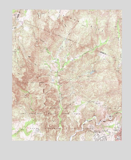
Fallbrook, CA USGS Topographic Map
Click on map above to begin viewing in our Map Viewer.

This topographic map contains these locations and features:
Feature Name Type Latitude Longitude GNIS ID View Map
Apostolic Assembly of the Faith in Christ ChurchChurchN33.3864°W117.2517°1868355View Map
Avenaloca MesaSummitN33.4939°W117.3223°1656427View Map
California Department of Forestry and Fire Protection De Luz Fire Station 16BuildingN33.4279°W117.3206°2664761View Map
Camps CreekStreamN33.4375°W117.3281°270244View Map
Chapel of the Hill Foursquare ChurchChurchN33.3814°W117.2550°1868362View Map
Church of ChristChurchN33.3831°W117.2520°1868365View Map
Cottonwood CreekStreamN33.4536°W117.3245°270622View Map
De LuzPopulated PlaceN33.4370°W117.3245°1656476View Map
De Luz Elementary SchoolSchoolN33.4423°W117.3192°270776View Map
De Luz HeightsPopulated PlaceN33.4311°W117.2767°1868370View Map
De Luz Volunteer Fire DepartmentBuildingN33.4391°W117.2856°2665291View Map
De Luz Volunteer Fire DepartmentBuildingN33.4347°W117.3086°2665380View Map
Dittermore Ranch (historical)LocaleN33.4128°W117.3531°1703662View Map
Doville RanchLocaleN33.4550°W117.2698°1703664View Map
FallbrookPopulated PlaceN33.3764°W117.2511°1652708View Map
Fallbrook Branch San Diego County LibraryBuildingN33.3828°W117.2511°1868375View Map
Fallbrook Church of ChristChurchN33.3856°W117.2511°1868377View Map
Fallbrook DivisionCivilN33.3923°W117.2531°1935100View Map
Fallbrook First Baptist ChurchChurchN33.3823°W117.2528°1868381View Map
Fallbrook Mercantile Shopping CenterLocaleN33.3764°W117.2517°1868384View Map
Fallbrook Post OfficePost OfficeN33.3757°W117.2542°1868386View Map
Fallbrook Street Elementary SchoolSchoolN33.3775°W117.2553°271051View Map
Fern CreekStreamN33.4356°W117.3261°271119View Map
Ferndale RanchLocaleN33.4314°W117.3300°1703666View Map
First Christian ChurchChurchN33.3811°W117.2539°1868390View Map
First Church of GodChurchN33.3784°W117.2517°1868392View Map
Garnsay RanchLocaleN33.4517°W117.3256°271273View Map
Jave RanchLocaleN33.4448°W117.3431°1703669View Map
Johnson RanchLocaleN33.4861°W117.3673°1703670View Map
Maie Ellis Elementary SchoolSchoolN33.3800°W117.2556°1868402View Map
Marchant RanchLocaleN33.4486°W117.2525°1703672View Map
Matthews 858 DamDamN33.4684°W117.3125°1664100View Map
Oak SlopeSlopeN33.4872°W117.3170°272752View Map
Redonda MesaSummitN33.4911°W117.3456°273248View Map
Richman RanchLocaleN33.4711°W117.3170°1703676View Map
Roblar CreekStreamN33.3881°W117.3211°273304View Map
Rocky PeakSummitN33.4550°W117.3542°273325View Map
Ross LakeReservoirN33.4400°W117.2857°273360View Map
Santa Margarita GrovesPopulated PlaceN33.4909°W117.2864°1849562View Map
Sky RanchLocaleN33.4614°W117.3709°273740View Map
Village ParkParkN33.3806°W117.2511°274342View Map
Village Square ParkParkN33.3817°W117.2500°1868434View Map
Willow SpringSpringN33.4953°W117.3709°274523View Map

Note: Coordinates in the location and feature list above are referenced to NAD83 datum.


Copyright (C) 2008-2024 Ryan Niemi / Sunset Dynamics ... All Rights Reserved