TopoQuest Logo
Do you find TopoQuest useful?
Help keep TopoQuest running and adding new maps/features by donating!
Bitcoin:  19c7KJd3qBynnjoSw5npx9KScwjBe4ifkT
Litecoin:  LXs6TkuXGGXo1vDsWCkWVdjQX94eUKd6ui
Home View Maps Find Maps Find Places Resources & Links


Whiteville, Virginia Topographic Map

USGS Map Title: Whiteville, VA
USGS Map MRC: 37078E2
DRG (GeoTIFF) Download: o37078e2.tif


Neighboring USGS Topographic Map Quads:


  Arvonia, VA  
37078F3
 

  Lakeside Village, VA  
37078F2
 

  Cartersville, VA  
37078F1
 

  Gold Hill, VA  
37078E3
 

  Whiteville, VA  
37078E2
 

  Trenholm, VA  
37078E1
 

  Hillcrest, VA  
37078D3
 

  Cumberland, VA  
37078D2
 

  Ballsville, VA  
37078D1


Map MRC Location:

N38°
W79°
N38°
W78°
H8 H7 H6 H5 H4 H3 H2 H1
G8 G7 G6 G5 G4 G3 G2 G1
F8 F7 F6 F5 F4 F3 F2 F1
E8 E7 E6 E5 E4 E3 E2 E1
D8 D7 D6 D5 D4 D3 D2 D1
C8 C7 C6 C5 C4 C3 C2 C1
B8 B7 B6 B5 B4 B3 B2 B1
A8 A7 A6 A5 A4 A3 A2 A1
N37°
W79°
N37°
W78°

Whiteville, VA USGS 1:24K Topographic Map Preview:
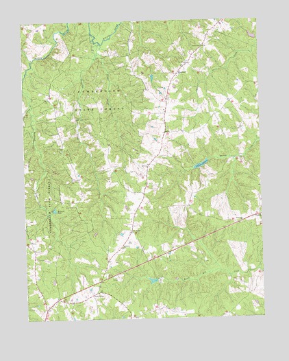
Whiteville, VA USGS Topographic Map
Click on map above to begin viewing in our Map Viewer.

This topographic map contains these locations and features:
Feature Name Type Latitude Longitude GNIS ID View Map
AshbyPopulated PlaceN37.5776°W78.1750°1477080View Map
Barrett DamDamN37.6018°W78.1814°1489591View Map
Bethlehem Baptist ChurchChurchN37.5301°W78.1986°1463237View Map
Bethlehem CemeteryCemeteryN37.5299°W78.1989°1494095View Map
Bigger CreekStreamN37.6118°W78.2094°1463429View Map
Bonbrook Lake DamDamN37.5451°W78.2347°1489590View Map
Bonbrook School (historical)SchoolN37.5910°W78.2347°1494096View Map
ClintonPopulated PlaceN37.5426°W78.1256°1499274View Map
Cumberland CountyCivilN37.5121°W78.2449°1494109View Map
Cumberland Volunteer Fire DepartmentBuildingN37.5073°W78.2304°2075464View Map
District 2CivilN37.5363°W78.2063°1927199View Map
Fleming DamDamN37.5168°W78.1831°1489541View Map
Fleming LakeReservoirN37.5160°W78.1831°1489542View Map
Flippen DamDamN37.5657°W78.1519°1489547View Map
Flippen LakeReservoirN37.5645°W78.1560°1489548View Map
Flippen MillpondReservoirN37.5657°W78.1519°1466726View Map
Flippens Mill (historical)LocaleN37.5657°W78.1519°1494117View Map
Grays SidingLocaleN37.5107°W78.2128°1467413View Map
Hendricks CemeteryCemeteryN37.5176°W78.2444°1494131View Map
Hill CemeteryCemeteryN37.5063°W78.2236°1494132View Map
Jenkins CemeteryCemeteryN37.5582°W78.2219°1494135View Map
Jenkins ChurchChurchN37.5710°W78.2297°1468669View Map
L B Atkins DamDamN37.6168°W78.1264°1489593View Map
Meador CemeteryCemeteryN37.5621°W78.1922°1494139View Map
Mount Calvary CemeteryCemeteryN37.6074°W78.1628°1494143View Map
Mount Calvary ChurchChurchN37.6068°W78.1625°1470830View Map
Oak ForestPopulated PlaceN37.5365°W78.1939°1471695View Map
Oak Grove Baptist ChurchChurchN37.5646°W78.1842°1471724View Map
Oak Grove CemeteryCemeteryN37.5649°W78.1847°1494148View Map
Pine Grove School (historical)SchoolN37.5626°W78.1333°1494151View Map
Reynolds CreekStreamN37.6154°W78.2083°1473167View Map
Rising Zion ChurchChurchN37.5407°W78.1350°1473254View Map
Sanderson DamDamN37.5968°W78.1664°1489592View Map
Sugar Fork School (historical)SchoolN37.5293°W78.2478°1494160View Map
Tally (historical)Populated PlaceN37.5704°W78.2400°1493948View Map
Taylor CemeteryCemeteryN37.5857°W78.1511°1494165View Map
Thomas ChapelChurchN37.6143°W78.1547°1475640View Map
Thomas Chapel CemeteryCemeteryN37.6146°W78.1550°1494167View Map
Turkey Cock School (historical)SchoolN37.6113°W78.1650°1494171View Map
WhitevillePopulated PlaceN37.6024°W78.1675°1500316View Map

Note: Coordinates in the location and feature list above are referenced to NAD83 datum.


Copyright (C) 2008-2024 Ryan Niemi / Sunset Dynamics ... All Rights Reserved