TopoQuest Logo
Do you find TopoQuest useful?
Help keep TopoQuest running and adding new maps/features by donating!
Bitcoin:  19c7KJd3qBynnjoSw5npx9KScwjBe4ifkT
Litecoin:  LXs6TkuXGGXo1vDsWCkWVdjQX94eUKd6ui
Home View Maps Find Maps Find Places Resources & Links


Whitesboro, Texas Topographic Map

USGS Map Title: Whitesboro, TX
USGS Map MRC: 33096F8
DRG (GeoTIFF) Download: o33096f8.tif


Neighboring USGS Topographic Map Quads:


  Horseshoe Bend, TX  
33097G1
 

  Dexter, TX  
33096G8
 

  Gordonville, TX  
33096G7
 

  Callisburg, TX  
33097F1
 

  Whitesboro, TX  
33096F8
 

  Sadler, TX  
33096F7
 

  Woodbine, TX  
33097E1
 

  Collinsville, TX  
33096E8
 

  Ethel, TX  
33096E7


Map MRC Location:

N34°
W97°
N34°
W96°
H8 H7 H6 H5 H4 H3 H2 H1
G8 G7 G6 G5 G4 G3 G2 G1
F8 F7 F6 F5 F4 F3 F2 F1
E8 E7 E6 E5 E4 E3 E2 E1
D8 D7 D6 D5 D4 D3 D2 D1
C8 C7 C6 C5 C4 C3 C2 C1
B8 B7 B6 B5 B4 B3 B2 B1
A8 A7 A6 A5 A4 A3 A2 A1
N33°
W97°
N33°
W96°

Whitesboro, TX USGS 1:24K Topographic Map Preview:
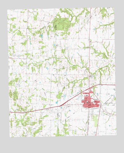
Whitesboro, TX USGS Topographic Map
Click on map above to begin viewing in our Map Viewer.

This topographic map contains these locations and features:
Feature Name Type Latitude Longitude GNIS ID View Map
Akers CemeteryCemeteryN33.6801°W96.9678°1350918View Map
BalmPopulated PlaceN33.7468°W96.9767°1379388View Map
Bing LakeReservoirN33.7233°W96.9606°1855377View Map
Bing Lake DamDamN33.7251°W96.9586°1855376View Map
Bones ChapelChurchN33.6848°W96.9328°1352649View Map
Cannon Oil FieldOilfieldN33.6923°W96.9358°1889643View Map
Central Baptist ChurchChurchN33.6529°W96.9072°2018612View Map
City of WhitesboroCivilN33.6613°W96.9022°2412259View Map
Copper BranchStreamN33.6962°W96.8753°1354967View Map
County Line CemeteryCemeteryN33.7140°W96.9442°1355165View Map
DixiePopulated PlaceN33.7168°W96.9047°1356078View Map
Eastside Church of ChristChurchN33.6576°W96.9011°2019631View Map
First Baptist ChurchChurchN33.6562°W96.9053°2019606View Map
First Presbyterian ChurchChurchN33.6576°W96.9069°2019649View Map
Flying H Ranch AirportAirportN33.6339°W96.9400°2675925View Map
Grayson County Constable's Office Precinct 3BuildingN33.6615°W96.9071°2739156View Map
Harville LakeReservoirN33.7001°W96.9586°1864987View Map
Harville Lake DamDamN33.7001°W96.9586°1864986View Map
K-K Oil FieldOilfieldN33.6696°W96.9961°1889640View Map
Kimbell - Sims Oil FieldOilfieldN33.7046°W96.9908°1889958View Map
Kimbell Oil FieldOilfieldN33.6515°W96.9908°1889642View Map
Liberty Hill CemeteryCemeteryN33.7379°W96.9775°1361165View Map
North Branch Big Mineral CreekStreamN33.6862°W96.9028°1364001View Map
North Union Street Church of ChristChurchN33.6673°W96.9042°2019632View Map
Shelden Oil FieldOilfieldN33.6757°W96.9892°1889641View Map
South Branch Big Mineral CreekStreamN33.6862°W96.9028°1368639View Map
Southwest Sadler Oil FieldOilfieldN33.6957°W96.9075°1889646View Map
Texas Vital Care Emergency Medical ServicesBuildingN33.6553°W96.9083°2655915View Map
TheodorePopulated PlaceN33.7146°W96.9044°1377154View Map
Three Acres AirportAirportN33.6448°W96.9984°2675885View Map
Union ChurchChurchN33.7109°W96.9056°1889645View Map
United ChurchChurchN33.6740°W96.8922°1889648View Map
Violott ChurchChurchN33.7009°W96.9800°1370664View Map
West Sadler Oil FieldOilfieldN33.7012°W96.8919°1889647View Map
West Sandusky Oil FieldOilfieldN33.7407°W96.9025°1889644View Map
Westview ChurchChurchN33.6562°W96.9511°1371306View Map
WhitesboroPopulated PlaceN33.6562°W96.9069°1371458View Map
Whitesboro CemeteryCemeteryN33.6540°W96.9331°1371459View Map
Whitesboro City HallBuildingN33.6561°W96.9072°2754003View Map
Whitesboro Elementary SchoolSchoolN33.6571°W96.9086°2005530View Map
Whitesboro Fire DepartmentBuildingN33.6556°W96.9084°2551657View Map
Whitesboro High SchoolSchoolN33.6637°W96.9072°2005531View Map
Whitesboro Middle SchoolSchoolN33.6640°W96.9158°2005532View Map
Whitesboro Oil FieldOilfieldN33.6743°W96.9250°1371460View Map
Whitesboro Police DepartmentBuildingN33.6561°W96.9074°2738939View Map
Whitesboro Post OfficePost OfficeN33.6554°W96.9073°2732176View Map

Note: Coordinates in the location and feature list above are referenced to NAD83 datum.


Copyright (C) 2008-2024 Ryan Niemi / Sunset Dynamics ... All Rights Reserved