TopoQuest Logo
Do you find TopoQuest useful?
Help keep TopoQuest running and adding new maps/features by donating!
Bitcoin:  19c7KJd3qBynnjoSw5npx9KScwjBe4ifkT
Litecoin:  LXs6TkuXGGXo1vDsWCkWVdjQX94eUKd6ui
Home View Maps Find Maps Find Places Resources & Links


Whitepine, Colorado Topographic Map

USGS Map Title: Whitepine, CO
USGS Map MRC: 38106E4
DRG (GeoTIFF) Download: o38106e4.tif


Neighboring USGS Topographic Map Quads:


  Fairview Peak, CO  
38106F5
 

  Cumberland Pass, CO  
38106F4
 

  Saint Elmo, CO  
38106F3
 

  Pitkin, CO  
38106E5
 

  Whitepine, CO  
38106E4
 

  Garfield, CO  
38106E3
 

  Doyleville, CO  
38106D5
 

  Sargents, CO  
38106D4
 

  Pahlone Peak, CO  
38106D3


Map MRC Location:

N39°
W107°
N39°
W106°
H8 H7 H6 H5 H4 H3 H2 H1
G8 G7 G6 G5 G4 G3 G2 G1
F8 F7 F6 F5 F4 F3 F2 F1
E8 E7 E6 E5 E4 E3 E2 E1
D8 D7 D6 D5 D4 D3 D2 D1
C8 C7 C6 C5 C4 C3 C2 C1
B8 B7 B6 B5 B4 B3 B2 B1
A8 A7 A6 A5 A4 A3 A2 A1
N38°
W107°
N38°
W106°

Whitepine, CO USGS 1:24K Topographic Map Preview:
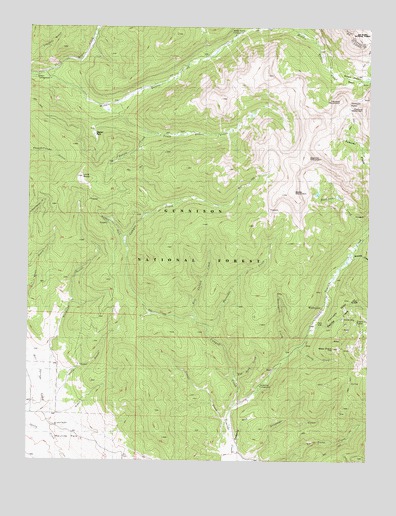
Whitepine, CO USGS Topographic Map
Click on map above to begin viewing in our Map Viewer.

This topographic map contains these locations and features:
Feature Name Type Latitude Longitude GNIS ID View Map
Akron MineMineN38.5378°W106.3911°1763875View Map
Akron MineMineN38.5400°W106.3950°189389View Map
Big Red Twenty-two MineMineN38.5136°W106.3856°1745797View Map
Bonanza CreekStreamN38.5589°W106.3822°189380View Map
Bonnie CreekStreamN38.5942°W106.4572°197379View Map
Brittle Basin MineMineN38.5181°W106.3770°1745798View Map
Brittle Silver BasinBasinN38.6111°W106.3811°189349View Map
Buckhorn CreekStreamN38.5672°W106.3759°189378View Map
Buffalo ForkStreamN38.5628°W106.4659°197378View Map
Canyon CreekStreamN38.5158°W106.4247°189397View Map
Central MountainSummitN38.6014°W106.3784°189312View Map
Coyote Park TrailTrailN38.5444°W106.4964°189410View Map
David H Shaft MineMineN38.5450°W106.3834°1745800View Map
Deadman GulchValleyN38.5009°W106.4161°189395View Map
Depler ParkFlatN38.5944°W106.4764°189407View Map
East Canyon CreekStreamN38.5403°W106.4400°197516View Map
Egg Rock CreekStreamN38.5242°W106.4242°197515View Map
Eldorado GulchValleyN38.5085°W106.4964°189398View Map
Ensign Tunnel MineMineN38.5450°W106.3834°1745801View Map
Erie MineMineN38.5408°W106.3753°1745802View Map
Fitzpatrick GulchValleyN38.6234°W106.4231°189408View Map
Galena CreekStreamN38.5381°W106.3972°189386View Map
Granite MountainSummitN38.5889°W106.3978°189310View Map
Graphite Basin MineMineN38.5919°W106.3784°1745803View Map
Graveyard CreekStreamN38.5283°W106.4064°189392View Map
Hicks GulchValleyN38.5195°W106.4926°197472View Map
Horseshoe CreekStreamN38.5369°W106.4345°189396View Map
Little BaldySummitN38.5814°W106.4809°189400View Map
Middle Quartz CampgroundLocaleN38.6231°W106.4250°197376View Map
Middle Quartz CreekStreamN38.6117°W106.4953°189405View Map
Morning Star MineMineN38.5378°W106.3911°1763877View Map
Morning Star MineMineN38.5350°W106.3850°1745807View Map
Mount ChapmanSummitN38.6242°W106.3845°189341View Map
Nest Egg MineMineN38.5358°W106.3981°1745808View Map
North Quartz CreekStreamN38.6117°W106.4953°189404View Map
North StarLocaleN38.5411°W106.3853°197473View Map
North Star MineMineN38.5411°W106.3850°189390View Map
Parole MineMineN38.5486°W106.3814°1745809View Map
Paywell MountainSummitN38.6039°W106.3867°189347View Map
Pitkin Stock DrivewayTrailN38.5858°W106.4920°203387View Map
Porcupine RidgeRidgeN38.5472°W106.3811°189387View Map
Princeton and Blackhawk MineMineN38.5903°W106.3784°1745811View Map
Snowblind CampgroundLocaleN38.5214°W106.4150°197471View Map
Snowblind GulchValleyN38.5049°W106.4235°197514View Map
South Quartz CreekStreamN38.6028°W106.4745°189406View Map
Spring CreekStreamN38.5328°W106.4009°189394View Map
Stella MountainSummitN38.5778°W106.4034°189379View Map
Stridiron GulchStreamN38.5161°W106.4945°189399View Map
Tomichi MineMineN38.5358°W106.4003°1745813View Map
Tomichi PassGapN38.6036°W106.3834°189346View Map
Victor MineMineN38.5383°W106.3911°1745814View Map
Victor MineMineN38.5378°W106.3911°1763876View Map
West Point HillSummitN38.5325°W106.3884°189391View Map
White Pine CemeteryCemeteryN38.5317°W106.4039°2123884View Map
White Pine MineMineN38.5358°W106.3981°1745815View Map
WhitepinePopulated PlaceN38.5417°W106.3936°189388View Map

Note: Coordinates in the location and feature list above are referenced to NAD83 datum.


Copyright (C) 2008-2024 Ryan Niemi / Sunset Dynamics ... All Rights Reserved