TopoQuest Logo
Do you find TopoQuest useful?
Help keep TopoQuest running and adding new maps/features by donating!
Bitcoin:  19c7KJd3qBynnjoSw5npx9KScwjBe4ifkT
Litecoin:  LXs6TkuXGGXo1vDsWCkWVdjQX94eUKd6ui
Home View Maps Find Maps Find Places Resources & Links


Saint Elmo, Colorado Topographic Map

USGS Map Title: Saint Elmo, CO
USGS Map MRC: 38106F3
DRG (GeoTIFF) Download: o38106f3.tif


Neighboring USGS Topographic Map Quads:


  Tincup, CO  
38106G4
 

  Mount Yale, CO  
38106G3
 

  Buena Vista West, CO  
38106G2
 

  Cumberland Pass, CO  
38106F4
 

  Saint Elmo, CO  
38106F3
 

  Mount Antero, CO  
38106F2
 

  Whitepine, CO  
38106E4
 

  Garfield, CO  
38106E3
 

  Maysville, CO  
38106E2


Map MRC Location:

N39°
W107°
N39°
W106°
H8 H7 H6 H5 H4 H3 H2 H1
G8 G7 G6 G5 G4 G3 G2 G1
F8 F7 F6 F5 F4 F3 F2 F1
E8 E7 E6 E5 E4 E3 E2 E1
D8 D7 D6 D5 D4 D3 D2 D1
C8 C7 C6 C5 C4 C3 C2 C1
B8 B7 B6 B5 B4 B3 B2 B1
A8 A7 A6 A5 A4 A3 A2 A1
N38°
W107°
N38°
W106°

Saint Elmo, CO USGS 1:24K Topographic Map Preview:
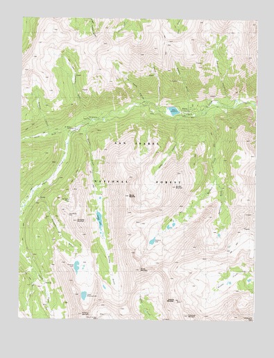
Saint Elmo, CO USGS Topographic Map
Click on map above to begin viewing in our Map Viewer.

This topographic map contains these locations and features:
Feature Name Type Latitude Longitude GNIS ID View Map
Alpine (historical)Populated PlaceN38.7111°W106.2770°203899View Map
Alpine LakeReservoirN38.7119°W106.2942°196446View Map
Alpine Number One QuarryMineN38.7000°W106.3506°1745729View Map
Baldwin CreekStreamN38.7156°W106.2700°189329View Map
Baldwin GulchValleyN38.6838°W106.2712°189330View Map
Baldwin LakeLakeN38.6576°W106.3046°196800View Map
Black Hawk MineMineN38.7000°W106.3506°1763870View Map
Boulder MountainSummitN38.6803°W106.2925°189305View Map
Carbonate MountainSummitN38.6278°W106.2839°189301View Map
Chrysolite MountainSummitN38.6656°W106.3442°189306View Map
Coal Camp CanyonValleyN38.7150°W106.3074°189323View Map
Cronin PeakSummitN38.6555°W106.2834°2071319View Map
Cyclone MountainSummitN38.6333°W106.2920°189303View Map
Deer CanyonValleyN38.7098°W106.2890°189328View Map
Elmer McMurray MineMineN38.7167°W106.2839°1745745View Map
Fairview MineMineN38.6325°W106.3100°1745748View Map
Forward Gold Mining Company MineMineN38.7000°W106.3506°1745750View Map
Garfield QuarryMineN38.6533°W106.2864°1745753View Map
Grizzly GulchValleyN38.7062°W106.3377°189332View Map
Grizzly LakeLakeN38.6664°W106.3328°189331View Map
Grizzly MountainSummitN38.6458°W106.3111°189304View Map
Grouse CanyonValleyN38.7164°W106.2617°189326View Map
Hancock (historical)Populated PlaceN38.6403°W106.3659°203900View Map
Iron Chest MineMineN38.6736°W106.3489°196801View Map
Iron City (historical)Populated PlaceN38.7086°W106.3381°203897View Map
Lehigh MineMineN38.7178°W106.2545°1745767View Map
Maple Leaf MineMineN38.7000°W106.3506°1745773View Map
Mary Murphy MineMineN38.6681°W106.3495°196802View Map
Mary Murphy MineMineN38.6542°W106.2934°1745774View Map
Matilda MineMineN38.7000°W106.3506°1745775View Map
Mount MammaSummitN38.6747°W106.3184°189327View Map
Mountain Morning RidgeRidgeN38.6553°W106.2836°2079339View Map
North Fork Chalk CreekStreamN38.7028°W106.3478°189321View Map
Ole Bull MineMineN38.7000°W106.3506°1745780View Map
Pomeroy GulchValleyN38.6766°W106.3664°189335View Map
Pomeroy LakeLakeN38.6468°W106.3445°189339View Map
Pomeroy MountainSummitN38.6292°W106.3422°189307View Map
Poplar GulchValleyN38.7080°W106.3380°189322View Map
Pride of the West MineMineN38.6264°W106.3334°189352View Map
Rarus Warrior MineMineN38.6667°W106.3506°1745786View Map
Rolla MineMineN38.6667°W106.3506°1745787View Map
Romley (historical)Populated PlaceN38.6750°W106.3700°203898View Map
Saint Elmo (historical)Populated PlaceN38.7047°W106.3481°204756View Map
San Isabel National ForestForestN38.7408°W106.2778°169595View Map
Sawmill GulchValleyN38.7016°W106.3599°2790959View Map
Sheep CanyonValleyN38.7126°W106.3026°189324View Map
Stonewall (historical)Populated PlaceN38.6311°W106.3597°196811View Map
Stonewall Shaft MineMineN38.6356°W106.3678°1745792View Map
Tabeguache PeakSummitN38.6253°W106.2509°203948View Map
Tilden MineMineN38.6667°W106.2672°1745761View Map
Uncle Sam MineMineN38.6461°W106.3145°1745795View Map
Upper Pomeroy LakeLakeN38.6348°W106.3405°189340View Map
Weldon GulchValleyN38.7139°W106.2863°189325View Map

Note: Coordinates in the location and feature list above are referenced to NAD83 datum.


Copyright (C) 2008-2024 Ryan Niemi / Sunset Dynamics ... All Rights Reserved