TopoQuest Logo
Do you find TopoQuest useful?
Help keep TopoQuest running and adding new maps/features by donating!
Bitcoin:  19c7KJd3qBynnjoSw5npx9KScwjBe4ifkT
Litecoin:  LXs6TkuXGGXo1vDsWCkWVdjQX94eUKd6ui
Home View Maps Find Maps Find Places Resources & Links


Whitebird School, Montana Topographic Map

USGS Map Title: Whitebird School, MT
USGS Map MRC: 45109E3
DRG (GeoTIFF) Download: o45109e3.tif


Neighboring USGS Topographic Map Quads:


  Springtime, MT  
45109F4
 

  Columbus West, MT  
45109F3
 

  Columbus East, MT  
45109F2
 

  Absarokee, MT  
45109E4
 

  Whitebird School, MT  
45109E3
 

  Shane Ridge, MT  
45109E2
 

  Roscoe NW, MT  
45109D4
 

  Roscoe NE, MT  
45109D3
 

  Cooney Reservoir, MT  
45109D2


Map MRC Location:

N46°
W110°
N46°
W109°
H8 H7 H6 H5 H4 H3 H2 H1
G8 G7 G6 G5 G4 G3 G2 G1
F8 F7 F6 F5 F4 F3 F2 F1
E8 E7 E6 E5 E4 E3 E2 E1
D8 D7 D6 D5 D4 D3 D2 D1
C8 C7 C6 C5 C4 C3 C2 C1
B8 B7 B6 B5 B4 B3 B2 B1
A8 A7 A6 A5 A4 A3 A2 A1
N45°
W110°
N45°
W109°

Whitebird School, MT USGS 1:24K Topographic Map Preview:
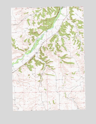
Whitebird School, MT USGS Topographic Map
Click on map above to begin viewing in our Map Viewer.

This topographic map contains these locations and features:
Feature Name Type Latitude Longitude GNIS ID View Map
02S20E32ABAA01 WellWellN45.6238°W109.2796°810622View Map
02S20E32ADDC01 WellWellN45.6213°W109.2860°810608View Map
02S20E32DDBB01 WellWellN45.6130°W109.2788°810540View Map
03S19E13CACB01 WellWellN45.5711°W109.3304°810201View Map
03S19E13CBAC01 WellWellN45.5719°W109.3321°810209View Map
03S19E13CCAA01 WellWellN45.5691°W109.3310°810188View Map
03S19E13CCAA02 WellWellN45.5688°W109.3310°810185View Map
03S19E13CCAB01 WellWellN45.5688°W109.3321°810186View Map
03S19E13CCAD01 WellWellN45.5680°W109.3313°810173View Map
03S19E23ABCD01 WellWellN45.5630°W109.3438°810134View Map
03S19E23BABD01 WellWellN45.5644°W109.3488°810145View Map
03S20E05ABBB01 WellWellN45.6086°W109.2838°810483View Map
03S20E05ABBB02 WellWellN45.6094°W109.2821°810494View Map
03S20E05BAAA01 WellWellN45.6091°W109.2849°810491View Map
03S20E05BAAB01 WellWellN45.6083°W109.2857°810481View Map
03S20E07AADB01 WellWellN45.5930°W109.2971°810344View Map
04S19E03BCDA01 WellWellN45.5169°W109.3724°809916View Map
Columbus DivisionCivilN45.6074°W109.3307°1940590View Map
Firemans PointCliffN45.6244°W109.2860°771370View Map
Firemans Point Fishing Access SiteLocaleN45.6169°W109.2960°1744502View Map
Halfway House (historical)LocaleN45.5689°W109.3325°2652092View Map
Joe Hill CreekStreamN45.6019°W109.3016°772833View Map
Mexican Joe CreekStreamN45.5549°W109.3735°774121View Map
Norve CouleeStreamN45.5697°W109.3518°774875View Map
Orson CouleeStreamN45.5605°W109.3668°774984View Map
Porter CouleeStreamN45.6249°W109.3202°775387View Map
Scott DitchCanalN45.5866°W109.3157°776307View Map
Shane CreekStreamN45.6169°W109.2893°776398View Map
Shane DitchCanalN45.6127°W109.2777°776400View Map
Swinging Bridge Fishing Access SiteLocaleN45.5833°W109.3291°1744509View Map
Whitebird CreekStreamN45.5758°W109.3335°778408View Map
Whitebird DitchCanalN45.5663°W109.3391°778409View Map
Whitebird Fishing Access SiteLocaleN45.5736°W109.3363°1744512View Map
Whitebird School (historical)SchoolN45.5697°W109.3318°778410View Map

Note: Coordinates in the location and feature list above are referenced to NAD83 datum.


Copyright (C) 2008-2024 Ryan Niemi / Sunset Dynamics ... All Rights Reserved