TopoQuest Logo
Do you find TopoQuest useful?
Help keep TopoQuest running and adding new maps/features by donating!
Bitcoin:  19c7KJd3qBynnjoSw5npx9KScwjBe4ifkT
Litecoin:  LXs6TkuXGGXo1vDsWCkWVdjQX94eUKd6ui
Home View Maps Find Maps Find Places Resources & Links


Springtime, Montana Topographic Map

USGS Map Title: Springtime, MT
USGS Map MRC: 45109F4
DRG (GeoTIFF) Download: o45109f4.tif


Neighboring USGS Topographic Map Quads:


  Stephens Hill, MT  
45109G5
 

  Antelope Point, MT  
45109G4
 

  Lindemulder Hill, MT  
45109G3
 

  Reed Point, MT  
45109F5
 

  Springtime, MT  
45109F4
 

  Columbus West, MT  
45109F3
 

  Sandborn Creek, MT  
45109E5
 

  Absarokee, MT  
45109E4
 

  Whitebird School, MT  
45109E3


Map MRC Location:

N46°
W110°
N46°
W109°
H8 H7 H6 H5 H4 H3 H2 H1
G8 G7 G6 G5 G4 G3 G2 G1
F8 F7 F6 F5 F4 F3 F2 F1
E8 E7 E6 E5 E4 E3 E2 E1
D8 D7 D6 D5 D4 D3 D2 D1
C8 C7 C6 C5 C4 C3 C2 C1
B8 B7 B6 B5 B4 B3 B2 B1
A8 A7 A6 A5 A4 A3 A2 A1
N45°
W110°
N45°
W109°

Springtime, MT USGS 1:24K Topographic Map Preview:
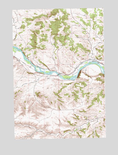
Springtime, MT USGS Topographic Map
Click on map above to begin viewing in our Map Viewer.

This topographic map contains these locations and features:
Feature Name Type Latitude Longitude GNIS ID View Map
Berry CreekStreamN45.6980°W109.3904°768722View Map
Bridge CouleeValleyN45.6897°W109.4424°769214View Map
Coulee CreekStreamN45.6986°W109.3946°770202View Map
Countryman Creek School (historical)SchoolN45.6424°W109.3974°770206View Map
CraverPopulated PlaceN45.6969°W109.3810°770282View Map
East White Beaver CreekStreamN45.7383°W109.4927°771119View Map
Interchange 400CrossingN45.7008°W109.3882°1726921View Map
Kennedy CouleeValleyN45.6424°W109.3860°772982View Map
Merrill Post Office (historical)Post OfficeN45.7008°W109.3896°1726885View Map
Oneida (historical)LocaleN45.6894°W109.4688°1726928View Map
Sectionhouse CreekStreamN45.6877°W109.4579°776336View Map
SpringtimePopulated PlaceN45.6983°W109.3874°777092View Map
Springtime Number 1 DamDamN45.7083°W109.3874°797133View Map
Springtime Post Office (historical)Post OfficeN45.6983°W109.3874°1726985View Map
Stillwater CountyCivilN45.6691°W109.3952°1719572View Map
Warner HillSummitN45.7433°W109.4396°778120View Map
West White Beaver CreekStreamN45.7380°W109.4927°778317View Map
Whistle CreekStreamN45.7030°W109.4857°778356View Map

Note: Coordinates in the location and feature list above are referenced to NAD83 datum.


Copyright (C) 2008-2024 Ryan Niemi / Sunset Dynamics ... All Rights Reserved