TopoQuest Logo
Do you find TopoQuest useful?
Help keep TopoQuest running and adding new maps/features by donating!
Bitcoin:  19c7KJd3qBynnjoSw5npx9KScwjBe4ifkT
Litecoin:  LXs6TkuXGGXo1vDsWCkWVdjQX94eUKd6ui
Home View Maps Find Maps Find Places Resources & Links


Wharton, West Virginia Topographic Map

USGS Map Title: Wharton, WV
USGS Map MRC: 37081H6
DRG (GeoTIFF) Download: o37081h6.tif


Neighboring USGS Topographic Map Quads:


  Madison, WV  
38081A7
 

  Williams Mountain, WV  
38081A6
 

  Sylvester, WV  
38081A5
 

  Clothier, WV  
37081H7
 

  Wharton, WV  
37081H6
 

  Whitesville, WV  
37081H5
 

  Amherstdale, WV  
37081G7
 

  Lorado, WV  
37081G6
 

  Pilot Knob, WV  
37081G5


Map MRC Location:

N38°
W82°
N38°
W81°
H8 H7 H6 H5 H4 H3 H2 H1
G8 G7 G6 G5 G4 G3 G2 G1
F8 F7 F6 F5 F4 F3 F2 F1
E8 E7 E6 E5 E4 E3 E2 E1
D8 D7 D6 D5 D4 D3 D2 D1
C8 C7 C6 C5 C4 C3 C2 C1
B8 B7 B6 B5 B4 B3 B2 B1
A8 A7 A6 A5 A4 A3 A2 A1
N37°
W82°
N37°
W81°

Wharton, WV USGS 1:24K Topographic Map Preview:
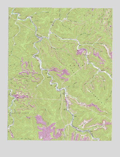
Wharton, WV USGS Topographic Map
Click on map above to begin viewing in our Map Viewer.

This topographic map contains these locations and features:
Feature Name Type Latitude Longitude GNIS ID View Map
Bandy BranchStreamN37.9426°W81.6407°1535198View Map
BandytownPopulated PlaceN37.9407°W81.6398°1553796View Map
Bandytown Post OfficePost OfficeN37.9407°W81.6407°1741708View Map
BarrettPopulated PlaceN37.8873°W81.6701°1553807View Map
Barrett - Wharton Public LibraryBuildingN37.8843°W81.6601°2727192View Map
Barrett Post OfficePost OfficeN37.8862°W81.6671°1741709View Map
Bean HollowValleyN37.9154°W81.7421°1535335View Map
Beaver Pond BranchStreamN37.9229°W81.6884°1535451View Map
BigsonPopulated PlaceN37.9915°W81.7235°1535993View Map
BimPopulated PlaceN37.9218°W81.6893°1560585View Map
Bim Post OfficePost OfficeN37.9220°W81.6871°2774587View Map
Bim Post Office (historical)Post OfficeN37.9226°W81.6862°1741710View Map
Bob WhitePopulated PlaceN37.9543°W81.7185°1536180View Map
Bob White Post OfficePost OfficeN37.9534°W81.7185°1741829View Map
Boone County Ambulance Authority 60BuildingN37.9725°W81.7071°2581192View Map
Browns BranchStreamN37.9662°W81.6651°1536429View Map
Bull CreekStreamN37.9895°W81.7387°1536689View Map
Casey CreekStreamN37.9412°W81.7093°1537084View Map
CazyPopulated PlaceN37.9423°W81.7098°1554088View Map
Christian Faith AcademySchoolN37.9724°W81.7134°2088165View Map
ClintonPopulated PlaceN37.8826°W81.6515°1537418View Map
Cow CreekStreamN37.8901°W81.6734°1537738View Map
District 2CivilN37.9267°W81.7122°1928215View Map
Dry BranchStreamN37.9232°W81.6821°1550956View Map
Duck Brown HollowValleyN37.9698°W81.6687°1538394View Map
Elizabeth ChurchChurchN37.9654°W81.6643°1538608View Map
GordonPopulated PlaceN37.9870°W81.6954°1554583View Map
Gordon Post OfficePost OfficeN37.9896°W81.6905°1741740View Map
Grapevine BranchStreamN37.8851°W81.6668°1539597View Map
Hatfield CemeteryCemeteryN37.8956°W81.6497°2724762View Map
Indian HollowValleyN37.9893°W81.6896°1540694View Map
Jacks BranchStreamN37.9957°W81.7460°1540769View Map
JacksonPopulated PlaceN37.9504°W81.7132°1741751View Map
Jarrell BranchStreamN37.9193°W81.6818°1540824View Map
Jarrells CreekStreamN37.9357°W81.6282°1540828View Map
Jerry ForkStreamN37.9226°W81.7498°1540872View Map
Jigly BranchStreamN37.8765°W81.7418°1540893View Map
KohlsaatPopulated PlaceN37.9418°W81.7046°1554895View Map
Kuhn HollowValleyN37.9545°W81.7196°1541295View Map
LantaPopulated PlaceN37.9923°W81.7368°1554911View Map
Laurel Lick BranchStreamN37.9876°W81.6860°1541481View Map
Left Fork Sycamore ForkStreamN37.9082°W81.7410°1541737View Map
Lick BranchStreamN37.9901°W81.6807°1541849View Map
Lick BranchStreamN37.9907°W81.7246°1541872View Map
MarniePopulated PlaceN37.9554°W81.6565°1555053View Map
MarthatownPopulated PlaceN37.9346°W81.6976°1555058View Map
Middle Ferrell CemeteryCemeteryN37.9493°W81.6529°1543167View Map
Mudlick BranchStreamN37.9398°W81.6429°1543937View Map
Old House BranchStreamN37.8840°W81.6637°1544358View Map
Pond Fork ImpoundmentReservoirN37.9534°W81.6832°1557385View Map
PondcoPopulated PlaceN37.8982°W81.6718°1545135View Map
Right Fork White Oak BranchStreamN37.9323°W81.7487°1545723View Map
Roach BranchStreamN37.9704°W81.7018°1545787View Map
Rockhouse Branch Refuse Bank DamDamN37.8851°W81.6915°1557387View Map
Skin Poplar BranchStreamN37.8873°W81.7487°1546867View Map
Skin Poplar Branch ImpoundmentReservoirN37.8751°W81.7415°1557391View Map
Skin Poplar Branch Refuse Dump DamDamN37.8751°W81.7415°1557390View Map
StarkPopulated PlaceN37.9120°W81.7440°1549938View Map
Stark CemeteryCemeteryN37.9112°W81.7429°1985163View Map
Still HollowValleyN37.9307°W81.6512°1547415View Map
Sycamore ForkStreamN37.9115°W81.7448°1547834View Map
Thom Cline Memorial BridgeBridgeN37.9721°W81.7113°2635297View Map
Trace ForkStreamN37.9012°W81.6259°1549523View Map
VanPopulated PlaceN37.9712°W81.7110°1555875View Map
Van Census Designated PlaceCensusN37.9712°W81.7138°2586894View Map
Van Elementary SchoolSchoolN37.9719°W81.7138°1741818View Map
Van Junior - Senior High SchoolSchoolN37.9704°W81.7127°1741819View Map
Van Post OfficePost OfficeN37.9681°W81.7145°1741820View Map
Van United Methodist ChurchChurchN37.9718°W81.7051°1741821View Map
Van Volunteer Fire DepartmentBuildingN37.9702°W81.7100°2578007View Map
West Fork Pond ForkStreamN37.9720°W81.7110°1548930View Map
West JunctionPopulated PlaceN37.9743°W81.7165°1555946View Map
WhartonPopulated PlaceN37.9034°W81.6773°1548979View Map
Wharton - Barrett Volunteer Fire DepartmentBuildingN37.9000°W81.6728°2577588View Map
Wharton ChurchChurchN37.9190°W81.6815°1548980View Map
Wharton Elementary SchoolSchoolN37.8945°W81.6719°1741823View Map
Wharton Junior High School (historical)SchoolN37.8868°W81.6676°1548981View Map
Wharton Number Two Mine Slurry PondReservoirN37.8851°W81.6915°1557388View Map
Wharton Post OfficePost OfficeN37.8973°W81.6713°1741824View Map
Whites BranchStreamN37.9765°W81.6998°1549091View Map
Workman BranchStreamN37.8846°W81.6521°1549403View Map

Note: Coordinates in the location and feature list above are referenced to NAD83 datum.


Copyright (C) 2008-2024 Ryan Niemi / Sunset Dynamics ... All Rights Reserved