TopoQuest Logo
Do you find TopoQuest useful?
Help keep TopoQuest running and adding new maps/features by donating!
Bitcoin:  19c7KJd3qBynnjoSw5npx9KScwjBe4ifkT
Litecoin:  LXs6TkuXGGXo1vDsWCkWVdjQX94eUKd6ui
Home View Maps Find Maps Find Places Resources & Links


Lorado, West Virginia Topographic Map

USGS Map Title: Lorado, WV
USGS Map MRC: 37081G6
DRG (GeoTIFF) Download: o37081g6.tif


Neighboring USGS Topographic Map Quads:


  Clothier, WV  
37081H7
 

  Wharton, WV  
37081H6
 

  Whitesville, WV  
37081H5
 

  Amherstdale, WV  
37081G7
 

  Lorado, WV  
37081G6
 

  Pilot Knob, WV  
37081G5
 

  Mallory, WV  
37081F7
 

  Oceana, WV  
37081F6
 

  Matheny, WV  
37081F5


Map MRC Location:

N38°
W82°
N38°
W81°
H8 H7 H6 H5 H4 H3 H2 H1
G8 G7 G6 G5 G4 G3 G2 G1
F8 F7 F6 F5 F4 F3 F2 F1
E8 E7 E6 E5 E4 E3 E2 E1
D8 D7 D6 D5 D4 D3 D2 D1
C8 C7 C6 C5 C4 C3 C2 C1
B8 B7 B6 B5 B4 B3 B2 B1
A8 A7 A6 A5 A4 A3 A2 A1
N37°
W82°
N37°
W81°

Lorado, WV USGS 1:24K Topographic Map Preview:
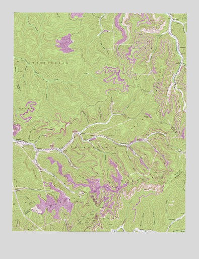
Lorado, WV USGS Topographic Map
Click on map above to begin viewing in our Map Viewer.

This topographic map contains these locations and features:
Feature Name Type Latitude Longitude GNIS ID View Map
Bald KnobPopulated PlaceN37.8709°W81.6357°1535163View Map
Bald Knob Post OfficePost OfficeN37.8723°W81.6357°1741707View Map
Beartree BranchStreamN37.7515°W81.6576°1535423View Map
Big Abe ForkStreamN37.8629°W81.6887°1535767View Map
Bright Prospect ChurchChurchN37.7571°W81.6323°1536350View Map
Brown-Browning CemeteryCemeteryN37.7513°W81.6491°2586327View Map
Buffalo MountainSummitN37.7698°W81.6971°1536647View Map
Camp BranchStreamN37.8171°W81.6784°1536894View Map
Castle BranchStreamN37.7501°W81.6484°1537090View Map
Coal BranchStreamN37.7557°W81.6346°1537437View Map
CranecoPopulated PlaceN37.7968°W81.7321°1554216View Map
Curtis ChurchChurchN37.7962°W81.6290°1537939View Map
Davy BranchStreamN37.7971°W81.7157°1538062View Map
Dennison ForkStreamN37.8365°W81.7254°1538131View Map
Dingess BranchStreamN37.7971°W81.7323°1538196View Map
Elklick BranchStreamN37.8023°W81.6968°1538658View Map
Elsie HollowValleyN37.7996°W81.7346°1538697View Map
GreenwoodPopulated PlaceN37.8554°W81.6307°1554611View Map
James BranchStreamN37.8704°W81.6368°1540808View Map
Jasper Workman BranchStreamN37.8651°W81.6368°1540836View Map
Jordan ForkStreamN37.7729°W81.7484°1541022View Map
Laurel BranchStreamN37.8123°W81.6882°1541371View Map
Lee ForkStreamN37.7998°W81.6671°1541606View Map
LoradoPopulated PlaceN37.7957°W81.7148°1542456View Map
Lorado Census Designated PlaceCensusN37.7937°W81.7233°2586849View Map
Lorado Post OfficePost OfficeN37.7963°W81.7299°1742565View Map
LundalePopulated PlaceN37.8012°W81.7443°1555010View Map
Meredith BranchStreamN37.8104°W81.6943°1543124View Map
Middle Fork Buffalo CreekStreamN37.7987°W81.6671°1543175View Map
New Zion ChurchChurchN37.7979°W81.6673°1544142View Map
North Fork Buffalo CreekStreamN37.8032°W81.6534°1544203View Map
PardeePopulated PlaceN37.8059°W81.7015°1555305View Map
Road Branch Elementary and Middle SchoolSchoolN37.7538°W81.6701°1545796View Map
Road ForkStreamN37.8173°W81.6709°1545802View Map
RocklickPopulated PlaceN37.8462°W81.6287°1549901View Map
Rocklick BranchStreamN37.8468°W81.6290°1545990View Map
SaundersPopulated PlaceN37.7998°W81.6723°1555576View Map
Slickrock BranchStreamN37.7509°W81.6546°1549522View Map
Spring MountainSummitN37.8209°W81.6473°1547203View Map
Spring Mountain Lookout TowerTowerN37.8307°W81.6504°1559881View Map
Sycamore CreekStreamN37.7529°W81.6715°1547824View Map
Toney ForkStreamN37.8059°W81.7029°1548156View Map
Trace ForkStreamN37.8721°W81.6879°1548210View Map
Upper Lick BranchStreamN37.8459°W81.7390°1548534View Map
Upper Road BranchStreamN37.8004°W81.7382°1548546View Map

Note: Coordinates in the location and feature list above are referenced to NAD83 datum.


Copyright (C) 2008-2024 Ryan Niemi / Sunset Dynamics ... All Rights Reserved