TopoQuest Logo
Do you find TopoQuest useful?
Help keep TopoQuest running and adding new maps/features by donating!
Bitcoin:  19c7KJd3qBynnjoSw5npx9KScwjBe4ifkT
Litecoin:  LXs6TkuXGGXo1vDsWCkWVdjQX94eUKd6ui
Home View Maps Find Maps Find Places Resources & Links


Westpoint, Indiana Topographic Map

USGS Map Title: Westpoint, IN
USGS Map MRC: 40087C1
DRG (GeoTIFF) Download: o40087c1.tif


Neighboring USGS Topographic Map Quads:


  Chatterton, IN  
40087D2
 

  Otterbein, IN  
40087D1
 

  Lafayette West, IN  
40086D8
 

  Attica, IN  
40087C2
 

  Westpoint, IN  
40087C1
 

  Romney, IN  
40086C8
 

  Mellott, IN  
40087B2
 

  Wingate, IN  
40087B1
 

  Linden, IN  
40086B8


Map MRC Location:

N41°
W88°
N41°
W87°
H8 H7 H6 H5 H4 H3 H2 H1
G8 G7 G6 G5 G4 G3 G2 G1
F8 F7 F6 F5 F4 F3 F2 F1
E8 E7 E6 E5 E4 E3 E2 E1
D8 D7 D6 D5 D4 D3 D2 D1
C8 C7 C6 C5 C4 C3 C2 C1
B8 B7 B6 B5 B4 B3 B2 B1
A8 A7 A6 A5 A4 A3 A2 A1
N40°
W88°
N40°
W87°

Westpoint, IN USGS 1:24K Topographic Map Preview:
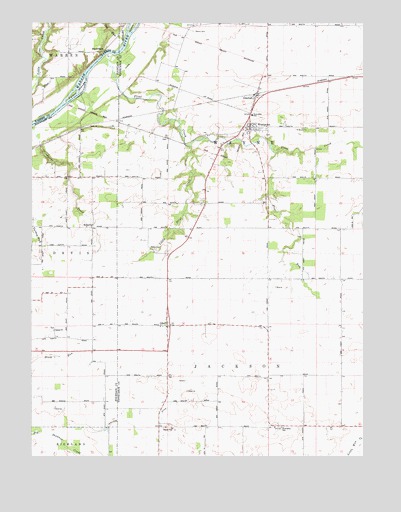
Westpoint, IN USGS Topographic Map
Click on map above to begin viewing in our Map Viewer.

This topographic map contains these locations and features:
Feature Name Type Latitude Longitude GNIS ID View Map
Bee RunStreamN40.3698°W87.0908°430708View Map
Black RockPopulated PlaceN40.3678°W87.0970°431141View Map
Flint CreekStreamN40.3661°W87.0967°434600View Map
Flint RunStreamN40.3375°W87.0333°434605View Map
Fulton IslandsIslandN40.3556°W87.1083°434898View Map
GlenhallPopulated PlaceN40.3542°W87.0408°435116View Map
Little Flint CreekStreamN40.3398°W87.0653°438059View Map
Little Wea CreekStreamN40.2528°W87.0033°438172View Map
Marks CemeteryCemeteryN40.3100°W87.0792°438632View Map
North Brothers Airport (historical)AirportN40.2759°W87.1070°449097View Map
OdellPopulated PlaceN40.2878°W87.0742°440511View Map
RobertsPopulated PlaceN40.3161°W87.1022°442149View Map
Salem ChurchChurchN40.2867°W87.1167°442920View Map
Sherry CemeteryCemeteryN40.3724°W87.0638°443369View Map
Township of JacksonCivilN40.2580°W87.0270°453471View Map
Township of WayneCivilN40.3531°W87.0433°454041View Map
Wallace DitchCanalN40.2578°W87.0836°445391View Map
West Point Census Designated PlaceCensusN40.3412°W87.0432°2583475View Map
West Point Volunteer Fire DepartmentBuildingN40.3452°W87.0446°2626436View Map
WestpointPopulated PlaceN40.3450°W87.0431°445856View Map

Note: Coordinates in the location and feature list above are referenced to NAD83 datum.


Copyright (C) 2008-2024 Ryan Niemi / Sunset Dynamics ... All Rights Reserved