TopoQuest Logo
Do you find TopoQuest useful?
Help keep TopoQuest running and adding new maps/features by donating!
Bitcoin:  19c7KJd3qBynnjoSw5npx9KScwjBe4ifkT
Litecoin:  LXs6TkuXGGXo1vDsWCkWVdjQX94eUKd6ui
Home View Maps Find Maps Find Places Resources & Links


Mellott, Indiana Topographic Map

USGS Map Title: Mellott, IN
USGS Map MRC: 40087B2
DRG (GeoTIFF) Download: o40087b2.tif


Neighboring USGS Topographic Map Quads:


  Williamsport, IN  
40087C3
 

  Attica, IN  
40087C2
 

  Westpoint, IN  
40087C1
 

  Stone Bluff, IN  
40087B3
 

  Mellott, IN  
40087B2
 

  Wingate, IN  
40087B1
 

  Veedersburg, IN  
40087A3
 

  Hillsboro, IN  
40087A2
 

  Waynetown, IN  
40087A1


Map MRC Location:

N41°
W88°
N41°
W87°
H8 H7 H6 H5 H4 H3 H2 H1
G8 G7 G6 G5 G4 G3 G2 G1
F8 F7 F6 F5 F4 F3 F2 F1
E8 E7 E6 E5 E4 E3 E2 E1
D8 D7 D6 D5 D4 D3 D2 D1
C8 C7 C6 C5 C4 C3 C2 C1
B8 B7 B6 B5 B4 B3 B2 B1
A8 A7 A6 A5 A4 A3 A2 A1
N40°
W88°
N40°
W87°

Mellott, IN USGS 1:24K Topographic Map Preview:
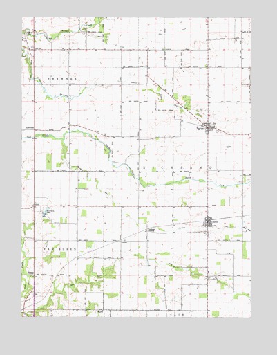
Mellott, IN USGS Topographic Map
Click on map above to begin viewing in our Map Viewer.

This topographic map contains these locations and features:
Feature Name Type Latitude Longitude GNIS ID View Map
AylesworthPopulated PlaceN40.2031°W87.2431°430367View Map
Beulah CemeteryCemeteryN40.2446°W87.2157°430994View Map
Campbell ChapelChurchN40.1278°W87.2050°432081View Map
Campbell FieldAirportN40.1276°W87.2108°2770221View Map
Cold Spring CemeteryCemeteryN40.1349°W87.2440°432751View Map
GrahamPopulated PlaceN40.1570°W87.1950°435277View Map
Harrison LakePopulated PlaceN40.1670°W87.2378°435794View Map
Hodson CemeteryCemeteryN40.1958°W87.1387°436270View Map
Hunter CornerPopulated PlaceN40.1714°W87.2431°436619View Map
Kell DitchCanalN40.2409°W87.1836°437202View Map
MellottPopulated PlaceN40.1653°W87.1478°438973View Map
Mellott Volunteer Fire DepartmentBuildingN40.1647°W87.1477°2701363View Map
Mud RunStreamN40.1634°W87.1297°439849View Map
NewtownPopulated PlaceN40.2042°W87.1478°440152View Map
Newtown CemeteryCemeteryN40.2111°W87.1541°440153View Map
North Fork Coal CreekStreamN40.1992°W87.2264°440249View Map
Old Baptist CemeteryCemeteryN40.2225°W87.1865°440529View Map
Rob RoyPopulated PlaceN40.2367°W87.2433°449720View Map
Simpson CornerPopulated PlaceN40.1425°W87.2431°443535View Map
Stephens CrossingPopulated PlaceN40.1609°W87.1808°444129View Map
Town of MellottCivilN40.1640°W87.1488°2396749View Map
Town of NewtownCivilN40.2044°W87.1482°2396815View Map
Township of RichlandCivilN40.1910°W87.1468°453791View Map
Turkey RunStreamN40.1992°W87.2270°444981View Map
Union ChurchChurchN40.2003°W87.2042°445110View Map

Note: Coordinates in the location and feature list above are referenced to NAD83 datum.


Copyright (C) 2008-2024 Ryan Niemi / Sunset Dynamics ... All Rights Reserved