TopoQuest Logo
Do you find TopoQuest useful?
Help keep TopoQuest running and adding new maps/features by donating!
Bitcoin:  19c7KJd3qBynnjoSw5npx9KScwjBe4ifkT
Litecoin:  LXs6TkuXGGXo1vDsWCkWVdjQX94eUKd6ui
Home View Maps Find Maps Find Places Resources & Links


West Eaton, New York Topographic Map

USGS Map Title: West Eaton, NY
USGS Map MRC: 42075G6
DRG (GeoTIFF) Download: o42075g6.tif


Neighboring USGS Topographic Map Quads:


  Cazenovia, NY  
42075H7
 

  Morrisville, NY  
42075H6
 

  Munnsville, NY  
42075H5
 

  Erieville, NY  
42075G7
 

  West Eaton, NY  
42075G6
 

  Hamilton, NY  
42075G5
 

  South Otselic, NY  
42075F7
 

  Otselic, NY  
42075F6
 

  Earlville, NY  
42075F5


Map MRC Location:

N43°
W76°
N43°
W75°
H8 H7 H6 H5 H4 H3 H2 H1
G8 G7 G6 G5 G4 G3 G2 G1
F8 F7 F6 F5 F4 F3 F2 F1
E8 E7 E6 E5 E4 E3 E2 E1
D8 D7 D6 D5 D4 D3 D2 D1
C8 C7 C6 C5 C4 C3 C2 C1
B8 B7 B6 B5 B4 B3 B2 B1
A8 A7 A6 A5 A4 A3 A2 A1
N42°
W76°
N42°
W75°

West Eaton, NY USGS 1:24K Topographic Map Preview:
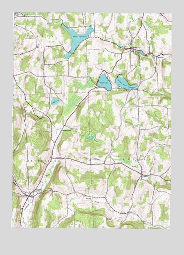
West Eaton, NY USGS Topographic Map
Click on map above to begin viewing in our Map Viewer.

This topographic map contains these locations and features:
Feature Name Type Latitude Longitude GNIS ID View Map
Bradley Brook ReservoirReservoirN42.8340°W75.6622°944577View Map
Dunhams PinnacleSummitN42.7562°W75.6769°948796View Map
Eaton ReservoirReservoirN42.8608°W75.6992°949321View Map
Fisk MarshSwampN42.8028°W75.6874°950181View Map
GeorgetownPopulated PlaceN42.7684°W75.7366°951019View Map
Georgetown StationLocaleN42.8062°W75.7116°951020View Map
Hatch LakeLakeN42.8346°W75.6778°952363View Map
Hawks CemeteryCemeteryN42.7909°W75.7118°952394View Map
Hillside CemeteryCemeteryN42.7705°W75.7293°952846View Map
Jackass HillSummitN42.8603°W75.7374°953869View Map
Jackass Hills FarmsLocaleN42.8553°W75.7311°2547248View Map
LebanonPopulated PlaceN42.7815°W75.6477°955147View Map
Lebanon Federated ChurchChurchN42.7809°W75.6474°2597863View Map
Lebanon Valley CemeteryCemeteryN42.7836°W75.6482°2542873View Map
Niles CemeteryCemeteryN42.7672°W75.6876°958589View Map
Otselic CreekStreamN42.7645°W75.7355°959554View Map
Otselic Valley Elementary SchoolSchoolN42.7684°W75.7386°2597831View Map
PiercevillePopulated PlaceN42.8501°W75.6368°960361View Map
School Number 1 (historical)SchoolN42.7592°W75.6613°974904View Map
South LebanonPopulated PlaceN42.7592°W75.6580°965804View Map
Texas HillSummitN42.7512°W75.7013°967183View Map
Torpy PondLakeN42.8232°W75.7168°967676View Map
Town of GeorgetownCivilN42.7791°W75.7472°978995View Map
West EatonPopulated PlaceN42.8545°W75.6560°969209View Map
West Eaton CemeteryCemeteryN42.8575°W75.6592°2542874View Map
West Eaton Post OfficePost OfficeN42.8541°W75.6556°2598892View Map
West Eaton Volunteer Ambulance CorpsBuildingN42.8561°W75.6565°2720089View Map

Note: Coordinates in the location and feature list above are referenced to NAD83 datum.


Copyright (C) 2008-2024 Ryan Niemi / Sunset Dynamics ... All Rights Reserved