TopoQuest Logo
Do you find TopoQuest useful?
Help keep TopoQuest running and adding new maps/features by donating!
Bitcoin:  19c7KJd3qBynnjoSw5npx9KScwjBe4ifkT
Litecoin:  LXs6TkuXGGXo1vDsWCkWVdjQX94eUKd6ui
Home View Maps Find Maps Find Places Resources & Links


Weldon East, Illinois Topographic Map

USGS Map Title: Weldon East, IL
USGS Map MRC: 40088A6
DRG (GeoTIFF) Download: o40088a6.tif


Neighboring USGS Topographic Map Quads:


  De Witt, IL  
40088B7
 

  Farmer City South, IL  
40088B6
 

  Mansfield, IL  
40088B5
 

  Weldon West, IL  
40088A7
 

  Weldon East, IL  
40088A6
 

  Monticello, IL  
40088A5
 

  Argenta, IL  
39088H7
 

  Cerro Gordo, IL  
39088H6
 

  Bement, IL  
39088H5


Map MRC Location:

N41°
W89°
N41°
W88°
H8 H7 H6 H5 H4 H3 H2 H1
G8 G7 G6 G5 G4 G3 G2 G1
F8 F7 F6 F5 F4 F3 F2 F1
E8 E7 E6 E5 E4 E3 E2 E1
D8 D7 D6 D5 D4 D3 D2 D1
C8 C7 C6 C5 C4 C3 C2 C1
B8 B7 B6 B5 B4 B3 B2 B1
A8 A7 A6 A5 A4 A3 A2 A1
N40°
W89°
N40°
W88°

Weldon East, IL USGS 1:24K Topographic Map Preview:
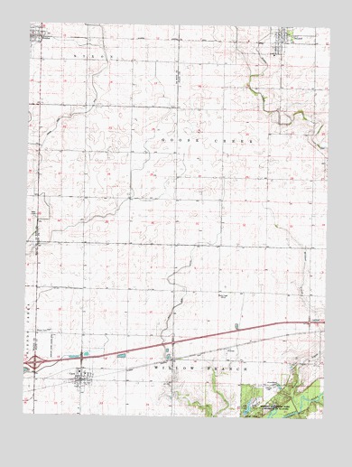
Weldon East, IL USGS Topographic Map
Click on map above to begin viewing in our Map Viewer.

This topographic map contains these locations and features:
Feature Name Type Latitude Longitude GNIS ID View Map
Allerton State ParkParkN40.0036°W88.6462°416751View Map
AmeniaPopulated PlaceN40.0220°W88.6665°422406View Map
Arrowhead LakeReservoirN40.0102°W88.6435°403639View Map
Ashland School (historical)SchoolN40.1003°W88.6684°1720032View Map
CiscoPopulated PlaceN40.0114°W88.7262°406127View Map
Cisco Fire Protection DistrictBuildingN40.0140°W88.7265°2682325View Map
Cisco Post OfficePost OfficeN40.0108°W88.7257°2788518View Map
De LandPopulated PlaceN40.1223°W88.6453°407015View Map
De Land Community Fire Protection DistrictBuildingN40.1217°W88.6454°2682324View Map
De Land Post OfficePost OfficeN40.1220°W88.6450°2788259View Map
East Cisco School (historical)SchoolN40.0111°W88.6884°1720026View Map
Enterprise School (historical)SchoolN40.0689°W88.7073°1720024View Map
Excelsior School (historical)SchoolN40.0398°W88.6690°1720037View Map
Flying Illini AirportAirportN40.1114°W88.6841°2770521View Map
Four H Memorial Lake DamDamN40.0014°W88.6576°1691091View Map
Four-H LakeReservoirN40.0030°W88.6566°408591View Map
Friends Creek DitchCanalN40.1045°W88.7231°408761View Map
Interchange 53CrossingN40.0164°W88.7454°1822183View Map
Kentuck CemeteryCemeteryN40.0595°W88.6783°1822189View Map
Kentucky Church (historical)ChurchN40.0642°W88.6690°1720035View Map
Kentucky School (historical)SchoolN40.0714°W88.6684°1720034View Map
Lincoln School (historical)SchoolN40.0992°W88.7448°1720019View Map
Morain School (historical)SchoolN40.0686°W88.6306°1720029View Map
New Union School (historical)SchoolN40.0406°W88.7076°1720025View Map
Norfleet Farms Airport (historical)AirportN40.0209°W88.7390°427168View Map
Pleasant Falls School (historical)SchoolN40.0984°W88.6306°1720031View Map
Pleasant Ridge School (historical)SchoolN40.0409°W88.7456°1720017View Map
Prairie View School (historical)SchoolN40.0989°W88.7076°1720020View Map
Prospect School (historical)SchoolN40.0692°W88.7448°1720022View Map
Township of Goose CreekCivilN40.1058°W88.6440°429061View Map
Village of CiscoCivilN40.0147°W88.7237°2397625View Map
Village of De LandCivilN40.1218°W88.6432°2398693View Map
Village of WeldonCivilN40.1215°W88.7497°2400120View Map
WeldonPopulated PlaceN40.1211°W88.7453°420724View Map
Wildcat CreekStreamN40.0217°W88.6251°421149View Map
Wildcat School (historical)SchoolN40.0175°W88.6262°1720028View Map
WILL-FM (Urbana)TowerN40.0384°W88.6695°428548View Map
WILL-TV (Urbana)TowerN40.0384°W88.6695°428563View Map

Note: Coordinates in the location and feature list above are referenced to NAD83 datum.


Copyright (C) 2008-2024 Ryan Niemi / Sunset Dynamics ... All Rights Reserved