TopoQuest Logo
Do you find TopoQuest useful?
Help keep TopoQuest running and adding new maps/features by donating!
Bitcoin:  19c7KJd3qBynnjoSw5npx9KScwjBe4ifkT
Litecoin:  LXs6TkuXGGXo1vDsWCkWVdjQX94eUKd6ui
Home View Maps Find Maps Find Places Resources & Links


Bement, Illinois Topographic Map

USGS Map Title: Bement, IL
USGS Map MRC: 39088H5
DRG (GeoTIFF) Download: o39088h5.tif


Neighboring USGS Topographic Map Quads:


  Weldon East, IL  
40088A6
 

  Monticello, IL  
40088A5
 

  Seymour, IL  
40088A4
 

  Cerro Gordo, IL  
39088H6
 

  Bement, IL  
39088H5
 

  Ivesdale, IL  
39088H4
 

  La Place, IL  
39088G6
 

  Hammond, IL  
39088G5
 

  Atwood, IL  
39088G4


Map MRC Location:

N40°
W89°
N40°
W88°
H8 H7 H6 H5 H4 H3 H2 H1
G8 G7 G6 G5 G4 G3 G2 G1
F8 F7 F6 F5 F4 F3 F2 F1
E8 E7 E6 E5 E4 E3 E2 E1
D8 D7 D6 D5 D4 D3 D2 D1
C8 C7 C6 C5 C4 C3 C2 C1
B8 B7 B6 B5 B4 B3 B2 B1
A8 A7 A6 A5 A4 A3 A2 A1
N39°
W89°
N39°
W88°

Bement, IL USGS 1:24K Topographic Map Preview:
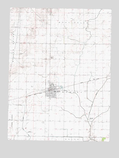
Bement, IL USGS Topographic Map
Click on map above to begin viewing in our Map Viewer.

This topographic map contains these locations and features:
Feature Name Type Latitude Longitude GNIS ID View Map
Bartram Landing Strip (historical)AirportN39.8828°W88.5962°1822162View Map
BementPopulated PlaceN39.9220°W88.5720°404159View Map
Bement Baptist ChurchChurchN39.9134°W88.5698°1822163View Map
Bement CemeteryCemeteryN39.9536°W88.5720°404160View Map
Bement County Forest PreserveParkN39.9267°W88.5612°2013442View Map
Bement Elementary SchoolSchoolN39.9214°W88.5692°1962172View Map
Bement Fire Protection District Station 1BuildingN39.9195°W88.5752°2681798View Map
Bement Fire Protection District Station 2BuildingN39.9300°W88.5743°2682269View Map
Bement High SchoolSchoolN39.9214°W88.5690°1822164View Map
Bement Police DepartmentBuildingN39.9221°W88.5735°2758852View Map
Bement Post OfficePost OfficeN39.9228°W88.5704°1962173View Map
Bement United Methodist ChurchChurchN39.9242°W88.5712°1822165View Map
BodmannPopulated PlaceN39.8828°W88.5792°422484View Map
Church of God (historical)ChurchN39.9195°W88.5740°1962174View Map
First Christian ChurchChurchN39.9217°W88.5706°1822178View Map
First Presbyterian ChurchChurchN39.9234°W88.5731°1822179View Map
PiattPopulated PlaceN39.9331°W88.5203°1822198View Map
Saint Michaels Roman Catholic ChurchChurchN39.9198°W88.5709°1962175View Map
Township of BementCivilN39.9228°W88.5374°428657View Map
Triple Creek AirportAirportN39.8941°W88.5254°427061View Map
Village of BementCivilN39.9229°W88.5719°2398092View Map

Note: Coordinates in the location and feature list above are referenced to NAD83 datum.


Copyright (C) 2008-2024 Ryan Niemi / Sunset Dynamics ... All Rights Reserved