TopoQuest Logo
Do you find TopoQuest useful?
Help keep TopoQuest running and adding new maps/features by donating!
Bitcoin:  19c7KJd3qBynnjoSw5npx9KScwjBe4ifkT
Litecoin:  LXs6TkuXGGXo1vDsWCkWVdjQX94eUKd6ui
Home View Maps Find Maps Find Places Resources & Links


Wayland, New York Topographic Map

USGS Map Title: Wayland, NY
USGS Map MRC: 42077E5
DRG (GeoTIFF) Download: o42077e5.tif


Neighboring USGS Topographic Map Quads:


  Conesus, NY  
42077F6
 

  Springwater, NY  
42077F5
 

  Bristol Springs, NY  
42077F4
 

  Dansville, NY  
42077E6
 

  Wayland, NY  
42077E5
 

  Naples, NY  
42077E4
 

  Arkport, NY  
42077D6
 

  Haskinville, NY  
42077D5
 

  Avoca, NY  
42077D4


Map MRC Location:

N43°
W78°
N43°
W77°
H8 H7 H6 H5 H4 H3 H2 H1
G8 G7 G6 G5 G4 G3 G2 G1
F8 F7 F6 F5 F4 F3 F2 F1
E8 E7 E6 E5 E4 E3 E2 E1
D8 D7 D6 D5 D4 D3 D2 D1
C8 C7 C6 C5 C4 C3 C2 C1
B8 B7 B6 B5 B4 B3 B2 B1
A8 A7 A6 A5 A4 A3 A2 A1
N42°
W78°
N42°
W77°

Wayland, NY USGS 1:24K Topographic Map Preview:
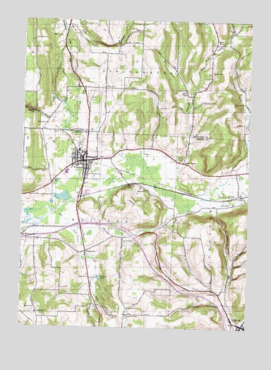
Wayland, NY USGS Topographic Map
Click on map above to begin viewing in our Map Viewer.

This topographic map contains these locations and features:
Feature Name Type Latitude Longitude GNIS ID View Map
Ashley CemeteryCemeteryN42.5929°W77.5875°942637View Map
Blackcrick HollowGapN42.5390°W77.5125°944197View Map
Bowles CornersLocaleN42.5673°W77.5361°944520View Map
Clover HillSummitN42.5745°W77.6219°946932View Map
CohoctonPopulated PlaceN42.5023°W77.5072°947007View Map
Cohocton Assembly of GodChurchN42.5079°W77.5104°2598009View Map
Davis HollowValleyN42.5258°W77.5094°948064View Map
Daybrook PondReservoirN42.5203°W77.5816°948087View Map
East Wayland CemeteryCemeteryN42.5351°W77.5689°949270View Map
Hemmer HillSummitN42.5459°W77.5567°952572View Map
Hinkle HollowValleyN42.5098°W77.5142°952880View Map
Holy Family Catholic CommunityChurchN42.5689°W77.5959°2598034View Map
Lighthouse Wesleyan ChurchChurchN42.5691°W77.5912°2597942View Map
Moon HollowValleyN42.5187°W77.5839°957583View Map
North Loon Lake CemeteryCemeteryN42.5051°W77.5664°2547883View Map
North Loon Lake ChurchChurchN42.5051°W77.5667°958845View Map
Pardee HollowValleyN42.5651°W77.5092°959856View Map
PatchinvillePopulated PlaceN42.5309°W77.5889°959976View Map
Pfaff HollowValleyN42.5351°W77.6219°970472View Map
Pleasant Valley East CemeteryCemeteryN42.6037°W77.5221°949249View Map
Punky HollowValleyN42.5651°W77.5380°970505View Map
Saint Josephs CemeteryCemeteryN42.5591°W77.6078°963724View Map
Saint Paul's Lutheran ChurchChurchN42.5022°W77.5052°2597956View Map
Saint Paul's United Church of ChristChurchN42.5660°W77.5901°2597957View Map
Sand HillSummitN42.5067°W77.6178°964372View Map
School Number 1 (historical)SchoolN42.5506°W77.5080°974878View Map
School Number 1 (historical)SchoolN42.5978°W77.5803°974884View Map
School Number 10 (historical)SchoolN42.5059°W77.6158°974936View Map
School Number 11 (historical)SchoolN42.5828°W77.6117°974975View Map
School Number 12 (historical)SchoolN42.5920°W77.5030°975020View Map
School Number 14 (historical)SchoolN42.5690°W77.5403°975081View Map
School Number 15 (historical)SchoolN42.6187°W77.6030°975103View Map
School Number 17 (historical)SchoolN42.6156°W77.5150°975135View Map
School Number 18 (historical)SchoolN42.6170°W77.6197°975144View Map
School Number 2 (historical)SchoolN42.5203°W77.5872°975164View Map
School Number 20 (historical)SchoolN42.5967°W77.5358°975215View Map
School Number 6 (historical)SchoolN42.5375°W77.5539°2370251View Map
School Number 8 (historical)SchoolN42.5078°W77.5653°975582View Map
School Number 8 (historical)SchoolN42.5142°W77.5161°975583View Map
School Number 9 (historical)SchoolN42.5562°W77.5567°975628View Map
Seventh Day Adventist ChurchChurchN42.5713°W77.5977°2597960View Map
Showboat Mobile Home ParkPopulated PlaceN42.5636°W77.6040°2599114View Map
Town of WaylandCivilN42.5287°W77.5913°979611View Map
Victory ParkParkN42.5737°W77.5930°968536View Map
Village of WaylandCivilN42.5660°W77.5926°2391202View Map
WaylandPopulated PlaceN42.5678°W77.5897°968949View Map
Wayland - Cohocton High SchoolSchoolN42.5628°W77.6009°2597632View Map
Wayland - Cohocton Middle SchoolSchoolN42.5637°W77.5997°2597633View Map
Wayland Elementary SchoolSchoolN42.5630°W77.5987°2597628View Map
Wayland Fire DepartmentBuildingN42.5680°W77.5904°2701084View Map
Wayland Free LibraryBuildingN42.5671°W77.5932°2599152View Map
Wayland Post OfficePost OfficeN42.5676°W77.5900°2599098View Map
Wayland Village CemeteryCemeteryN42.5722°W77.5907°2547884View Map
Wayland Village Wastewater Treatment PlantLocaleN42.5611°W77.5928°2597163View Map

Note: Coordinates in the location and feature list above are referenced to NAD83 datum.


Copyright (C) 2008-2024 Ryan Niemi / Sunset Dynamics ... All Rights Reserved