TopoQuest Logo
Do you find TopoQuest useful?
Help keep TopoQuest running and adding new maps/features by donating!
Bitcoin:  19c7KJd3qBynnjoSw5npx9KScwjBe4ifkT
Litecoin:  LXs6TkuXGGXo1vDsWCkWVdjQX94eUKd6ui
Home View Maps Find Maps Find Places Resources & Links


Wautubbee, Mississippi Topographic Map

USGS Map Title: Wautubbee, MS
USGS Map MRC: 32088A7
DRG (GeoTIFF) Download: o32088a7.tif


Neighboring USGS Topographic Map Quads:


  Rose Hill, MS  
32088B8
 

  Stonewall, MS  
32088B7
 

  Sable, MS  
32088B6
 

  Pachuta, MS  
32088A8
 

  Wautubbee, MS  
32088A7
 

  Quitman, MS  
32088A6
 

  Heidelberg, MS  
31088H8
 

  Hale, MS  
31088H7
 

  De Soto, MS  
31088H6


Map MRC Location:

N33°
W89°
N33°
W88°
H8 H7 H6 H5 H4 H3 H2 H1
G8 G7 G6 G5 G4 G3 G2 G1
F8 F7 F6 F5 F4 F3 F2 F1
E8 E7 E6 E5 E4 E3 E2 E1
D8 D7 D6 D5 D4 D3 D2 D1
C8 C7 C6 C5 C4 C3 C2 C1
B8 B7 B6 B5 B4 B3 B2 B1
A8 A7 A6 A5 A4 A3 A2 A1
N32°
W89°
N32°
W88°

Wautubbee, MS USGS 1:24K Topographic Map Preview:
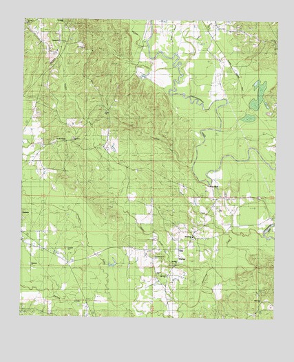
Wautubbee, MS USGS Topographic Map
Click on map above to begin viewing in our Map Viewer.

This topographic map contains these locations and features:
Feature Name Type Latitude Longitude GNIS ID View Map
Adams ChapelChurchN32.0290°W88.7970°666153View Map
Alligator BranchStreamN32.0926°W88.7709°687489View Map
Bethel ChurchChurchN32.0863°W88.8342°690785View Map
Bethlehem Baptist ChurchChurchN32.1138°W88.8467°666996View Map
Bethlehem School (historical)SchoolN32.1129°W88.8456°709414View Map
Bostic BranchStreamN32.1029°W88.7970°667455View Map
Choctaw (historical)Populated PlaceN32.1043°W88.8070°709416View Map
ElwoodPopulated PlaceN32.0182°W88.8017°669757View Map
Elwood CemeteryCemeteryN32.0182°W88.8070°690792View Map
Fleming School (historical)SchoolN32.0507°W88.7870°709429View Map
Friendship ChurchChurchN32.1240°W88.8570°670226View Map
Gordon CreekStreamN32.0221°W88.7806°670537View Map
Green BranchStreamN32.0918°W88.7745°687518View Map
Hebron ChurchChurchN32.0321°W88.8742°687524View Map
Johns BranchStreamN32.1107°W88.7939°671907View Map
Kidd Lake DamDamN32.1185°W88.8650°681015View Map
King BluffCliffN32.0554°W88.7820°690797View Map
King CemeteryCemeteryN32.0465°W88.7775°690798View Map
Little Zion ChurchChurchN32.1168°W88.7506°690800View Map
McCants CreekStreamN32.1101°W88.8145°673293View Map
McCloud BridgeBridgeN32.0013°W88.8012°687536View Map
Mount Nebo Church (historical)ChurchN32.0363°W88.8659°687541View Map
Oak Grove ChurchChurchN32.0179°W88.8031°690803View Map
Oaky CreekStreamN32.0638°W88.7917°675135View Map
Old Pleasant Hill CemeteryCemeteryN32.0254°W88.8092°690804View Map
Old Souenlovie CemeteryCemeteryN32.0732°W88.8537°690805View Map
Pachuta CemeteryCemeteryN32.0413°W88.8739°709456View Map
Pachuta CreekStreamN32.0113°W88.8337°675372View Map
Pachuta Oil FieldOilfieldN32.0043°W88.8439°709457View Map
Pine Hill CemeteryCemeteryN32.1238°W88.8745°709458View Map
Pine Hill School (historical)SchoolN32.1235°W88.8734°709459View Map
Pleasant Hill Baptist ChurchChurchN32.0349°W88.7900°676063View Map
Pleasant Hill CemeteryCemeteryN32.0340°W88.7898°709467View Map
Sanctified ChurchChurchN32.0229°W88.7987°690808View Map
Scarbrough Bridge (historical)BridgeN32.0121°W88.7800°687552View Map
Shots CreekStreamN32.0354°W88.7728°677750View Map
Souenlovie CreekStreamN32.0352°W88.7550°692365View Map
Sovenlovie Baptist ChurchChurchN32.0765°W88.8506°677985View Map
Stonewall SchoolSchoolN32.1224°W88.7687°678318View Map
Supervisor District 1CivilN32.0436°W88.7589°711813View Map
Tabernacle ChurchChurchN32.0232°W88.8703°668459View Map
WautubbeePopulated PlaceN32.1163°W88.8584°692311View Map
White Oak CemeteryCemeteryN32.0115°W88.7620°679596View Map
White Oak ChurchChurchN32.0071°W88.7564°679598View Map

Note: Coordinates in the location and feature list above are referenced to NAD83 datum.


Copyright (C) 2008-2024 Ryan Niemi / Sunset Dynamics ... All Rights Reserved