TopoQuest Logo
Do you find TopoQuest useful?
Help keep TopoQuest running and adding new maps/features by donating!
Bitcoin:  19c7KJd3qBynnjoSw5npx9KScwjBe4ifkT
Litecoin:  LXs6TkuXGGXo1vDsWCkWVdjQX94eUKd6ui
Home View Maps Find Maps Find Places Resources & Links


Stonewall, Mississippi Topographic Map

USGS Map Title: Stonewall, MS
USGS Map MRC: 32088B7
DRG (GeoTIFF) Download: o32088b7.tif


Neighboring USGS Topographic Map Quads:


  Chunky, MS  
32088C8
 

  Meehan, MS  
32088C7
 

  Meridian South, MS  
32088C6
 

  Rose Hill, MS  
32088B8
 

  Stonewall, MS  
32088B7
 

  Sable, MS  
32088B6
 

  Pachuta, MS  
32088A8
 

  Wautubbee, MS  
32088A7
 

  Quitman, MS  
32088A6


Map MRC Location:

N33°
W89°
N33°
W88°
H8 H7 H6 H5 H4 H3 H2 H1
G8 G7 G6 G5 G4 G3 G2 G1
F8 F7 F6 F5 F4 F3 F2 F1
E8 E7 E6 E5 E4 E3 E2 E1
D8 D7 D6 D5 D4 D3 D2 D1
C8 C7 C6 C5 C4 C3 C2 C1
B8 B7 B6 B5 B4 B3 B2 B1
A8 A7 A6 A5 A4 A3 A2 A1
N32°
W89°
N32°
W88°

Stonewall, MS USGS 1:24K Topographic Map Preview:
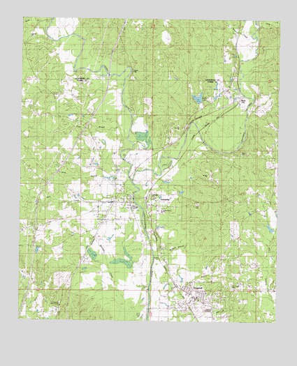
Stonewall, MS USGS Topographic Map
Click on map above to begin viewing in our Map Viewer.

This topographic map contains these locations and features:
Feature Name Type Latitude Longitude GNIS ID View Map
Alday CemeteryCemeteryN32.1949°W88.7681°690784View Map
Allen BranchStreamN32.1790°W88.8220°666200View Map
BasicPopulated PlaceN32.2185°W88.7692°666554View Map
Boyd School (historical)SchoolN32.1940°W88.8570°687496View Map
Browns CreekStreamN32.2438°W88.7648°667647View Map
C W McLemore Pond DamDamN32.1618°W88.7534°681034View Map
Chunky RiverStreamN32.1829°W88.8217°668444View Map
Coats CreekStreamN32.2479°W88.7598°668633View Map
Concord CemeteryCemeteryN32.2424°W88.8698°706372View Map
Concord ChurchChurchN32.2426°W88.8745°668737View Map
Dollar LakeReservoirN32.2175°W88.7891°690790View Map
Dunns FallsFallsN32.2288°W88.8214°683991View Map
Earles Ferry (historical)CrossingN32.1474°W88.8100°687506View Map
East CemeteryCemeteryN32.1740°W88.7909°669563View Map
East EnterprisePopulated PlaceN32.1724°W88.8084°709423View Map
East Jerusalem ChurchChurchN32.1882°W88.8481°669586View Map
EnterprisePopulated PlaceN32.1743°W88.8314°669792View Map
Enterprise Baptist ChurchChurchN32.1729°W88.8212°687509View Map
Enterprise CemeteryCemeteryN32.1796°W88.8262°709427View Map
Enterprise High SchoolSchoolN32.1724°W88.8198°709428View Map
Enterprise Lookout TowerTowerN32.1315°W88.8553°690793View Map
Enterprise Police DepartmentBuildingN32.1718°W88.8209°2754154View Map
Enterprise Post OfficePost OfficeN32.1747°W88.8298°2768688View Map
Enterprise Volunteer Fire Department Station 1BuildingN32.1735°W88.8307°2667695View Map
Enterprise Volunteer Fire Department Station 2BuildingN32.1663°W88.8309°2667903View Map
Fivemile BranchStreamN32.2279°W88.8500°687513View Map
Interchange 134CrossingN32.1638°W88.8676°691500View Map
Interchange 137CrossingN32.2049°W88.8439°691501View Map
Issac Moore Pond DamDamN32.1768°W88.8317°681057View Map
J Gandy Lake DamDamN32.2135°W88.7917°681092View Map
Jackson BranchStreamN32.1585°W88.8131°671768View Map
Jesse Davis Pond DamDamN32.1818°W88.8000°681062View Map
Kidd BranchStreamN32.2060°W88.8295°672120View Map
Kidd School (historical)SchoolN32.2063°W88.8473°687526View Map
Kramer CemeteryCemeteryN32.1521°W88.8095°672216View Map
Mayhoff Springs (historical)Populated PlaceN32.2090°W88.7778°687535View Map
Mount Zion ChurchChurchN32.1854°W88.7850°674352View Map
New Hope ChurchChurchN32.2071°W88.8523°674693View Map
Okatibbee CreekStreamN32.1829°W88.8220°691590View Map
Pleasant Hill School (historical)SchoolN32.1943°W88.7612°687549View Map
Saint Marys ChurchChurchN32.1771°W88.8106°690807View Map
StonewallPopulated PlaceN32.1318°W88.7934°678313View Map
Stonewall CemeteryCemeteryN32.1371°W88.7806°709479View Map
Stonewall Police DepartmentBuildingN32.1345°W88.7838°2754264View Map
Stonewall Post OfficePost OfficeN32.1336°W88.7843°2768680View Map
Stonewall Volunteer Fire DepartmentBuildingN32.1342°W88.7839°2668075View Map
Supervisor District 3CivilN32.1519°W88.8230°711815View Map
Town of EnterpriseCivilN32.1731°W88.8162°2406454View Map
Town of StonewallCivilN32.1364°W88.7957°2406671View Map
Wanita CreekStreamN32.2476°W88.8656°679326View Map
Weir CreekStreamN32.1796°W88.8242°679427View Map
Wesley Chapel SchoolSchoolN32.1707°W88.8059°690811View Map
West EnterprisePopulated PlaceN32.1724°W88.8250°709483View Map
White House (historical)Populated PlaceN32.1876°W88.8195°709485View Map
Whites Mill (historical)LocaleN32.1590°W88.7528°687565View Map
Zion Chapel CemeteryCemeteryN32.1404°W88.7725°679991View Map
Zion Hill ChurchChurchN32.2207°W88.8078°680024View Map

Note: Coordinates in the location and feature list above are referenced to NAD83 datum.


Copyright (C) 2008-2024 Ryan Niemi / Sunset Dynamics ... All Rights Reserved