TopoQuest Logo
Do you find TopoQuest useful?
Help keep TopoQuest running and adding new maps/features by donating!
Bitcoin:  19c7KJd3qBynnjoSw5npx9KScwjBe4ifkT
Litecoin:  LXs6TkuXGGXo1vDsWCkWVdjQX94eUKd6ui
Home View Maps Find Maps Find Places Resources & Links


Wadley North, Alabama Topographic Map

USGS Map Title: Wadley North, AL
USGS Map MRC: 33085B5
DRG (GeoTIFF) Download: o33085b5.tif


Neighboring USGS Topographic Map Quads:


  Lineville East, AL  
33085C6
 

  Ofelia, AL  
33085C5
 

  Wedowee, AL  
33085C4
 

  Mellow Valley, AL  
33085B6
 

  Wadley North, AL  
33085B5
 

  Roanoke West, AL  
33085B4
 

  Daviston, AL  
33085A6
 

  Wadley South, AL  
33085A5
 

  Milltown, AL  
33085A4


Map MRC Location:

N34°
W86°
N34°
W85°
H8 H7 H6 H5 H4 H3 H2 H1
G8 G7 G6 G5 G4 G3 G2 G1
F8 F7 F6 F5 F4 F3 F2 F1
E8 E7 E6 E5 E4 E3 E2 E1
D8 D7 D6 D5 D4 D3 D2 D1
C8 C7 C6 C5 C4 C3 C2 C1
B8 B7 B6 B5 B4 B3 B2 B1
A8 A7 A6 A5 A4 A3 A2 A1
N33°
W86°
N33°
W85°

Wadley North, AL USGS 1:24K Topographic Map Preview:
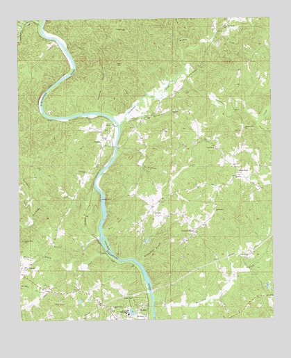
Wadley North, AL USGS Topographic Map
Click on map above to begin viewing in our Map Viewer.

This topographic map contains these locations and features:
Feature Name Type Latitude Longitude GNIS ID View Map
AlmondPopulated PlaceN33.1465°W85.6216°155991View Map
Almond ChurchChurchN33.1471°W85.6238°140185View Map
Antioch CemeteryCemeteryN33.1554°W85.6083°113108View Map
Atchinalgi (historical)LocaleN33.1612°W85.5750°140186View Map
Beaverdam CreekStreamN33.1332°W85.5591°154977View Map
Bethlehem ChurchChurchN33.1960°W85.5275°114133View Map
Big Hunting ClubLocaleN33.2098°W85.5400°140191View Map
Buck BranchStreamN33.2415°W85.5430°112841View Map
Buck MountainSummitN33.1579°W85.6230°115134View Map
Cedar CreekStreamN33.1523°W85.5813°155015View Map
College LakeReservoirN33.1284°W85.5698°131233View Map
College Lake DamDamN33.1268°W85.5700°131232View Map
ConcordPopulated PlaceN33.1351°W85.5027°140205View Map
Concord CemeteryCemeteryN33.1340°W85.5002°1805730View Map
Concord ChurchChurchN33.1337°W85.5022°163254View Map
CorinthPopulated PlaceN33.1685°W85.5575°116627View Map
Corinth ChurchChurchN33.1740°W85.5558°140208View Map
Corinth Volunteer Fire DepartmentBuildingN33.1695°W85.5498°2683137View Map
Cornhouse CreekStreamN33.2060°W85.5750°149947View Map
Crooked CreekStreamN33.2479°W85.6127°159466View Map
Crooked Creek (historical)LocaleN33.2496°W85.6144°140209View Map
Dewberry BranchStreamN33.2112°W85.5850°117264View Map
Fisher CemeteryCemeteryN33.1882°W85.6136°118310View Map
Fixico CreekStreamN33.2065°W85.5069°118346View Map
Forester ChapelPopulated PlaceN33.1612°W85.5388°118502View Map
Forester Chapel ChurchChurchN33.1612°W85.5386°140215View Map
Frost DamDamN33.1301°W85.5966°131236View Map
Frost LakeReservoirN33.1301°W85.5966°131235View Map
Gay CemeteryCemeteryN33.2193°W85.5422°118877View Map
Hillabeehago BranchStreamN33.1479°W85.5658°120115View Map
Hodge IslandIslandN33.1748°W85.5844°120168View Map
Hope Memorial ChurchChurchN33.1704°W85.5280°120351View Map
Hunter BranchStreamN33.1490°W85.5994°120552View Map
Hurricane CreekStreamN33.1676°W85.5838°155110View Map
Knight CemeteryCemeteryN33.2098°W85.5600°121270View Map
Knight DamDamN33.1568°W85.5616°131254View Map
Level RoadLocaleN33.1857°W85.5155°155132View Map
Macedonia ChurchChurchN33.1846°W85.5177°122160View Map
MalonePopulated PlaceN33.1987°W85.5841°156649View Map
Malone CemeteryCemeteryN33.2037°W85.5972°140234View Map
Malone ChurchChurchN33.1965°W85.5836°140235View Map
Malone Ferry (historical)CrossingN33.2015°W85.5750°155424View Map
No Business CreekStreamN33.1957°W85.5766°155178View Map
Oak MountainSummitN33.2315°W85.5761°124123View Map
Pine Flat ChurchChurchN33.2465°W85.5213°124768View Map
Pine Grove CemeteryCemeteryN33.1859°W85.5913°124779View Map
Pleasant Grove CemeteryCemeteryN33.2457°W85.5705°124938View Map
Pleasant Grove SchoolSchoolN33.1307°W85.5797°124969View Map
Pleasant Hill CemeteryCemeteryN33.1329°W85.6047°1805734View Map
Pleasant Hill ChurchChurchN33.1321°W85.6058°124999View Map
Price BranchStreamN33.1612°W85.5841°125260View Map
Price IslandIslandN33.1562°W85.5822°125268View Map
Southern Union State CollegeSchoolN33.1276°W85.5716°127143View Map
Stephens Mill (historical)LocaleN33.1385°W85.6102°135821View Map
Swan CemeteryCemeteryN33.2032°W85.5144°127576View Map
Swan HillSummitN33.2043°W85.5130°127578View Map
Transco DamDamN33.1385°W85.5050°131237View Map
Turkeypen CreekStreamN33.1751°W85.6197°128179View Map
Wadley DivisionCivilN33.1669°W85.5561°165936View Map
Wellborne Ferry (historical)CrossingN33.2404°W85.6041°135830View Map
Whites ChapelChurchN33.1346°W85.5700°128913View Map
Wildcat CreekStreamN33.2282°W85.5422°128966View Map
Wolfpen CreekStreamN33.1365°W85.6125°129178View Map
Woodville ChurchChurchN33.1443°W85.5491°135834View Map
Woodville ChurchChurchN33.2112°W85.5486°129220View Map

Note: Coordinates in the location and feature list above are referenced to NAD83 datum.


Copyright (C) 2008-2024 Ryan Niemi / Sunset Dynamics ... All Rights Reserved