TopoQuest Logo
Do you find TopoQuest useful?
Help keep TopoQuest running and adding new maps/features by donating!
Bitcoin:  19c7KJd3qBynnjoSw5npx9KScwjBe4ifkT
Litecoin:  LXs6TkuXGGXo1vDsWCkWVdjQX94eUKd6ui
Home View Maps Find Maps Find Places Resources & Links


Vestaburg, Michigan Topographic Map

USGS Map Title: Vestaburg, MI
USGS Map MRC: 43084D8
DRG (GeoTIFF) Download: o43084d8.tif


Neighboring USGS Topographic Map Quads:


  Blanchard, MI  
43085E1
 

  Winn, MI  
43084E8
 

  Mount Pleasant, MI  
43084E7
 

  Edmore, MI  
43085D1
 

  Vestaburg, MI  
43084D8
 

  Riverdale, MI  
43084D7
 

  Stanton, MI  
43085C1
 

  Crystal, MI  
43084C8
 

  Sumner, MI  
43084C7


Map MRC Location:

N44°
W85°
N44°
W84°
H8 H7 H6 H5 H4 H3 H2 H1
G8 G7 G6 G5 G4 G3 G2 G1
F8 F7 F6 F5 F4 F3 F2 F1
E8 E7 E6 E5 E4 E3 E2 E1
D8 D7 D6 D5 D4 D3 D2 D1
C8 C7 C6 C5 C4 C3 C2 C1
B8 B7 B6 B5 B4 B3 B2 B1
A8 A7 A6 A5 A4 A3 A2 A1
N43°
W85°
N43°
W84°

Vestaburg, MI USGS 1:24K Topographic Map Preview:
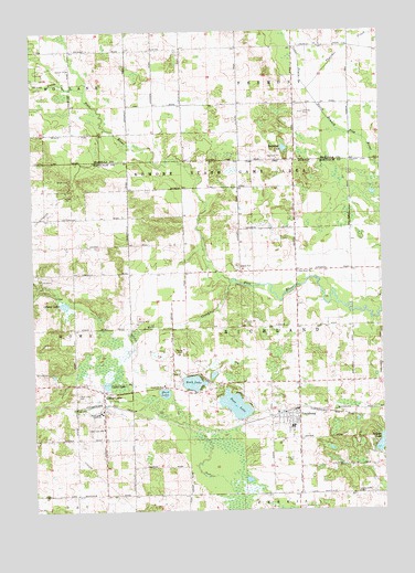
Vestaburg, MI USGS Topographic Map
Click on map above to begin viewing in our Map Viewer.

This topographic map contains these locations and features:
Feature Name Type Latitude Longitude GNIS ID View Map
Bass LakeLakeN43.4024°W84.9283°620689View Map
Bullhead LakeLakeN43.4694°W84.9094°622232View Map
Cedar DrainCanalN43.4928°W84.9034°622911View Map
Cedar LakeLakeN43.4078°W84.9738°622928View Map
Cedar LakePopulated PlaceN43.4061°W84.9750°622937View Map
Cedar Lake AcademySchoolN43.4009°W84.9747°622938View Map
Cedar Lake CemeteryCemeteryN43.4056°W84.9842°622939View Map
Cedar Lake Post OfficePost OfficeN43.4008°W84.9750°2561762View Map
Cedar Lake SchoolSchoolN43.3967°W84.9745°622940View Map
Cedar Lake Station (historical)LocaleN43.4025°W84.9750°2561764View Map
Cornerstone Worship CenterChurchN43.4083°W84.9000°2561525View Map
Deaner LakeLakeN43.3920°W84.8757°624429View Map
Edmore State Game AreaParkN43.4617°W84.9295°625384View Map
Family Medical Care of VestaburgHospitalN43.4083°W84.9094°2561523View Map
First Baptist ChurchChurchN43.3972°W84.9214°2561524View Map
Kingdom Hall of Jehovah's WitnessesChurchN43.4083°W84.9069°2561526View Map
Marl LakeLakeN43.4057°W84.9533°631589View Map
Offnear LakeLakeN43.4287°W84.9888°633947View Map
Pine River ChurchChurchN43.4373°W84.9042°634990View Map
Richland CemeteryCemeteryN43.3884°W84.9058°635882View Map
Richland Township Fire DepartmentBuildingN43.3993°W84.9106°2561520View Map
Richland Township LibraryBuildingN43.3992°W84.9083°2561519View Map
Rock LakeLakeN43.4083°W84.9431°636082View Map
Skunk CreekStreamN43.4848°W84.9800°638076View Map
Thatcher CreekStreamN43.4850°W84.9003°1614698View Map
Township of RichlandCivilN43.4226°W84.9053°1626972View Map
VestaburgPopulated PlaceN43.3992°W84.9056°1615560View Map
Vestaburg Church of ChristChurchN43.3978°W84.9083°2561527View Map
Vestaburg High SchoolSchoolN43.3967°W84.9072°2561522View Map
Vestaburg Post OfficePost OfficeN43.3992°W84.9081°2561518View Map
Vestaburg Station (historical)LocaleN43.4008°W84.9064°2561521View Map
Winn United Methodist ChurchChurchN43.4944°W84.9256°2544038View Map
Wolf CreekStreamN43.4345°W84.9284°1616680View Map

Note: Coordinates in the location and feature list above are referenced to NAD83 datum.


Copyright (C) 2008-2024 Ryan Niemi / Sunset Dynamics ... All Rights Reserved