TopoQuest Logo
Do you find TopoQuest useful?
Help keep TopoQuest running and adding new maps/features by donating!
Bitcoin:  19c7KJd3qBynnjoSw5npx9KScwjBe4ifkT
Litecoin:  LXs6TkuXGGXo1vDsWCkWVdjQX94eUKd6ui
Home View Maps Find Maps Find Places Resources & Links


Stanton, Michigan Topographic Map

USGS Map Title: Stanton, MI
USGS Map MRC: 43085C1
DRG (GeoTIFF) Download: o43085c1.tif


Neighboring USGS Topographic Map Quads:


  Six Lakes, MI  
43085D2
 

  Edmore, MI  
43085D1
 

  Vestaburg, MI  
43084D8
 

  Langston, MI  
43085C2
 

  Stanton, MI  
43085C1
 

  Crystal, MI  
43084C8
 

  Greenville East, MI  
43085B2
 

  Sheridan, MI  
43085B1
 

  Butternut, MI  
43084B8


Map MRC Location:

N44°
W86°
N44°
W85°
H8 H7 H6 H5 H4 H3 H2 H1
G8 G7 G6 G5 G4 G3 G2 G1
F8 F7 F6 F5 F4 F3 F2 F1
E8 E7 E6 E5 E4 E3 E2 E1
D8 D7 D6 D5 D4 D3 D2 D1
C8 C7 C6 C5 C4 C3 C2 C1
B8 B7 B6 B5 B4 B3 B2 B1
A8 A7 A6 A5 A4 A3 A2 A1
N43°
W86°
N43°
W85°

Stanton, MI USGS 1:24K Topographic Map Preview:
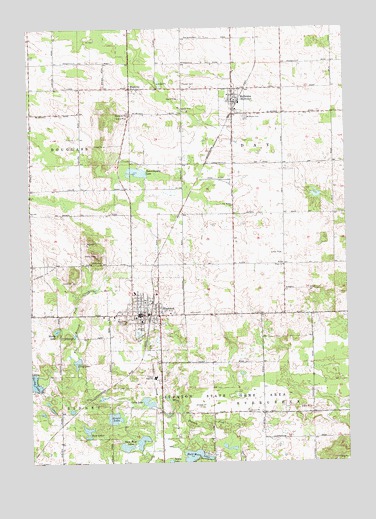
Stanton, MI USGS Topographic Map
Click on map above to begin viewing in our Map Viewer.

This topographic map contains these locations and features:
Feature Name Type Latitude Longitude GNIS ID View Map
Activities BuildingBuildingN43.2525°W85.1014°2561834View Map
Beatrice E Doser BuildingBuildingN43.2533°W85.1011°2561836View Map
Central High SchoolSchoolN43.2748°W85.0753°622998View Map
City of StantonCivilN43.2928°W85.0789°1627122View Map
Colby LakeLakeN43.2666°W85.0790°623552View Map
Colby Post Office (historical)Post OfficeN43.2644°W85.0756°2560203View Map
Colby's Station (historical)LocaleN43.2644°W85.0756°2559945View Map
Congregational ChurchChurchN43.2936°W85.0817°2561510View Map
Day Bethel ChurchChurchN43.3242°W85.0442°624373View Map
Day Township Fire DepartmentBuildingN43.3570°W85.0446°2636191View Map
First Baptist ChurchChurchN43.2936°W85.0800°2561511View Map
Forest Hill CemeteryCemeteryN43.2911°W85.0883°626262View Map
Frost ChurchChurchN43.3070°W85.0250°626519View Map
Grass LakeLakeN43.2631°W85.0917°627190View Map
Gray LakeLakeN43.2790°W85.1067°627261View Map
Half Moon LakeLakeN43.2519°W85.0608°627622View Map
Hardley LakeLakeN43.2882°W85.1147°627775View Map
Hemmingway LakeLakeN43.3336°W85.0825°628097View Map
Instruction East BuildingBuildingN43.2539°W85.1008°2561844View Map
Instruction North BuildingBuildingN43.2542°W85.1025°2561846View Map
Instruction West BuildingBuildingN43.2539°W85.1017°2561839View Map
McBridePopulated PlaceN43.3542°W85.0428°631804View Map
McBrides CemeteryCemeteryN43.3495°W85.0383°631805View Map
McBrides Post OfficePost OfficeN43.3531°W85.0439°2561604View Map
McBrides Station (historical)LocaleN43.3536°W85.0417°2561622View Map
Montcalm Community CollegeSchoolN43.2514°W85.1028°2561535View Map
Montcalm Community College LibraryBuildingN43.2531°W85.1017°2561837View Map
Montcalm County Emergency ServicesBuildingN43.2983°W85.0854°2662083View Map
Montcalm County Sheriff's OfficeBuildingN43.3019°W85.0859°2561507View Map
Palmer CemeteryCemeteryN43.3589°W85.0628°634423View Map
Penny LakeLakeN43.2503°W85.0705°634600View Map
Saint Bernadette of Lourdes ChurchChurchN43.2931°W85.0697°2561512View Map
Stanley P Ash BuildingBuildingN43.2542°W85.1014°2561842View Map
StantonPopulated PlaceN43.2925°W85.0814°638726View Map
Stanton City HallBuildingN43.2906°W85.0814°2561504View Map
Stanton Community Fire DepartmentBuildingN43.2910°W85.0811°2561505View Map
Stanton Elementary SchoolSchoolN43.2989°W85.0836°2561517View Map
Stanton Family Care CenterHospitalN43.2972°W85.0850°2561506View Map
Stanton Mobile Home ParkPopulated PlaceN43.2961°W85.0875°2561503View Map
Stanton Oil FieldOilfieldN43.3061°W85.1192°1623647View Map
Stanton Police DepartmentBuildingN43.2906°W85.0810°2737605View Map
Stanton Post OfficePost OfficeN43.2953°W85.0850°2561502View Map
Stanton State Game AreaParkN43.2700°W85.0525°638732View Map
Stanton Station (historical)LocaleN43.2964°W85.0767°2561489View Map
Township of DayCivilN43.3367°W85.0238°1626161View Map
Traditional Congregational ChurchChurchN43.2983°W85.0836°2561508View Map
Trinity Evangelical Free ChurchChurchN43.2933°W85.0794°2561509View Map
Twin LakesLakeN43.2586°W85.1025°1615260View Map
Twin Stone LakesLakeN43.2546°W85.0881°1615284View Map
Upper Elementary SchoolSchoolN43.2736°W85.0761°2561516View Map
Village of McBrideCivilN43.3520°W85.0442°2399284View Map
WestvillePopulated PlaceN43.3578°W85.0836°1616229View Map
Westville Post Office (historical)Post OfficeN43.3578°W85.0836°2560062View Map
White Pine LibraryBuildingN43.2917°W85.0811°2561490View Map

Note: Coordinates in the location and feature list above are referenced to NAD83 datum.


Copyright (C) 2008-2024 Ryan Niemi / Sunset Dynamics ... All Rights Reserved