TopoQuest Logo
Do you find TopoQuest useful?
Help keep TopoQuest running and adding new maps/features by donating!
Bitcoin:  19c7KJd3qBynnjoSw5npx9KScwjBe4ifkT
Litecoin:  LXs6TkuXGGXo1vDsWCkWVdjQX94eUKd6ui
Home View Maps Find Maps Find Places Resources & Links


Bodcaw, Arkansas Topographic Map

USGS Map Title: Bodcaw, AR
USGS Map MRC: 33093E4
DRG (GeoTIFF) Download: o33093e4.tif


Neighboring USGS Topographic Map Quads:


  Hope, AR  
33093F5
 

  Emmet, AR  
33093F4
 

  Laneburg, AR  
33093F3
 

  Patmos, AR  
33093E5
 

  Bodcaw, AR  
33093E4
 

  Willisville, AR  
33093E3
 

  Old Town, AR  
33093D5
 

  Falcon, AR  
33093D4
 

  Lamartine, AR  
33093D3


Map MRC Location:

N34°
W94°
N34°
W93°
H8 H7 H6 H5 H4 H3 H2 H1
G8 G7 G6 G5 G4 G3 G2 G1
F8 F7 F6 F5 F4 F3 F2 F1
E8 E7 E6 E5 E4 E3 E2 E1
D8 D7 D6 D5 D4 D3 D2 D1
C8 C7 C6 C5 C4 C3 C2 C1
B8 B7 B6 B5 B4 B3 B2 B1
A8 A7 A6 A5 A4 A3 A2 A1
N33°
W94°
N33°
W93°

Bodcaw, AR USGS 1:24K Topographic Map Preview:
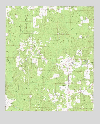
Bodcaw, AR USGS Topographic Map
Click on map above to begin viewing in our Map Viewer.

This topographic map contains these locations and features:
Feature Name Type Latitude Longitude GNIS ID View Map
Allen BranchStreamN33.5757°W93.4846°45828View Map
AzorPopulated PlaceN33.5918°W93.4249°56913View Map
Barbaree BranchStreamN33.5137°W93.4782°46084View Map
BodcawPopulated PlaceN33.5585°W93.4071°76388View Map
Bodcaw Baptist ChurchChurchN33.5576°W93.4068°61552View Map
Bodcaw Number 1 Missionary Baptist ChurchChurchN33.5768°W93.4599°81978View Map
Bodcaw Oil FieldOilfieldN33.5354°W93.3946°76389View Map
Bodcaw Volunteer Fire DepartmentBuildingN33.5586°W93.4069°2116167View Map
Brockmans Store (historical)LocaleN33.5221°W93.4107°60340View Map
Corinth CemeteryCemeteryN33.5229°W93.3768°48041View Map
Corinth ChurchChurchN33.5235°W93.3935°48046View Map
Downs CemeteryCemeteryN33.5093°W93.4924°48596View Map
Dunn CemeteryCemeteryN33.5343°W93.4041°48709View Map
Ebenezer CemeteryCemeteryN33.5540°W93.4768°48796View Map
Ebenezer Church (historical)ChurchN33.5537°W93.4771°60351View Map
Forest Hill School (historical)SchoolN33.6246°W93.4388°60355View Map
Garner CreekStreamN33.5968°W93.4099°49347View Map
Hamm BranchStreamN33.5337°W93.4474°49803View Map
Hinton United Methodist ChurchChurchN33.5132°W93.4988°77189View Map
Hooper BranchStreamN33.5304°W93.4255°50290View Map
Little Bodcau CreekStreamN33.5112°W93.4827°77511View Map
Little Bodcaw School (historical)SchoolN33.5771°W93.4596°60367View Map
Owens BranchStreamN33.5332°W93.4580°53107View Map
Providence ChurchChurchN33.5921°W93.4199°53824View Map
Register (historical)Populated PlaceN33.5743°W93.4563°60472View Map
Ross CemeteryCemeteryN33.6121°W93.4963°54218View Map
Shiloh ChurchChurchN33.5026°W93.4477°54786View Map
Shiloh School (historical)SchoolN33.5043°W93.4541°60393View Map
Town of BodcawCivilN33.5606°W93.4013°2405293View Map
Township of ParkerCivilN33.5638°W93.4063°68906View Map
Union BranchStreamN33.5848°W93.4110°55780View Map
White Oak CreekStreamN33.5526°W93.4932°56275View Map
Whitten BranchStreamN33.5332°W93.4641°56335View Map

Note: Coordinates in the location and feature list above are referenced to NAD83 datum.


Copyright (C) 2008-2024 Ryan Niemi / Sunset Dynamics ... All Rights Reserved